Log in to your account

AroundUs is a community-driven map of interesting places, built by curious explorers like you. It grows with every review, story, and photo you share.
Connect to save your favorite spots, contribute locations, and create personalized routes.
Continue with Google
Continue with Apple
Continue with X
Continue with Facebook
Continue with email
By continuing, you accept our Terms and Conditions and our Privacy Policy
Create an account

Suti I community development block

Add to collection
Map
Suggest a change
Share

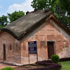
Suti I community development block, Community development block in Jangipur subdivision, India.

Suti I is an administrative block within West Bengal comprising numerous villages spread across the region. The block features a mix of settled areas and rural spaces with varied landscape and settlement patterns.

The block experienced significant geographical changes driven by river dynamics that altered land boundaries over time. These shifts shaped the current settlement pattern and administrative divisions visible today.

Multiple religious communities call this area home and shape the character of village life through their presence and daily practices. Local artisan traditions and household-based work remain visible throughout the settlements.

The area is connected by regular bus services linking different villages and has health centers dispersed throughout. Visitors should expect a rural setting with basic infrastructure and plan accordingly for village-based travel.

The region has a strong household-based tobacco craft industry that provides income for many families across the villages. This traditional skill has been passed down through generations and remains central to local livelihoods.

Location: Jangipur subdivision

Elevation above the sea: 25 m

Shares border with: Suti II community development block, Murarai I community development block, Murarai II community development block, Raghunathganj I community development block, Raghunathganj II community development block

GPS coordinates: 24.62300,88.02400

Latest update: December 10, 2025 20:05

Photos
Reviews

Visited this place? Tap the stars to rate it and share your experience / photos with the community! Try now! You can cancel it anytime.

« Suti I community development block - Community development block in Jangipur subdivision, India » is provided by Around Us (aroundus.com). Images and texts are derived from Wikimedia project under a Creative Commons license. You are allowed to copy, distribute, and modify copies of this page, under the conditions set by the license, as long as this note is clearly visible.

Discover hidden gems everywhere you go!

From secret cafés to breathtaking viewpoints, skip the crowded tourist spots and find places that match your style. Our app makes it easy with voice search, smart filtering, route optimization, and insider tips from travelers worldwide. Download now for the complete mobile experience.

Around Us App Screenshot

A unique approach to discovering new places

Le Figaro

All the places worth exploring

France Info

A tailor-made excursion in just a few clicks

20 Minutes