Enable Location

We need your location to show you interesting places around you

Discover nearby places

Find interesting locations and hidden gems around you

Precise directions

Get accurate directions and distances to places

Your location is never shared with other users. It's only used when you tap the location button.

Vaithalmala

Log in to your account

Start exploring — it's free

Trusted by 62,522 travelers worldwide

Continue with Google
Continue with Apple
or

We will send you a code to connect

By continuing, you accept our Terms and Conditions and our Privacy Policy

Check your inbox

We've sent a pincode in your inbox. Please enter the code below.

Vaithalmala

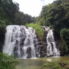
Vaithalmala, Mountain summit in Taliparamba, India.

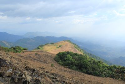
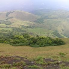
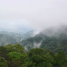
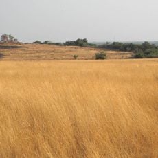
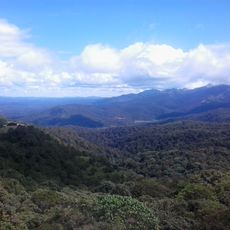
Vaithalmala is a mountain summit in the Western Ghats that rises to 1,372 meters, featuring dense forests transitioning to open grasslands across its slopes. The peak itself offers sweeping views over the surrounding valleys and distant forest-covered ridges.

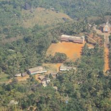
For many generations, this summit served as a natural boundary between Kerala and Karnataka states, shaping settlement patterns on both sides. The location's role as a dividing line influenced how communities developed on either slope.

Local communities shape the grasslands through their daily practices, creating patterns in the vegetation that visitors encounter on the slopes. Walking here, you notice how people have always lived with this mountain rather than just passed through it.

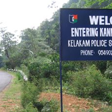
The most direct approach is through Pottanplavu, which offers regular transport connections from the nearest towns. From Kannur, buses reach Taliparamba and continue to the Kudiyanmala base, where most trekking begins.

An observation tower at the summit gives views reaching across half of Kannur district, revealing distant Kodagu forests and the Paithal valley below. This structure lets visitors see the landscape in ways they would miss from the slopes alone.

The community of curious travelers

AroundUs brings together thousands of curated places, local tips, and hidden gems, enriched daily by 60,000 contributors worldwide.

Start exploring
Location
Taliparamba
Elevation above the sea
1,371.6 m
GPS coordinates
12.14507,75.57166
Latest update
December 20, 2025 14:11
« Vaithalmala - Mountain summit in Taliparamba, India » is provided by Around Us (aroundus.com). Images and texts are derived from Wikimedia project under a Creative Commons license. You are allowed to copy, distribute, and modify copies of this page, under the conditions set by the license, as long as this note is clearly visible.

Discover hidden gems everywhere you go!

From secret cafés to breathtaking viewpoints, skip the crowded tourist spots and find places that match your style. Our app makes it easy with voice search, smart filtering, route optimization, and insider tips from travelers worldwide. Download now for the complete mobile experience.

Around Us App Screenshot

A unique approach to discovering new places

Le Figaro

All the places worth exploring

France Info

A tailor-made excursion in just a few clicks

20 Minutes

Around Us
Travel Guide & Maps
Download

Send to your phone

QR Code
1

Open the camera app on your mobile.

2

Point at the QR code with your camera. A notification will appear.

3

Tap the notification to open the link.