Enable Location

We need your location to show you interesting places around you

Discover nearby places

Find interesting locations and hidden gems around you

Precise directions

Get accurate directions and distances to places

Your location is never shared with other users. It's only used when you tap the location button.

Tadiandamol

Log in to your account

Start exploring — it's free

Trusted by 63,483 travelers worldwide

Continue with Google
Continue with Apple
or

We will send you a code to connect

By continuing, you accept our Terms and Conditions and our Privacy Policy

Check your inbox

We've sent a pincode in your inbox. Please enter the code below.

Tadiandamol
Discussion Reviews 1 Photos
12.7k Popularity

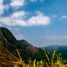
Tadiandamol, Mountain summit in Kodagu district, India.

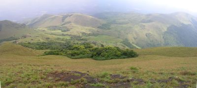
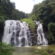
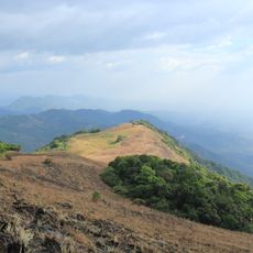
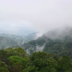
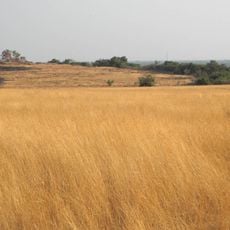
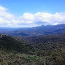
Tadiandamol rises to 1,748 meters within the Western Ghats and features dense shola forests in its valleys along with grassy slopes at higher elevations. The mountain displays distinct vegetation zones that change as you climb higher.

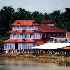
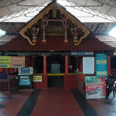
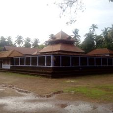
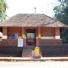
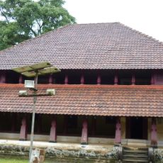
The mountain is connected to Nalaknad Palace at its base, built in the late 1790s as a refuge for Kodagu Ruler Chikka Veera Rajendra during conflicts. This relationship reflects the area's strategic importance during that period.

The name comes from the Kodava language, where 'thadi' means broad, 'anda' shows possession, and 'mol' refers to a hill or peak. Visitors can learn about this linguistic connection as they explore the region's local heritage.

The trail starts from Nalaknad Palace and covers about 7 kilometers uphill, taking approximately five hours for the full walk. Plan your return journey to arrive back before darkness falls.

This peak is the highest in Kodagu district and the third highest in Karnataka, behind Mullayyanagiri and Kudremukha. This ranking makes it a notable destination for hikers seeking the region's top summits.

The community of curious travelers

AroundUs brings together thousands of curated places, local tips, and hidden gems, enriched daily by 60,000 contributors worldwide.

Start exploring
Location
Elevation above the sea
1,748 m
GPS coordinates
12.21756,75.60882
Latest update
December 7, 2025 20:44
Reviews
Share your experience

No review yet

Discussions
Start a discussion...

No discussion yet

« Tadiandamol - Mountain summit in Kodagu district, India » is provided by Around Us (aroundus.com). Images and texts are derived from Wikimedia project under a Creative Commons license. You are allowed to copy, distribute, and modify copies of this page, under the conditions set by the license, as long as this note is clearly visible.

Discover hidden gems everywhere you go!

From secret cafés to breathtaking viewpoints, skip the crowded tourist spots and find places that match your style. Our app makes it easy with voice search, smart filtering, route optimization, and insider tips from travelers worldwide. Download now for the complete mobile experience.

Around Us App Screenshot

A unique approach to discovering new places

Le Figaro

All the places worth exploring

France Info

A tailor-made excursion in just a few clicks

20 Minutes

Around Us
Travel Guide & Maps
Download

Send to your phone

QR Code
1

Open the camera app on your mobile.

2

Point at the QR code with your camera. A notification will appear.

3

Tap the notification to open the link.