Enable Location

We need your location to show you interesting places around you

Discover nearby places

Find interesting locations and hidden gems around you

Precise directions

Get accurate directions and distances to places

Your location is never shared with other users. It's only used when you tap the location button.

Yarim Tepe

Log in to your account

Start exploring — it's free

Trusted by 62,626 travelers worldwide

Continue with Google
Continue with Apple
or

We will send you a code to connect

By continuing, you accept our Terms and Conditions and our Privacy Policy

Check your inbox

We've sent a pincode in your inbox. Please enter the code below.

Yarim Tepe

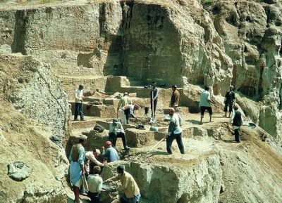
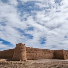
Yarim Tepe, Tell and archaeological settlement in Golestan Province, Iran.

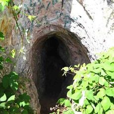
Yarim Tepe is a settlement mound in northeastern Iran containing remains of mud-brick houses distributed across multiple levels of occupation. The site displays numerous overlapping layers of residential and craft areas spanning different periods of habitation.

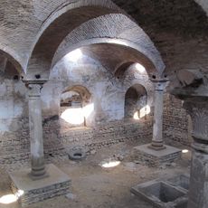
Soviet archaeologists conducted systematic excavations from 1969 to 1976, revealing thirteen distinct settlement layers at this location. Their work demonstrated continuous habitation and construction across thousands of years.

The pottery and building styles visible in the excavations show how different ancient peoples occupied and adapted this place over time. Visitors can observe through the remains how daily life and practices transformed across generations.

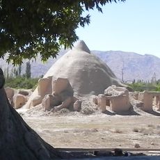
The location sits in a dry region, making sturdy footwear and sun protection essential for visiting. Excavated areas are partly exposed, but many sections require careful navigation across the uneven ground surface.

Lead artifacts discovered in the oldest layers here show that residents smelted lead long before they worked with copper. This craft represents an unexpected window into the metallurgical skills of early cultures in this region.

The community of curious travelers

AroundUs brings together thousands of curated places, local tips, and hidden gems, enriched daily by 60,000 contributors worldwide.

Start exploring
Inception
52 century BCE
GPS coordinates
37.14782,55.20032
Latest update
December 13, 2025 17:00
« Yarim Tepe - Tell and archaeological settlement in Golestan Province, Iran » is provided by Around Us (aroundus.com). Images and texts are derived from Wikimedia project under a Creative Commons license. You are allowed to copy, distribute, and modify copies of this page, under the conditions set by the license, as long as this note is clearly visible.

Discover hidden gems everywhere you go!

From secret cafés to breathtaking viewpoints, skip the crowded tourist spots and find places that match your style. Our app makes it easy with voice search, smart filtering, route optimization, and insider tips from travelers worldwide. Download now for the complete mobile experience.

Around Us App Screenshot

A unique approach to discovering new places

Le Figaro

All the places worth exploring

France Info

A tailor-made excursion in just a few clicks

20 Minutes

Around Us
Travel Guide & Maps
Download

Send to your phone

QR Code
1

Open the camera app on your mobile.

2

Point at the QR code with your camera. A notification will appear.

3

Tap the notification to open the link.