Enable Location

We need your location to show you interesting places around you

Discover nearby places

Find interesting locations and hidden gems around you

Precise directions

Get accurate directions and distances to places

Your location is never shared with other users. It's only used when you tap the location button.

Sappada

Log in to your account

Start exploring — it's free

Trusted by 62,168 travelers worldwide

Continue with Google
Continue with Apple
or

We will send you a code to connect

By continuing, you accept our Terms and Conditions and our Privacy Policy

Check your inbox

We've sent a pincode in your inbox. Please enter the code below.

Sappada, Mountain municipality in Friuli-Venezia Giulia, Italy

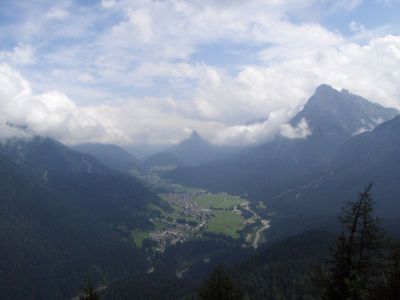
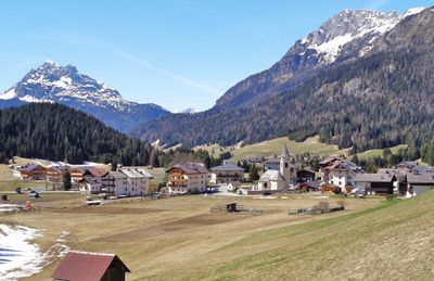
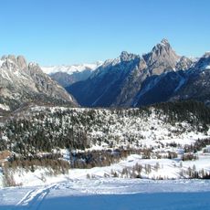
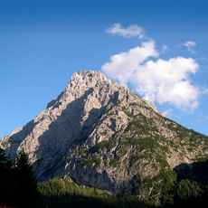
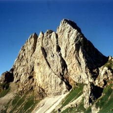
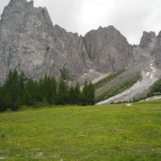
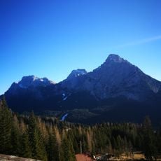
Sappada is a mountain municipality in the Province of Udine in the Carnic Alps, located at 1,250 meters elevation and surrounded by forests and several small alpine lakes. The different hamlets spread along the valley and display various building styles adapted to the slope and climate.

The first mention dates back to 973, when the area was under Bavarian administration and Germanic settlers arrived from the north. After centuries under changing rulerships, the place transferred from Veneto to Friuli-Venezia Giulia in 2017.

The spoken dialect here connects with German words that earlier settlers from Bavaria brought and that remain heard in daily conversations today. This form of speech stays alive through the care taken in talks between generations and in festivals that take place throughout the year.

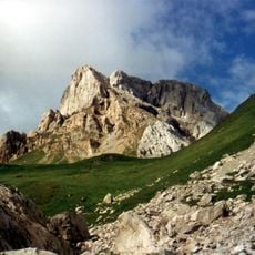
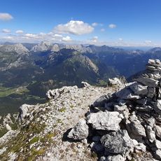
The municipality offers lodging across different price ranges and features hiking trails, cycling routes, and ski areas accessible throughout the year. In winter, visitors need warm clothing and proper footwear, while summer requires lighter gear for mountain walks.

Old wooden houses in the hamlets of Sappada Vecchia and Cima show the Nordic blockbau technique, where logs are stacked without nails. This construction method has lasted for centuries and protects interior spaces from winter cold through thick, naturally insulating walls.

The community of curious travelers

AroundUs brings together thousands of curated places, local tips, and hidden gems, enriched daily by 60,000 contributors worldwide.

Start exploring
Capital city
Sappada
Elevation above the sea
1,250 m
Shares border with
Forni Avoltri, Prato Carnico, Vigo di Cadore, Santo Stefano di Cadore
GPS coordinates
46.56554,12.68026
Latest update
December 13, 2025 16:51
« Sappada - Mountain municipality in Friuli-Venezia Giulia, Italy » is provided by Around Us (aroundus.com). Images and texts are derived from Wikimedia project under a Creative Commons license. You are allowed to copy, distribute, and modify copies of this page, under the conditions set by the license, as long as this note is clearly visible.

Discover hidden gems everywhere you go!

From secret cafés to breathtaking viewpoints, skip the crowded tourist spots and find places that match your style. Our app makes it easy with voice search, smart filtering, route optimization, and insider tips from travelers worldwide. Download now for the complete mobile experience.

Around Us App Screenshot

A unique approach to discovering new places

Le Figaro

All the places worth exploring

France Info

A tailor-made excursion in just a few clicks

20 Minutes

Around Us
Travel Guide & Maps
Download

Send to your phone

QR Code
1

Open the camera app on your mobile.

2

Point at the QR code with your camera. A notification will appear.

3

Tap the notification to open the link.