Tre Cime di Lavaredo, Mountain peaks in Sexten Dolomites, Italy.
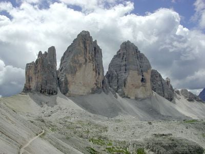
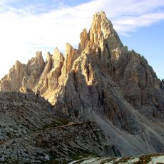
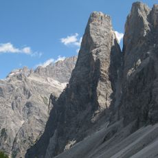
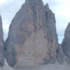
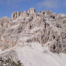
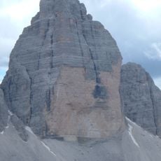
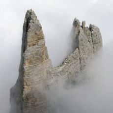
Tre Cime di Lavaredo is a group of three limestone peaks in the Sexten Dolomites of Belluno province, with Cima Grande rising to 2,999 meters (9,839 feet), Cima Ovest to 2,973 meters (9,754 feet), and Cima Piccola to 2,857 meters (9,373 feet). The northern walls drop vertically and form one of the most recognizable mountain profiles in the Alps, while the southern slopes are gentler and ringed by a high plateau.
The area became a front line during the First World War between Italian and Austro-Hungarian troops, who carved tunnels and positions into the rock faces. After the war ended, the region changed hands several times before becoming part of Italy permanently.
The Ladin name refers to the three stone towers that stand side by side, each with its own distinct profile visible from the approach trails. Hikers today pass stone markers and old boundary signs that mark where different territories once met in these high mountains.
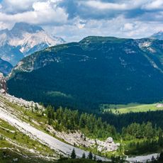
A circular trail of about ten kilometers (six miles) loops around the peaks starting from Rifugio Auronzo and takes around three and a half hours to walk. The route is well marked and offers several branches to other mountain huts where visitors can view the northern walls from closer positions.
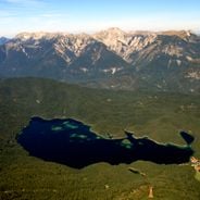
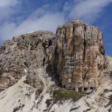
The peaks belong to a World Heritage site and are surrounded by several small lakes scattered across the plateau in shallow depressions. On clear days, the rock faces reflect in the water and create changing views depending on the time of day and light conditions.
Location: Province of Belluno
Elevation above the sea: 2,999 m
Address: Tre Cime di Lavaredo, Italy
GPS coordinates: 46.61861,12.30556
Latest update: December 4, 2025 19:04
The Alps offer a wide range of natural landscapes. You find mountain lakes with clear waters, like the Eibsee in Bavaria or the Sorapis Lake in the Dolomites, gorges carved by torrents like the Partnach Gorge or the Cirque of Sixt-Fer-à-Cheval, and stunning rocky peaks such as the Tre Cime di Lavaredo or Mont Aiguille in Vercors. The mountain range also shows remarkable geological formations, like the Désert de Platé with its eroded limestone rocks creating endless striped surfaces, or the steep cliffs that surround the valleys and give each region its character. These sites can be reached by hiking trails, allowing visitors to see the variety of alpine scenery and how water, ice, and weather have shaped these mountains.
Sexten Dolomites
2.4 km
Monte Piana
4.8 km
Antonio Locatelli Hut
2.1 km
Paternkofel
1.5 km
Sextener Rotwand
6.5 km
Einserkofel
4 km
Parco naturale Dolomiti di Sesto
4.9 km
Zwölferkofel
4.2 km
Elferkofel
5.9 km
Dreischusterspitze
5.6 km
Haunold
8.1 km
Große Zinne
248 m
Dreischusterhütte
6.3 km
Monte Popera
6.5 km
Fort Plätzwiese
8.8 km
Dürrensteinhütte
8.8 km
Fort Landro
6.2 km
Croda dei Baranci
8 km
Sextenstein
2.3 km
Piz Popena
8.9 km
Cime Passaporto
1.1 km
Western Zinne
637 m
Kleine Zinne
97 m
St. Valentin in Moos
8.2 km
Chapel in Landro
6.2 km
Lago di Misurina
5.3 km
Hotel Alte Post
6.4 km
Alpine chapel
567 mVisited this place? Tap the stars to rate it and share your experience / photos with the community! Try now! You can cancel it anytime.
Discover hidden gems everywhere you go!
From secret cafés to breathtaking viewpoints, skip the crowded tourist spots and find places that match your style. Our app makes it easy with voice search, smart filtering, route optimization, and insider tips from travelers worldwide. Download now for the complete mobile experience.
A unique approach to discovering new places❞
— Le Figaro
All the places worth exploring❞
— France Info
A tailor-made excursion in just a few clicks❞
— 20 Minutes