Enable Location

We need your location to show you interesting places around you

Discover nearby places

Find interesting locations and hidden gems around you

Precise directions

Get accurate directions and distances to places

Your location is never shared with other users. It's only used when you tap the location button.

Dente Italiano

Log in to your account

Start exploring — it's free

Trusted by 61,945 travelers worldwide

Continue with Google
Continue with Apple
or

We will send you a code to connect

By continuing, you accept our Terms and Conditions and our Privacy Policy

Check your inbox

We've sent a pincode in your inbox. Please enter the code below.

Dente Italiano

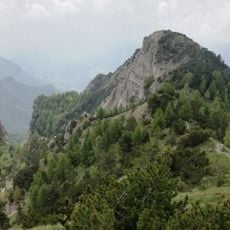
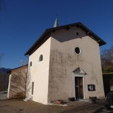
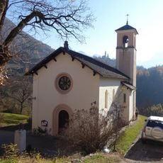
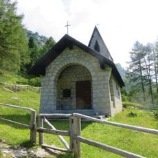
Dente Italiano, Mountain summit in Trambileno, Italy

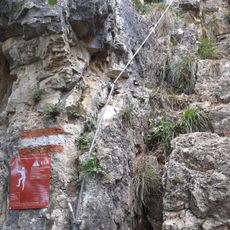
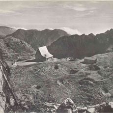
Dente Italiano is a summit in the Pasubio range of the Vicentine Alps standing at 2,220 meters, positioned between the Cosmagnon basin and surrounding alpine formations. Multiple climbing routes reach the peak, with the Ghersi walkway linking it to other notable sites across the massif.

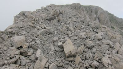
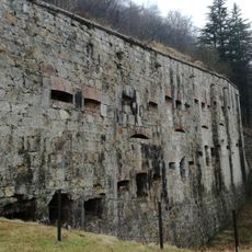
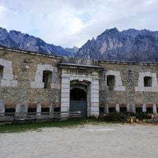
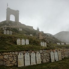
During World War I, the summit functioned as a strategic fortification where Italian and Austrian forces held opposing positions on this high mountain front. A massive explosion involving 50,000 kg of explosives in March 1918 caused permanent damage to the northern section during mine warfare operations.

The name "Dente Italiano" emerged from World War I divisions, marking the boundary between Italian and Austrian territorial control on this ridge. Visitors can sense this historical split reflected in how the landscape was shaped and defended during that era.

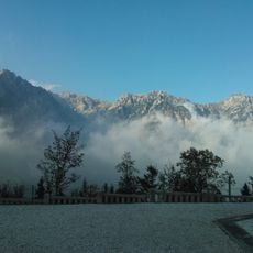
The mountain is most accessible during summer months when snow clears from the routes and conditions allow safe travel. Sturdy footwear and preparation for variable mountain weather are essential regardless of which route you choose.

The northern slope still bears visible scars and deformations from the 1918 explosion, making it a striking testament to mountain warfare history. These physical marks remain a silent reminder of how intensely this high-altitude terrain was contested.

The community of curious travelers

AroundUs brings together thousands of curated places, local tips, and hidden gems, enriched daily by 60,000 contributors worldwide.

Start exploring
Location
Elevation above the sea
2,220 m
GPS coordinates
45.79432,11.17598
Latest update
December 10, 2025 20:01
« Dente Italiano - Mountain summit in Trambileno, Italy » is provided by Around Us (aroundus.com). Images and texts are derived from Wikimedia project under a Creative Commons license. You are allowed to copy, distribute, and modify copies of this page, under the conditions set by the license, as long as this note is clearly visible.

Discover hidden gems everywhere you go!

From secret cafés to breathtaking viewpoints, skip the crowded tourist spots and find places that match your style. Our app makes it easy with voice search, smart filtering, route optimization, and insider tips from travelers worldwide. Download now for the complete mobile experience.

Around Us App Screenshot

A unique approach to discovering new places

Le Figaro

All the places worth exploring

France Info

A tailor-made excursion in just a few clicks

20 Minutes

Around Us
Travel Guide & Maps
Download

Send to your phone

QR Code
1

Open the camera app on your mobile.

2

Point at the QR code with your camera. A notification will appear.

3

Tap the notification to open the link.