Madonie Regional Natural Park, UNESCO Global Geopark in Sicily, Italy
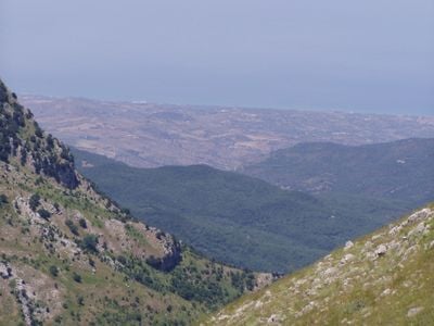
Madonie Regional Natural Park (Parco delle Madonie) is a protected area of 39,941 hectares spanning fifteen municipalities in northern Sicily, between the Imera and Pollina rivers. Its central core rises above 1,600 metres from Pizzo Carbonara (1,979 m) to Pizzo Antenna (1,977 m) and Monte Ferro (1,906 m), built of limestone with harsh forms, while softer clayey-sandy slopes lie at the edges. Beech forests grow only at 1,500 metres and above.
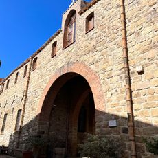
Arab and Norman rulers founded many of the settlements inside the park during the Middle Ages, still clustered around old castles and monasteries. Some of these villages developed into small trading centers between coast and interior during the 11th and 12th centuries.
The traditional communities inside the reserve maintain crafts such as pottery and basket weaving from willow, visible in small workshops around the villages. Many towns still hold harvest festivals celebrating local produce from the surrounding fields and forests.
Many marked trails begin in the mountain villages and pass through woods, meadows, and ridges that can be explored on foot or by bicycle. In summer the higher zones are cooler than the coast, while winter often brings snow to the peaks.
Abies nebrodensis, a fir species that grows only in a small valley in the Madonie, is among the rarest conifers in Europe. Pizzo Carbonara, the second highest peak in Sicily, offers a wide view from its summit across the interior to the coast below.
The community of curious travelers
AroundUs brings together thousands of curated places, local tips, and hidden gems, enriched daily by 93,423 contributors worldwide.