Enable Location

We need your location to show you interesting places around you

Discover nearby places

Find interesting locations and hidden gems around you

Precise directions

Get accurate directions and distances to places

Your location is never shared with other users. It's only used when you tap the location button.

Isahaya

Log in to your account

Join the adventure

Create your free account and start exploring (like 60k+ others)

We will send you a code to connect

or
Continue with Google
Continue with Apple
By continuing, you accept our Terms and Conditions and our Privacy Policy

Check your inbox

We've sent a pincode in your inbox. Please enter the code below.

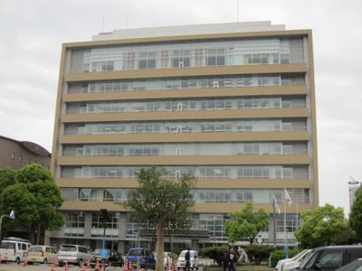
Isahaya, Commercial city in Nagasaki Prefecture, Japan

Description

Isahaya sits on a narrow strip of land where the Shimabara and Nagasaki peninsulas meet, surrounded by Omura Bay, the Ariake Sea, and Tachibana Bay. The city spreads over flat, reclaimed terrain that was once underwater, with modern residential neighborhoods, commercial streets, and rice fields extending toward the sea.

History

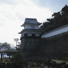
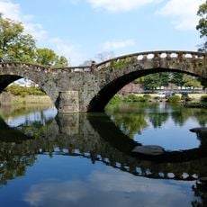
The area developed as a commercial center in the 13th century before becoming a castle town during the Edo period under the Isahaya family. Starting in the late 20th century, a large-scale reclamation project in the bay reshaped the coastline and created new farmland from the tidal flats of the Ariake Sea.

Culture

The city maintains strong connections to traditional Japanese agriculture, particularly through its extensive rice cultivation in lands reclaimed from the Ariake Sea.

Practical

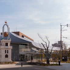
The city serves as a transport hub with direct rail links to Nagasaki, about 16 kilometers to the southwest, including access to the Nishi Kyushu Shinkansen line. Buses and local trains connect the city center with smaller towns on both peninsulas, while the main train station sits close to hotels and shops.

Did you know?

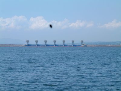
The sea embankment in Isahaya Bay, begun in the late 1980s, encloses one of the largest embanked areas in Japan and creates wide, flat farmland where tidal flats once lay. Flood gates regulate tidal flow and separate the interior from the saltwater sea.

Inception
September 1, 1940
Reference
422045
Shares border with
Nagasaki, Omura, Unzen, Nagayo, Tara
Address
〒854-8601 長崎県諫早市東小路町7ー1
GPS coordinates
32.84339,130.05314
Latest update
December 13, 2025 17:19

AroundUs brings together thousands of curated places, local tips, and hidden gems, enriched daily by 60,000 contributors worldwide. Discover all places nearby (Nagasaki Prefecture).

« Isahaya - Commercial city in Nagasaki Prefecture, Japan » is provided by Around Us (aroundus.com). Images and texts are derived from Wikimedia project under a Creative Commons license. You are allowed to copy, distribute, and modify copies of this page, under the conditions set by the license, as long as this note is clearly visible.

Discover hidden gems everywhere you go!

From secret cafés to breathtaking viewpoints, skip the crowded tourist spots and find places that match your style. Our app makes it easy with voice search, smart filtering, route optimization, and insider tips from travelers worldwide. Download now for the complete mobile experience.

Around Us App Screenshot

A unique approach to discovering new places

Le Figaro

All the places worth exploring

France Info

A tailor-made excursion in just a few clicks

20 Minutes

Around Us
Travel Guide & Maps
Download

Send to your phone

QR Code
1

Open the camera app on your mobile.

2

Point at the QR code with your camera. A notification will appear.

3

Tap the notification to open the link.