
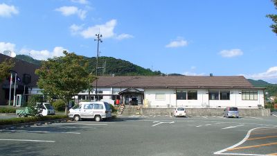
Gyokutō, town in Tamana district, Kumamoto prefecture, Japan
Location: Kumamoto Prefecture
Location: Tamana district
Inception: March 1, 1955
Website: https://www.town.gyokuto.kumamoto.jp/
Shares border with: Kumamoto, Yamaga, Tamana, Nagomi
Website: https://town.gyokuto.kumamoto.jp
GPS coordinates: 32.91889,130.62853
Latest update: March 10, 2025 10:29

Kumamoto Castle
14.5 km
Kumamoto National College of Technology
12.1 km
Yachiyo-za
12.3 km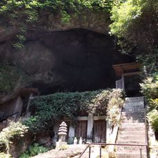
Reigandō
11 km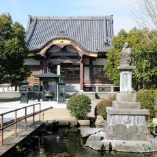
Renge-in Tanjō-ji
8.8 km
Kumamoto Prefectural Museum of Art
14.1 km
Sakuranobaba Johsaien
13.9 km
Taishō-ji ato
14.5 km
Mount Tatsuda
14.1 km
Unganzenji
11.1 km
Kyū Hosokawa Gyōbutei
13.9 km
Kumamoto City Museum
13.9 km
Kumamoto Prefectural Ancient Burial Mound Museum
9.2 km
Shimada Museum of Art
13.3 km
Natsume Sōseki's Former Uchitsuboi Residence
14.2 km
浄行寺
14.4 km
Kenmotsudai Arboretum
14.2 km
往生院
13.1 km
Kōfuku-ji
8.9 km
Jōdō-ji
10.7 km
Kumamoto City Water Science Museum
11.9 km
Kōshi Manga Museum
11.3 km
Eta Funayama Kofun
6.4 km
Koshishinishigoshi Library
11.3 km
Honmyō-ji
12.7 km
Nabeta Cave Tombs
12 km
Tonkararin Tunnel Structure
6 km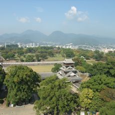
Kumamoto Castle Park
14.2 kmReviews
Visited this place? Tap the stars to rate it and share your experience / photos with the community! Try now! You can cancel it anytime.
Discover hidden gems everywhere you go!
From secret cafés to breathtaking viewpoints, skip the crowded tourist spots and find places that match your style. Our app makes it easy with voice search, smart filtering, route optimization, and insider tips from travelers worldwide. Download now for the complete mobile experience.

A unique approach to discovering new places❞
— Le Figaro
All the places worth exploring❞
— France Info
A tailor-made excursion in just a few clicks❞
— 20 Minutes