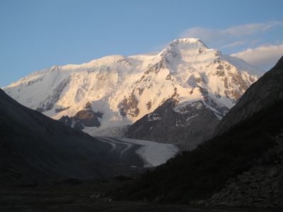
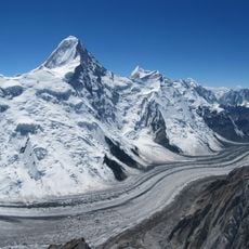
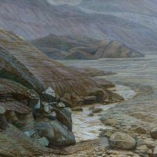
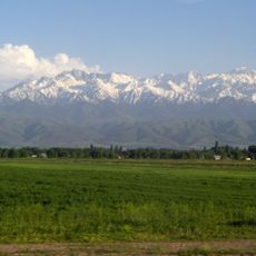
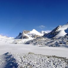
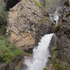
Pik Karakol, Mountain summit in Issyk-Kul Region, Kyrgyzstan
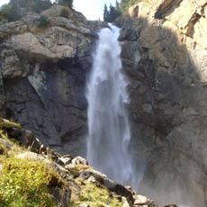
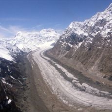
Pik Karakol is a mountain in the Tian Shan range that rises to about 5,200 meters (17,000 feet) and features steep rocky slopes throughout. Glaciers and snowfields cover parts of the peak, shaping the terrain and creating a dramatic alpine landscape.
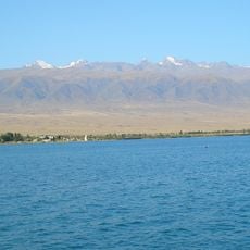
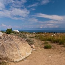
The mountain served as a landmark for nomadic peoples crossing Central Asian mountain passes over many centuries. This natural waypoint helped travelers and traders navigate their routes through the challenging terrain.
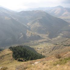
Local communities maintain traditional practices around the mountain, including seasonal grazing patterns and ceremonies that honor the natural landscape.
Climbing the peak requires significant mountaineering experience, specialized gear, and days to acclimatize to the altitude. Hiring a local guide is essential for learning the safest routes and managing the physical demands.
Temperature swings between seasons exceed 50 degrees Celsius, creating starkly different weather conditions at different elevations. These extremes shift where snow persists and where ice forms on the slopes.
Location: Issyk-Kul Region
Elevation above the sea: 5,216 m
GPS coordinates: 42.17237,78.46497
Latest update: December 14, 2025 11:20
Kolsay Lakes National Park
84.9 km
Assy-Turgen Observatory
126.7 km
Bartogay Lake
130.9 km
Engil'chek Glacier
111.8 km
Issyk-Kul protected area
102.6 km
Кырчын
103.6 km
Holy Trinity Church, Karakol
35.7 km
Karakol Dungan Mosque
36.7 km
Свято-Троицкий Иссык-Кульский монастырь
68.9 km
Przhevalsky Museum
46.1 km
Barskoon waterfall
75.8 km
Lednik Semjonova
128.7 km
Almaty State Complex Nature Sanctuary
133.3 km
Lednik Petrova
34.7 km
Pik Nansena
96.3 km
Kairak falls
127.5 km
Sarychat glacier
13.7 km
Open air Museum Issyk Kull at Cholpon Ata
127.7 km
Lednik Kaindy
100.3 km
Peshchera Akchunkur
84.1 km
Lednik Komsomolets
123.1 km
Lednik Zvëzdochka
135.8 km
Fairy Tale Canyon
91.7 km
Lednik Shokal'skogo
112.8 km
Lednik Aksu
132.9 km
Ozero Karakol' (lanaw nga asin sa Kirgistan, Issyk-Kul'skaya Oblast')
93.3 km
Istochnik Dzhilusu
122.3 km
Natural Monument "Chinturgen firry grove"
131.2 kmVisited this place? Tap the stars to rate it and share your experience / photos with the community! Try now! You can cancel it anytime.
Discover hidden gems everywhere you go!
From secret cafés to breathtaking viewpoints, skip the crowded tourist spots and find places that match your style. Our app makes it easy with voice search, smart filtering, route optimization, and insider tips from travelers worldwide. Download now for the complete mobile experience.
A unique approach to discovering new places❞
— Le Figaro
All the places worth exploring❞
— France Info
A tailor-made excursion in just a few clicks❞
— 20 Minutes