Gorodetsky Glacier, Mountain glacier in Trans-Ili Alatau Range, Kazakhstan.
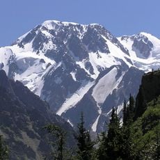
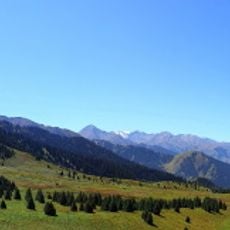
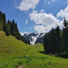
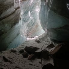
Gorodetsky Glacier is a rock glacier on the northern slope of the Zailiysky Alatau, made up of a left and a right branch. The left branch starts on steep slopes of the axial ridge whose summits reach 4,000 m; it is 5.5 km long, covers 3.8 km² and holds 0.14 km³ of ice, with its firn line at 3,770 m. The right branch runs west from the crest of a side spur dividing the Bolshaya Almatinka basin from the Talgar basin, ends at 3,650 m and holds 0.10 km³ of ice.
Vladimir Dmitrievich Gorodetsky (1878–1943), a dendrologist and archaeologist, first visited the glacier in 1916. It was named in his honour twenty years later, in 1936. In Soviet times glaciologists worked on the ice, among them Nikolai Nikitich Palgov (1889–1970), academician of the Academy of Sciences of the Kazakh SSR.
The glacier carries the name of Vladimir Dmitrievich Gorodetsky (1878–1943), a dendrologist and archaeologist who reached it in 1916; it was named after him twenty years later. In Soviet times the Academy of Sciences of the Kazakh SSR sent glaciologists here, among them academician Nikolai Nikitich Palgov (1889–1970).
The glacier sits on the northern slope of the Zailiysky Alatau, with its left branch rising from slopes up to 4,000 m and its right branch ending at 3,650 m. Access is on foot over high mountain terrain, so plan for glacier travel and check conditions before setting out. The left branch has been retreating since 1982.
The two branches of the glacier have shown differing retreat patterns, with the left arm experiencing greater withdrawal between 1938 and 1961 than the right one. This difference illustrates how neighboring ice masses respond distinctly to environmental shifts.
The community of curious travelers
AroundUs brings together thousands of curated places, local tips, and hidden gems, enriched daily by 93,768 contributors worldwide.