Bolaven Plateau, Mountain plateau in southern Laos
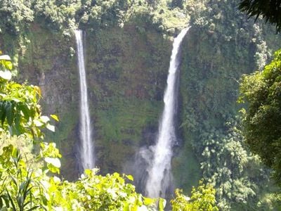
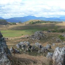
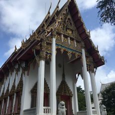
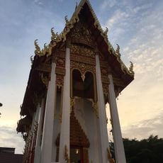
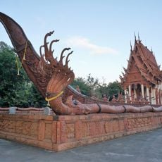
The Bolaven Plateau is a highland region in southern Laos, situated between the Annamite Range and the Mekong River, with elevations ranging from 1,000 to 1,350 meters. The landscape features multiple waterfalls, traditional ethnic villages, and coffee plantations that define the character and use of the land.
French colonizers began transforming the region into an agricultural center starting in 1893, introducing coffee and rubber cultivation to the area. These activities fundamentally reshaped the local economy and left lasting marks on the landscape and settlement patterns.
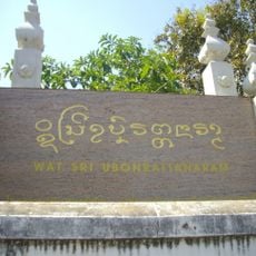
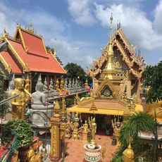
The plateau takes its name from the Laven people, who inhabit this land alongside the Alak, Katu, Taoy, and Suay communities. You can encounter their traditional practices and spiritual beliefs woven into village life and daily activities throughout the region.
The best time to explore is during the cooler season when roads are dry and trails are safer to navigate. You can rent scooters or book guided tours to visit waterfalls, villages, and plantations at your own pace.
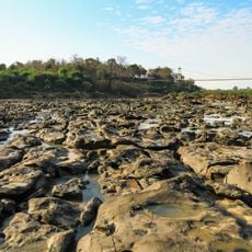
Scientists have discovered evidence beneath the plateau of a meteorite impact that occurred around 790,000 years ago. This cosmic event scattered tiny glass fragments called tektites across a vast area spanning Asia and Australia.
GPS coordinates: 15.11000,106.44000
Latest update: December 6, 2025 16:03
Laos combines Buddhist temples, waterfalls and caves. The temple complexes display religious art and architecture from different periods. The natural areas include waterfalls like Kuang Si, cave systems like Tham Kong Lo and mountain ranges with views over the Mekong. The country preserves its cultural and geological features.
Khone Phapheng Falls
137 km
Vat Phou
73.2 km
Pha Taem National Park
104.3 km
Wat Sirindhorn Wararam Phu Phrao
104.6 km
Wat Maha Wanaram
170 km
Virachey National Park
106 km
Phu Chong-Na Yoi National Park
130.3 km
Wat Si Ubon Rattanaram
170.7 km
Champasak cultural landscape
75.4 km
Kaeng Tana National Park
105.9 km
Wat Tai Phra Chao Yai Ong Tue
169.6 km
Wat Thung Si Mueang
170.1 km
Champasak Palace
68.1 km
Wat Mani Wanaram
170.1 km
Xe Pian National Protected Area
73.4 km
Wat Luang
69 km
Wat Luang
170.2 km
Pakse Bridge
67.3 km
Wat Sa Prasan Suk
169.1 km
Ubon Ratchathani University Stadium
163.6 km
Sirindhorn Reservoir
114 km
Prasat Ban Ben
166.4 km
Tad Yuang
33.3 km
Phou N'droni
88.8 km
Phou Dènmuang (tumoy sa bukid)
155.6 km
Phou Paao
117.2 km
Phou Niang (tahud sa bukid sa Laos)
73.6 km
Tad Fane Waterfall
34.3 kmVisited this place? Tap the stars to rate it and share your experience / photos with the community! Try now! You can cancel it anytime.
Discover hidden gems everywhere you go!
From secret cafés to breathtaking viewpoints, skip the crowded tourist spots and find places that match your style. Our app makes it easy with voice search, smart filtering, route optimization, and insider tips from travelers worldwide. Download now for the complete mobile experience.
A unique approach to discovering new places❞
— Le Figaro
All the places worth exploring❞
— France Info
A tailor-made excursion in just a few clicks❞
— 20 Minutes