Enable Location

We need your location to show you interesting places around you

Discover nearby places

Find interesting locations and hidden gems around you

Precise directions

Get accurate directions and distances to places

Your location is never shared with other users. It's only used when you tap the location button.

Lentainių piliakalnis

Log in to your account

Start exploring — it's free

Trusted by 61,972 travelers worldwide

Continue with Google
Continue with Apple
or

We will send you a code to connect

By continuing, you accept our Terms and Conditions and our Privacy Policy

Check your inbox

We've sent a pincode in your inbox. Please enter the code below.

Lentainių piliakalnis

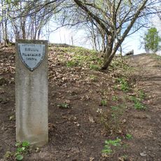
Lentainių piliakalnis, Archaeological hillfort in Domeikavos seniūnija, Lithuania.

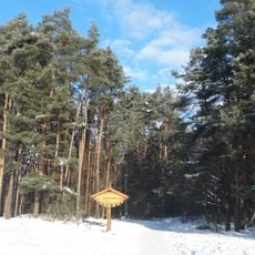
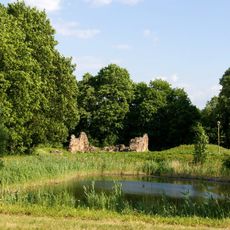
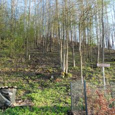
Lentainių piliakalnis is an archaeological hillfort located on the right bank of the Neris River, featuring an oval platform measuring roughly 23 by 15 meters on its upper terrace. The site sits near the Kaunas-Šėta road and is now accessible via newly installed stairs that lead visitors up from ground level.

The settlement was established in the first millennium and remained occupied through the beginning of the second millennium, as revealed by archaeological investigations between 2001 and 2004. This long occupation shows that the location served as a settlement throughout centuries of the region's development.

The site reveals traces of an ancient settlement that visitors can observe through exposed structures and foundation remains visible today. Pottery and everyday objects uncovered during excavations suggest how people once lived in this location.

The site is easy to reach and offers parking at the entrance along with newer stairs that provide safe access up the slope. Visitors should allow time to climb the stairs and take in the view from the upper platform once they arrive.

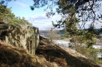
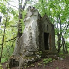
A concrete bunker built in 1915 was integrated into the hillfort, and construction workers took soil from the original rampart to build it. This military structure from the early 20th century now sits atop layers of much older settlement history.

The community of curious travelers

AroundUs brings together thousands of curated places, local tips, and hidden gems, enriched daily by 60,000 contributors worldwide.

Start exploring
Location
Domeikavos seniūnija
GPS coordinates
54.96161,23.94775
Latest update
December 14, 2025 16:42
« Lentainių piliakalnis - Archaeological hillfort in Domeikavos seniūnija, Lithuania » is provided by Around Us (aroundus.com). Images and texts are derived from Wikimedia project under a Creative Commons license. You are allowed to copy, distribute, and modify copies of this page, under the conditions set by the license, as long as this note is clearly visible.

Discover hidden gems everywhere you go!

From secret cafés to breathtaking viewpoints, skip the crowded tourist spots and find places that match your style. Our app makes it easy with voice search, smart filtering, route optimization, and insider tips from travelers worldwide. Download now for the complete mobile experience.

Around Us App Screenshot

A unique approach to discovering new places

Le Figaro

All the places worth exploring

France Info

A tailor-made excursion in just a few clicks

20 Minutes

Around Us
Travel Guide & Maps
Download

Send to your phone

QR Code
1

Open the camera app on your mobile.

2

Point at the QR code with your camera. A notification will appear.

3

Tap the notification to open the link.