Houten, Cycling municipality in Utrecht, Netherlands.
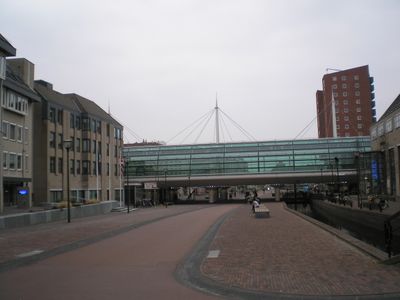
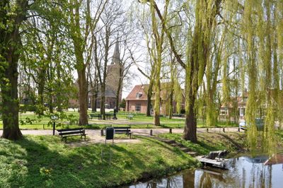
Houten is a municipality in Utrecht designed around cycling as the primary way to move through residential neighborhoods. The layout integrates pathways for bicycles and pedestrians throughout, with green spaces separating different areas.
Originally an agricultural area, the municipality became a planned residential zone during the 20th century. This transformation shaped how the place was built from the ground up with cycling infrastructure in mind.
The community here is shaped by cycling as a way of life, with residents naturally choosing bikes over cars for daily movement. This choice influences how neighborhoods feel and how people interact in public spaces throughout the municipality.
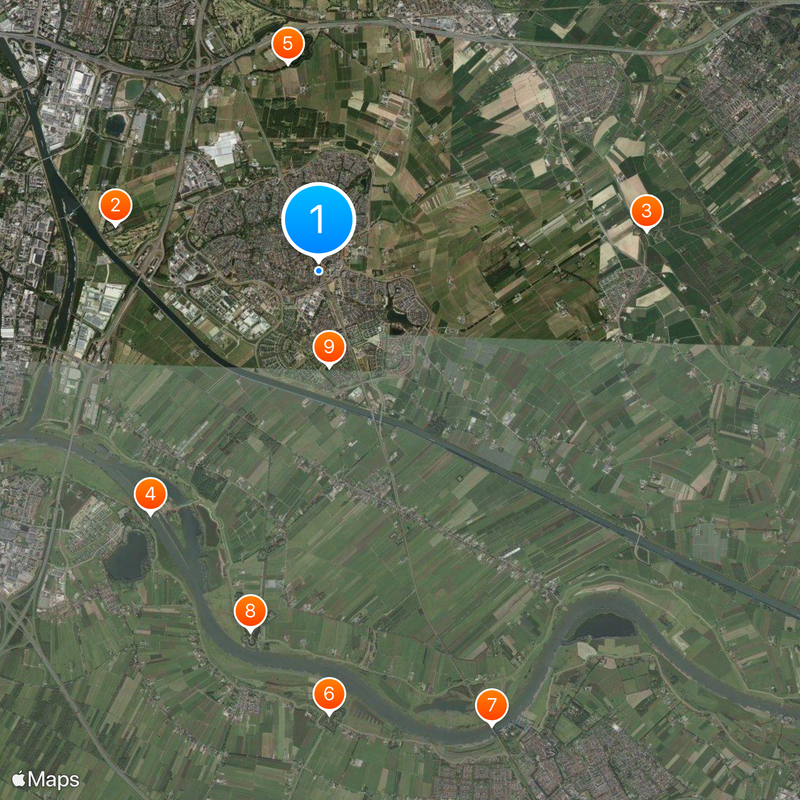
The place is easily reached by train from Utrecht and has clear bicycle routes throughout for navigation. Visitors find it most convenient to move around on foot or by bike, as car access is limited in many areas.
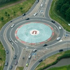
The area uses a dual ring road system that keeps cars out of residential streets while giving cyclists priority everywhere. This design means traffic flows in an entirely different way than in most other places.
Location: Utrecht
Capital city: Houten
Elevation above the sea: 2 m
Shares border with: Vianen, Nieuwegein, Utrecht, Bunnik, Wijk bij Duurstede, Culemborg
Phone: +31306392611
Email: gemeentehuis@houten.nl
Website: http://houten.nl
GPS coordinates: 52.02610,5.17280
Latest update: December 6, 2025 21:26
Kasteel Heemstede
3.4 km
Beverweerd Castle
5.3 km
Hagestein weir-lock complex
4.7 km
Fectio
3.4 km
Fort Everdingen
7.1 km
Kuilenburgse spoorbrug
7.8 km
Fort Honswijk
5.9 km
Schonauwen
1.5 km
Kasteel te Culemborg
8.2 km
Wickenburgh
3 km
Wulven
2.5 km
Kasteel Hagestein
5.9 km
Honswijk
6.4 km
Oud Wulven, Houten
2.3 km
Fort Het Hemeltje
3.1 km
Sint-Michaëlkerk
3.6 km
Goilberdingen
7.3 km
Huis Vuilkoop
3.1 km
Rijsenburgh
5.8 km
Kasteel Schalkwijk
4.4 km
Onze Lieve Vrouwe ten Hemelopneming, Houten
630 m
Town hall of Houten
1 km
De Bol op Redichem
8 km
Nederlands Hervormde Kerk, Houten
792 m
Watertoren Bunnik
6.7 km
Schonauwen
1.3 km
Ridderhofstad Heemstede
3.6 km
De Steenen Poort
1.4 kmVisited this place? Tap the stars to rate it and share your experience / photos with the community! Try now! You can cancel it anytime.
Discover hidden gems everywhere you go!
From secret cafés to breathtaking viewpoints, skip the crowded tourist spots and find places that match your style. Our app makes it easy with voice search, smart filtering, route optimization, and insider tips from travelers worldwide. Download now for the complete mobile experience.
A unique approach to discovering new places❞
— Le Figaro
All the places worth exploring❞
— France Info
A tailor-made excursion in just a few clicks❞
— 20 Minutes