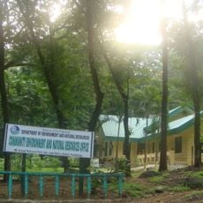
Magalang, Provincial administrative center in Pampanga, Philippines
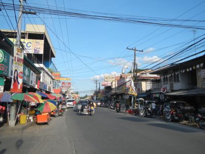
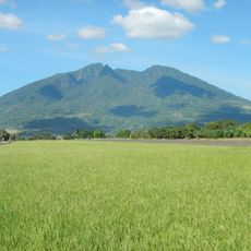
Magalang is a municipality in Pampanga province located at the base of Mount Arayat, spread across a sizable area in the foothills. It is divided into 27 barangays, or administrative districts, that structure the local landscape.
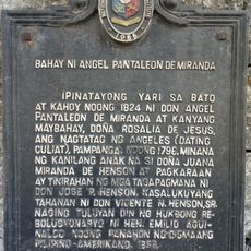
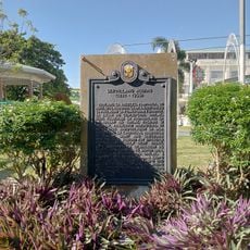
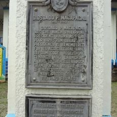
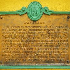
Augustinian missionaries founded the community in the early 17th century, but the original site was relocated several times due to flooding problems. The town settled in its present location during the middle of the 19th century.
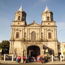
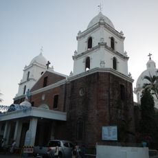
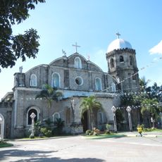
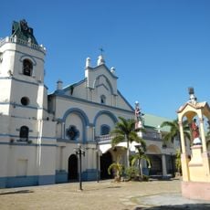
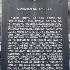
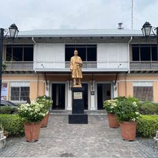
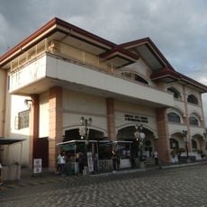
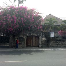
The San Bartolome Parish Church forms the heart of the community and shapes daily life through religious traditions and gatherings. The building reflects the deep Catholic faith that has guided the town for generations.
The area is dominated by agricultural land, with a major university offering research and educational programs in farming techniques. Walking or using a motorbike works well for exploring the smaller communities and farms.
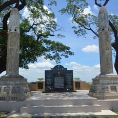
The town preserves old signal towers left behind from Spanish colonial times, which once allowed distant military outposts to communicate with each other. These stone structures still stand today as remnants of that bygone era.
GPS coordinates: 15.21735,120.67450
Latest update: December 7, 2025 20:22
Mount Arayat
7.6 km
Angeles Church
12.9 km
Eastern Economic Corridor
15 km
Nayong Pilipino Clark
15.6 km
Bamban Bridge
13.2 km
Immaculate Conception Parish Church
15.9 km
Magalang Church
1.6 km
Santa Catalina Parish Church
12.9 km
Pamintuan Mansion historical marker
12.8 km
Mount Arayat National Park
7.5 km
House of Angel Pantaleon de Miranda historical marker
12.9 km
Zoocobia Fun Zoo
16.5 km
Church of Angeles historical marker
12.9 km
Death March historical marker
16.6 km
Museum of Angeles City
12.8 km
Pamintuan Mansion
12.7 km
Pamintuan Mansion
12.7 km
The House of the Aquino Family historical marker
12.1 km
Aquino Ancestral House
12.1 km
Servillano Aquino historical marker
12.1 km
Museum of Philippine Social History
12.7 km
Renato D. Tayag historical marker
12.8 km
Artillery Memorial historical marker
11.4 km
Angeles City Library and Information Center
12.8 km
Diosdado P. Macapagal historical marker
12.9 km
Magalang historical marker
1.5 km
Angel Pantaleon de Miranda House
12.9 km
City Public Order and Safety Coordinating Office
14.7 kmVisited this place? Tap the stars to rate it and share your experience / photos with the community! Try now! You can cancel it anytime.
Discover hidden gems everywhere you go!
From secret cafés to breathtaking viewpoints, skip the crowded tourist spots and find places that match your style. Our app makes it easy with voice search, smart filtering, route optimization, and insider tips from travelers worldwide. Download now for the complete mobile experience.
A unique approach to discovering new places❞
— Le Figaro
All the places worth exploring❞
— France Info
A tailor-made excursion in just a few clicks❞
— 20 Minutes