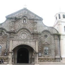
San Juan, Administrative division in Metro Manila, Philippines
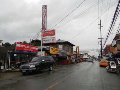
San Juan is a municipality in Metro Manila, Philippines, situated within a compact urban area that blends residential and commercial spaces. The town consists of several administrative districts that organize the daily functioning of its neighborhoods.
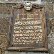
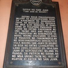
The area gained importance in 1896 when revolutionary forces clashed with Spanish colonial troops in a battle that would shape the region. This confrontation marked a turning point in the local struggle for independence.
Water festivals celebrated each June bring residents into the streets to honor Saint John the Baptist with traditional dousing rituals. These gatherings show how the community keeps its religious customs alive through participation and shared celebration.
The municipality connects easily to other parts of Metro Manila through various transportation routes, making it straightforward to navigate the area. Schools, shops, and services are spread throughout the districts, so visitors can find what they need locally.
A shrine here marks where an old gunpowder storage facility once stood during the 1770s. Many visitors pass through without realizing the site holds remnants of this overlooked piece of history.
The community of curious travelers
AroundUs brings together thousands of curated places, local tips, and hidden gems, enriched daily by 60,000 contributors worldwide.