Enable Location

We need your location to show you interesting places around you

Discover nearby places

Find interesting locations and hidden gems around you

Precise directions

Get accurate directions and distances to places

Your location is never shared with other users. It's only used when you tap the location button.

San Mateo

Log in to your account

Start exploring — it's free

Trusted by 62,096 travelers worldwide

Continue with Google
Continue with Apple
or

We will send you a code to connect

By continuing, you accept our Terms and Conditions and our Privacy Policy

Check your inbox

We've sent a pincode in your inbox. Please enter the code below.

San Mateo

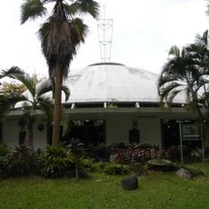
San Mateo, Municipality in Rizal, Philippines

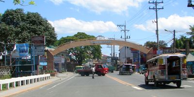
San Mateo is a municipality in Rizal province on the Philippine island of Luzon, sitting at roughly 80 meters above sea level. It shares borders with Quezon City and Marikina to the west, Antipolo to the south, and Rodriguez to the east.

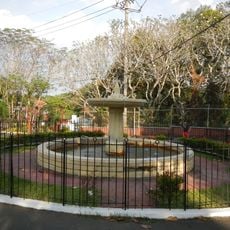
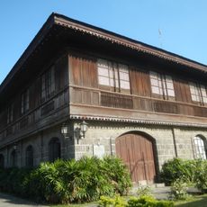
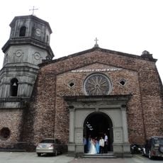
The settlement was founded in 1571 as an outlying community of Pasig and named after the apostle Matthew. During Spanish colonial rule, the area gradually developed into an independent administrative district.

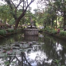
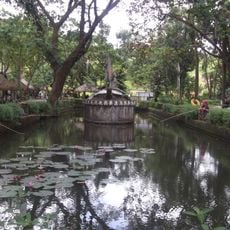
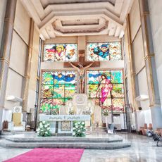
The name comes from Saint Matthew, one of the twelve apostles in the New Testament, chosen as patron by Spanish colonizers. Catholic festivals and processions still shape the rhythm of life for many residents, especially around the local diocesan church.

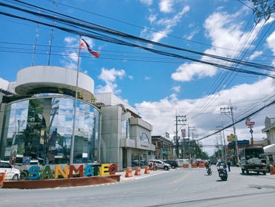
The streets are mostly paved and suited for cars, jeepneys, and tricycles, but traffic can be heavy during morning and late afternoon. Visitors exploring the area should travel outside rush hours and keep a map or navigation app ready.

A dense network of jeepney, bus, and tricycle routes links the area to neighboring cities and Metro Manila, giving travelers many options to choose from. These vehicles usually run without fixed schedules but stop at most corners and intersections on hand signal.

The community of curious travelers

AroundUs brings together thousands of curated places, local tips, and hidden gems, enriched daily by 60,000 contributors worldwide.

Start exploring
Location
Inception
February 29, 1908
Elevation above the sea
80 m
Shares border with
Rodriguez, Antipolo, Quezon City, Marikina
GPS coordinates
14.69694,121.12194
Latest update
December 13, 2025 19:28
Around this place
Philippines

Batasang Pambansa Complex

3 km
Parish of the Holy Sacrifice
Philippines

Parish of the Holy Sacrifice

6.9 km
La Mesa Watershed Reservation
Philippines

La Mesa Watershed Reservation

5.7 km
Avilon Zoo
Philippines

Avilon Zoo

6.2 km
La Mesa Ecopark
Philippines

La Mesa Ecopark

5.4 km
Balara Filters Park
Philippines

Balara Filters Park

6.4 km
Philippines

Novaliches Cathedral

5.9 km
University of the Philippines, College of Social Sciences and Philosophy
Philippines

University of the Philippines, College of Social Sciences and Philosophy

7.4 km
La Mesa Reservoir
Philippines

La Mesa Reservoir

4.4 km
Monument to the Heroes of 1896 historical marker
Philippines

Monument to the Heroes of 1896 historical marker

7.1 km
Eulogio Rodriguez Ancestral House
Philippines

Eulogio Rodriguez Ancestral House

4.7 km
Homage of the Filipino People to the Heroes of 96
Philippines

Homage of the Filipino People to the Heroes of 96

7.1 km
Vinzons Hall
Philippines

Vinzons Hall

7.1 km
Licerio I. Geronimo historical marker
Philippines

Licerio I. Geronimo historical marker

4.7 km
Diocesan Shrine and Parish of Nuestra Señora de Aranzazu
Philippines

Diocesan Shrine and Parish of Nuestra Señora de Aranzazu

488 m
New site of the Monument of the Cry of Pugad Lawin historical marker
Philippines

New site of the Monument of the Cry of Pugad Lawin historical marker

7.1 km
Bagong Silangan Barangay Hall
Philippines

Bagong Silangan Barangay Hall

1.2 km
Battle of San Mateo historical marker
Philippines

Battle of San Mateo historical marker

1.2 km
University of the Philippines College of Law historical marker
Philippines

University of the Philippines College of Law historical marker

7 km
Eulogio Rodriguez y Adona historical marker
Philippines

Eulogio Rodriguez y Adona historical marker

4.7 km
Rodriguez Municipal Hall
Philippines

Rodriguez Municipal Hall

4.7 km
Constitutional Commission of 1986 historical marker
Philippines

Constitutional Commission of 1986 historical marker

3 km
Town of Rodriguez historical marker
Philippines

Town of Rodriguez historical marker

4.7 km
Church of the Holy Sacrifice historical marker
Philippines

Church of the Holy Sacrifice historical marker

6.9 km
Melchora Aquino historical marker
Philippines

Melchora Aquino historical marker

7.5 km
Iglesia ni Cristo historical marker
Philippines

Iglesia ni Cristo historical marker

7.3 km
The Philippine Assembly historical marker
Philippines

The Philippine Assembly historical marker

3.1 km
Church and Shrine of Our Lady of Aranzazu historical marker
Philippines

Church and Shrine of Our Lady of Aranzazu historical marker

493 m
Show the full map
« San Mateo - Municipality in Rizal, Philippines » is provided by Around Us (aroundus.com). Images and texts are derived from Wikimedia project under a Creative Commons license. You are allowed to copy, distribute, and modify copies of this page, under the conditions set by the license, as long as this note is clearly visible.

Discover hidden gems everywhere you go!

From secret cafés to breathtaking viewpoints, skip the crowded tourist spots and find places that match your style. Our app makes it easy with voice search, smart filtering, route optimization, and insider tips from travelers worldwide. Download now for the complete mobile experience.

Around Us App Screenshot

A unique approach to discovering new places

Le Figaro

All the places worth exploring

France Info

A tailor-made excursion in just a few clicks

20 Minutes

Around Us
Travel Guide & Maps
Download

Send to your phone

QR Code
1

Open the camera app on your mobile.

2

Point at the QR code with your camera. A notification will appear.

3

Tap the notification to open the link.