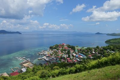
Culion, municipality of the Philippines in the province of Palawan
Culion is a municipality on an island in northern Palawan, part of the Calamian group of islands. The small town has a quiet port, simple streets, green hills, and clear water surrounding it on all sides.
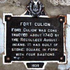
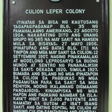
Culion was established as a colony for people with leprosy in 1906 during American rule, isolating patients on the island to manage the disease. The settlement grew into a significant medical facility until the disease was eradicated in 2006, and the area became an official municipality in 1992.
Culion's name reflects its complex past and present community identity. The island values its history while residents embrace tourism and local development to share their stories with visitors.
Culion is reached by boat from nearby islands like Coron or Busuanga, with the journey taking several hours across calm seas. The town offers simple guesthouses and local eateries where travelers can stay and taste fresh seafood, best visited during the dry season.
Mount Oltaloro has a carved caduceus symbol on the hillside, often mistaken for a medical emblem but actually rooted in Greek mythology. This subtle reminder connects the island's past as a place of fear to its present as a symbol of revival and community hope.
The community of curious travelers
AroundUs brings together thousands of curated places, local tips, and hidden gems, enriched daily by 60,000 contributors worldwide.