San Juan, Administrative division in Metro Manila, Philippines
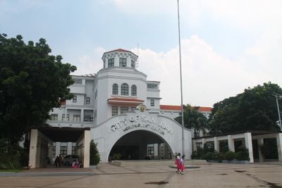
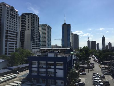
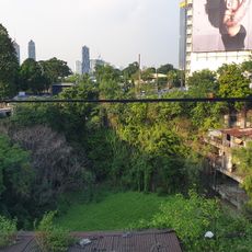
San Juan is a small city within Metro Manila, positioned between Quezon City and Manila proper, forming part of the capital region's central corridor. The compact urban area consists of residential neighborhoods, commercial streets, and several government offices arranged around main thoroughfares.
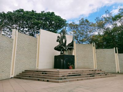
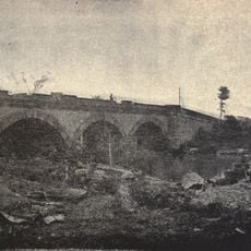
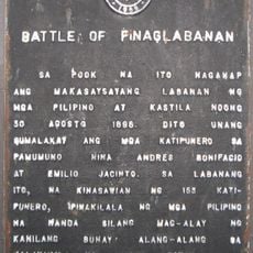
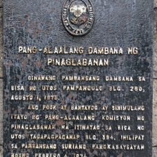
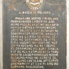
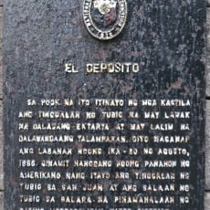
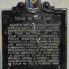
The settlement began as a Spanish colonial land grant in 1590, growing gradually under centuries of foreign administration. In 1896, the area witnessed one of the earliest armed confrontations of the Philippine independence movement.
The Wattah Wattah Festival takes place every June 24, featuring water celebrations throughout the streets to honor Saint John the Baptist.
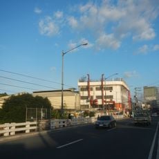
The city sits in the heart of Metro Manila and is easily reachable by public transit, with the LRT Line 2 providing direct access through the J Ruiz station. Jeepneys and buses run frequently along main roads, connecting different neighborhoods together.
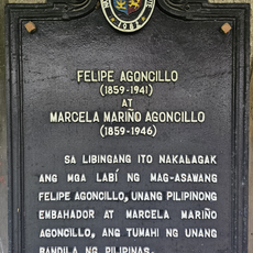
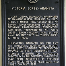
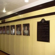
The small urban area has produced five Philippine presidents, establishing its reputation as a place where national leaders have their roots. This concentration of heads of state from such a limited territory remains an unusual feature of the city's identity.
Location: Metro Manila
Inception: 1623
Elevation above the sea: 24 m
Reference: 1381400000
Shares border with: Quezon City, Mandaluyong, Manila
Website: https://sanjuancity.gov.ph
GPS coordinates: 14.60400,121.03000
Latest update: December 13, 2025 15:35
EDSA Shrine
3.3 km
Broadway Centrum
903 m
Pinaglabanan Shrine
229 m
Skycity
3.2 km
Wack Wack Golf and Country Club
2.6 km
White Cross Orphanage
517 m
San Juan River Bridge
1.1 km
Museo El Deposito
191 m
Mira-Nila House
2.3 km
Sevilla Bridge
1.2 km
Battle of Pinaglabanan historical marker
522 m
Club Filipino Kalayaan Hall historical marker
2 km
Camp Crame historical marker
2.6 km
Pinaglabanan Memorial Shrine historical marker
102 m
Almacen de Polvora historical marker
811 m
El Deposito historical marker
90 m
Felipe Agoncillo and Marcela Mariño Agoncillo historical marker
603 m
Victoria Lopez-Araneta historical marker
508 m
Jose Rizal University historical marker
1.2 km
Church of San Juan del Monte historical marker
648 m
The Club Filipino and the Nacionalista Party historical marker
2 km
Vicente Fabella y Fernandez historical marker
1.3 km
Bridge of San Juan historical marker
1.1 km
Club Filipino historical marker
2 km
The Church of San Juan del Monte historical marker
219 m
Mira-Nila House historical marker
2.3 km
Jose P. Laurel historical marker
2.8 km
Wack Wack Golf and Country Club
2.4 kmVisited this place? Tap the stars to rate it and share your experience / photos with the community! Try now! You can cancel it anytime.
Discover hidden gems everywhere you go!
From secret cafés to breathtaking viewpoints, skip the crowded tourist spots and find places that match your style. Our app makes it easy with voice search, smart filtering, route optimization, and insider tips from travelers worldwide. Download now for the complete mobile experience.
A unique approach to discovering new places❞
— Le Figaro
All the places worth exploring❞
— France Info
A tailor-made excursion in just a few clicks❞
— 20 Minutes