Chest opened
+${chestReward.xp} XP
Explorer
NOUVEAU ×${chestReward.collectible.quantity}
tapez pour fermer
Chest locked

Open chests in the app

Around Us is built for your phone — chests unlock when you walk, explore and capture nearby places.

Enable Location

We need your location to show you interesting places around you

Discover nearby places

Find interesting locations and hidden gems around you

Precise directions

Get accurate directions and distances to places

Your location is never shared with other users. It's only used when you tap the location button.

Marikina-Infanta Highway

Log in to your account

Start exploring — it's free

Trusted by 72,993 travelers worldwide

Continue with Google
Continue with Apple
or

We will send you a code to connect

By continuing, you accept our Terms and Conditions and our Privacy Policy

Check your inbox

We've sent a pincode in your inbox. Please enter the code below.

Marikina-Infanta Highway
Discussion Reviews 1 Photos
18.6k Popularity

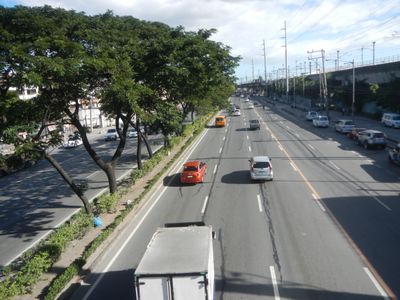
Marikina-Infanta Highway, road in the Philippines

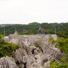
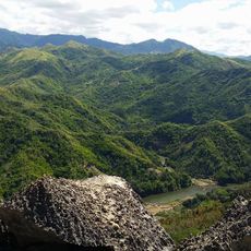
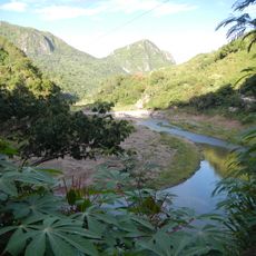
The Marikina-Infanta Highway is a road on the Philippines that connects Marikina City with the town of Infanta in Quezon province and runs through mountain areas. The route crosses the Sierra Madre mountains with winding sections, passes through small towns like Tanay, and offers views of hills, Laguna de Bay, and forests along the way.

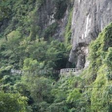
The road was built in the early 1900s and starts in Marikina City near Katipunan Avenue. The Querocep Bridge was reconstructed after a landslide in December 2015 and replaced with a new steel bridge by 2018, making the route safer.

The highway links Marikina to small mountain communities and serves as a vital route for locals visiting family and buying supplies. It has become a favorite destination for motorcycle riders and outdoor enthusiasts who appreciate the winding curves and cool mountain air.

The road is mostly well maintained and passable for all vehicle types, though some sections may still be under repair. Small restaurants and cafes dot the route for breaks, and places like Sierra Madre Hotel & Resort in Tanay offer comfortable stops for longer stays.

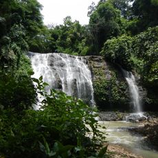
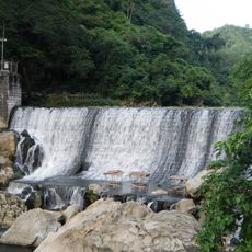
The road is a favorite among motorcycle riders and is also used for occasional sports car drives, as the curves and hilly terrain offer an exciting driving experience. Waterfalls like Palo Alto Falls in Baras are just a short distance away and make the route ideal for weekend trips with stops.

The community of curious travelers

AroundUs brings together thousands of curated places, local tips, and hidden gems, enriched daily by 60,000 contributors worldwide.

Start exploring
GPS coordinates
14.61361,121.33556
Latest update
February 16, 2026 23:42
Reviews
Share your experience

No review yet

Discussions
Start a discussion...

No discussion yet

« Marikina-Infanta Highway - road in the Philippines » is provided by Around Us (aroundus.com). Images and texts are derived from Wikimedia project under a Creative Commons license. You are allowed to copy, distribute, and modify copies of this page, under the conditions set by the license, as long as this note is clearly visible.

Discover hidden gems everywhere you go!

From secret cafés to breathtaking viewpoints, skip the crowded tourist spots and find places that match your style. Our app makes it easy with voice search, smart filtering, route optimization, and insider tips from travelers worldwide. Download now for the complete mobile experience.

Around Us App Screenshot

A unique approach to discovering new places

Le Figaro

All the places worth exploring

France Info

A tailor-made excursion in just a few clicks

20 Minutes

Around Us
Travel Guide & Maps
Download

Send to your phone

QR Code
1

Open the camera app on your mobile.

2

Point at the QR code with your camera. A notification will appear.

3

Tap the notification to open the link.