Chest opened
+${chestReward.xp} XP
Explorer
NOUVEAU ×${chestReward.collectible.quantity}
tapez pour fermer
Chest locked

Open chests in the app

Around Us is built for your phone — chests unlock when you walk, explore and capture nearby places.

Enable Location

We need your location to show you interesting places around you

Discover nearby places

Find interesting locations and hidden gems around you

Precise directions

Get accurate directions and distances to places

Your location is never shared with other users. It's only used when you tap the location button.

MacArthur Highway

Log in to your account

Start exploring — it's free

Trusted by 72,975 travelers worldwide

Continue with Google
Continue with Apple
or

We will send you a code to connect

By continuing, you accept our Terms and Conditions and our Privacy Policy

Check your inbox

We've sent a pincode in your inbox. Please enter the code below.

MacArthur Highway
Discussion Reviews 1 Photos
19.5k Popularity

MacArthur Highway, major highway on the island of Luzon, Philippines

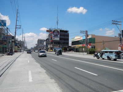
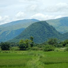
MacArthur Highway is a long trunk road stretching from northern Metro Manila to the town of Aparri in Cagayan, passing through diverse landscapes and communities. The road features busy city sections lined with shops and markets in urban areas, while rural portions show farms, small villages, and open countryside.

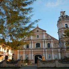
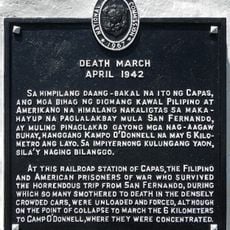
Construction of the highway began in the late 1920s during the American period, built in sections to connect Manila with northern towns. The section from Caloocan to Urdaneta was renamed MacArthur Highway in the 1960s to honor General Douglas MacArthur, a key figure in World War II.

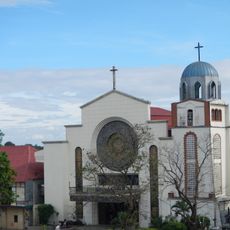
The highway is named after General Douglas MacArthur and stands as a reminder of the American period in Philippine history. Today it serves as a vital part of daily life for communities along its route, connecting urban centers with rural villages and supporting local markets, celebrations, and the way people move through their daily routines.

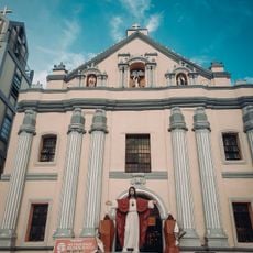
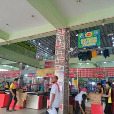
The highway can be crowded in urban sections, especially near major cities like Angeles and San Fernando, while rural stretches are quieter for travel. Along the route, visitors will find public markets, roadside food stalls, and stops where they can rest, sample local dishes, and purchase handmade goods.

In 1991, the eruption of Mount Pinatubo damaged a section of the highway near Tarlac, leading teams to rebuild and strengthen the road. This event shows how the route has adapted to natural challenges and remains a symbol of the country's ability to overcome obstacles.

The community of curious travelers

AroundUs brings together thousands of curated places, local tips, and hidden gems, enriched daily by 60,000 contributors worldwide.

Start exploring
GPS coordinates
16.00150,120.57600
Latest update
February 16, 2026 22:40
Reviews
Share your experience

No review yet

Discussions
Start a discussion...

No discussion yet

« MacArthur Highway - major highway on the island of Luzon, Philippines » is provided by Around Us (aroundus.com). Images and texts are derived from Wikimedia project under a Creative Commons license. You are allowed to copy, distribute, and modify copies of this page, under the conditions set by the license, as long as this note is clearly visible.

Discover hidden gems everywhere you go!

From secret cafés to breathtaking viewpoints, skip the crowded tourist spots and find places that match your style. Our app makes it easy with voice search, smart filtering, route optimization, and insider tips from travelers worldwide. Download now for the complete mobile experience.

Around Us App Screenshot

A unique approach to discovering new places

Le Figaro

All the places worth exploring

France Info

A tailor-made excursion in just a few clicks

20 Minutes

Around Us
Travel Guide & Maps
Download

Send to your phone

QR Code
1

Open the camera app on your mobile.

2

Point at the QR code with your camera. A notification will appear.

3

Tap the notification to open the link.