Marão Tunnel, Road tunnel through Serra do Marão mountain range, Portugal
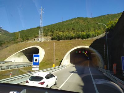
The Marão Tunnel is a twin-tube road passage running beneath the Serra do Marão mountain range, connecting Porto with Vila Real via the A4 motorway. The underground route stretches for several kilometers and allows drivers to cross the mountain barrier without climbing over the summit.
The project emerged from the need to pierce through the mountain range and solve a long-standing traffic bottleneck on the previous mountain route. Its completion transformed traffic flows and created a modern transportation link across northern Portugal.
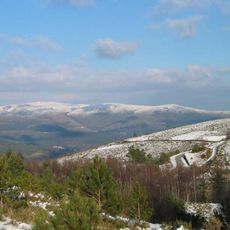
The tunnel represents a transformative connection between the coastal and inland regions of northern Portugal, linking different economic and social territories.
The tunnel is equipped with modern lighting and ventilation systems that ensure safe passage regardless of weather conditions outside. Drivers should expect moderate traffic, particularly during peak hours, and maintain appropriate speeds for the underground section.
The tunnel ranks as Portugal's longest underground road passage and represented a major engineering milestone when it opened. The parallel tubes allow traffic to flow in both directions independently, which significantly reduces bottlenecks and delays.
The community of curious travelers
AroundUs brings together thousands of curated places, local tips, and hidden gems, enriched daily by 60,000 contributors worldwide.