Chest opened
+${chestReward.xp} XP
Explorer
NOUVEAU ×${chestReward.collectible.quantity}
tapez pour fermer
Chest locked

Open chests in the app

Around Us is built for your phone — chests unlock when you walk, explore and capture nearby places.

Enable Location

We need your location to show you interesting places around you

Discover nearby places

Find interesting locations and hidden gems around you

Precise directions

Get accurate directions and distances to places

Your location is never shared with other users. It's only used when you tap the location button.

Iron Gate

Log in to your account

Start exploring — it's free

Trusted by 72,887 travelers worldwide

Continue with Google
Continue with Apple
or

We will send you a code to connect

By continuing, you accept our Terms and Conditions and our Privacy Policy

Check your inbox

We've sent a pincode in your inbox. Please enter the code below.

Iron Gate
Discussion Reviews 9 Photos
65.2k Popularity

Iron Gate, River gorge system in Carpathian Mountains, Romania and Serbia

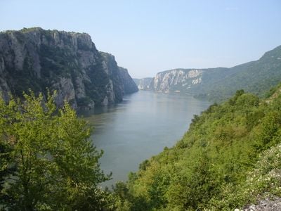
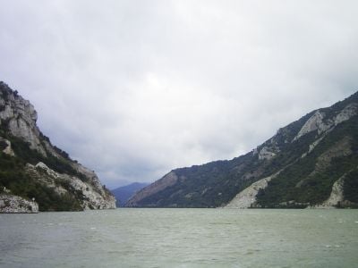
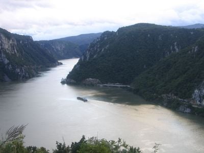
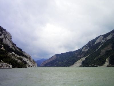
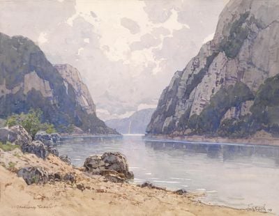
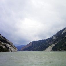
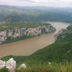
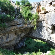
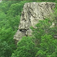
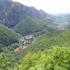
The Iron Gate is a gorge system along the section of the Danube between Romania and Serbia that stretches roughly 130 kilometers and consists of four narrow valleys and three wider basins. The rock walls rise at some points up to 600 meters (2,000 feet) above the water level and form one of the most dramatic landscapes along the entire river course.

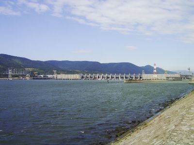
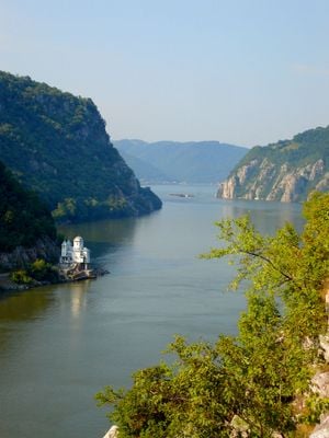
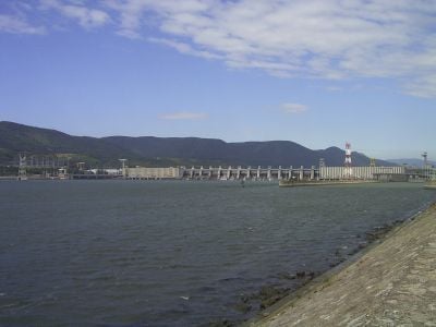
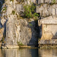
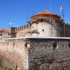
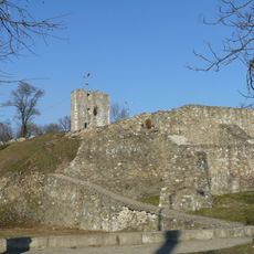
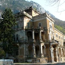
The Romans secured the passage in the 2nd century AD under Emperor Trajan when they built a road along the riverside and placed an inscription on the cliff. In the 1970s the area was fundamentally changed by the construction of two dams that flooded islands and old riverside villages.

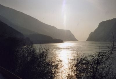
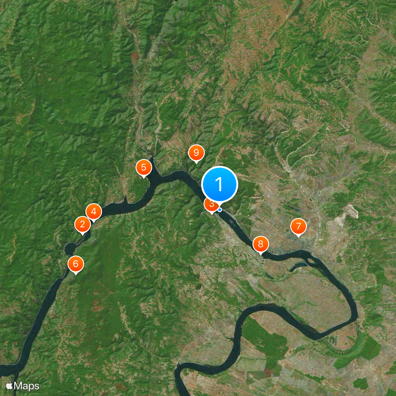
The name refers to the narrow passages where the river squeezes between tall rock walls that were once difficult for ships to navigate. Today visitors can drive along the riverside roads and stop at several viewpoints to watch the river landscape and the steep cliffs on both sides.

The best time to visit is between spring and autumn when paths are accessible and the view reaches farthest in clear weather. Several roads follow the river course on both sides so you can reach the main points by car or bus.

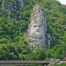
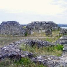
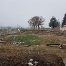
When the dam was built the Roman tablet with Emperor Trajan's inscription had to be moved to a higher spot on the Serbian cliff face to protect it from the rising water. At the Lepenski Vir archaeological site on the Serbian side you can see foundations of settlements from the Mesolithic period whose inhabitants lived along the riverbank more than 7,000 years ago.

The community of curious travelers

AroundUs brings together thousands of curated places, local tips, and hidden gems, enriched daily by 60,000 contributors worldwide.

Start exploring
GPS coordinates
44.67111,22.52972
Latest update
December 13, 2025 18:27
Reviews
Share your experience

No review yet

Discussions
Start a discussion...

No discussion yet

« Iron Gate - River gorge system in Carpathian Mountains, Romania and Serbia » is provided by Around Us (aroundus.com). Images and texts are derived from Wikimedia project under a Creative Commons license. You are allowed to copy, distribute, and modify copies of this page, under the conditions set by the license, as long as this note is clearly visible.

Discover hidden gems everywhere you go!

From secret cafés to breathtaking viewpoints, skip the crowded tourist spots and find places that match your style. Our app makes it easy with voice search, smart filtering, route optimization, and insider tips from travelers worldwide. Download now for the complete mobile experience.

Around Us App Screenshot

A unique approach to discovering new places

Le Figaro

All the places worth exploring

France Info

A tailor-made excursion in just a few clicks

20 Minutes

Around Us
Travel Guide & Maps
Download

Send to your phone

QR Code
1

Open the camera app on your mobile.

2

Point at the QR code with your camera. A notification will appear.

3

Tap the notification to open the link.