Chest opened
+${chestReward.xp} XP
Explorer
NOUVEAU ×${chestReward.collectible.quantity}
tapez pour fermer
Chest locked

Open chests in the app

Around Us is built for your phone — chests unlock when you walk, explore and capture nearby places.

Enable Location

We need your location to show you interesting places around you

Discover nearby places

Find interesting locations and hidden gems around you

Precise directions

Get accurate directions and distances to places

Your location is never shared with other users. It's only used when you tap the location button.

Khalmer-Yu

Log in to your account

Start exploring — it's free

Trusted by 72,885 travelers worldwide

Continue with Google
Continue with Apple
or

We will send you a code to connect

By continuing, you accept our Terms and Conditions and our Privacy Policy

Check your inbox

We've sent a pincode in your inbox. Please enter the code below.

Discussion Reviews 1 Photos
20.7k Popularity

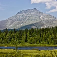
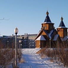
Khalmer-Yu, human settlement in Russia

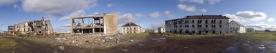
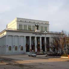
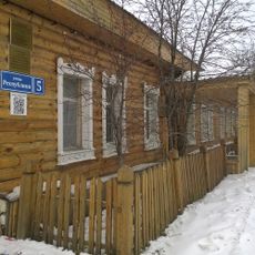
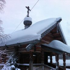
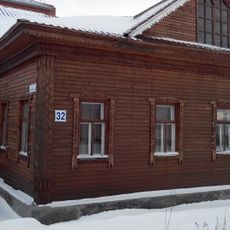
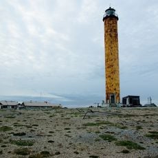
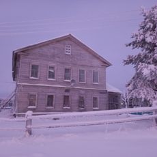
Khalmer-Yu is an abandoned Soviet coal mining settlement in the Komi Republic, established in the 1950s as a center for coal extraction from the Pechora Basin. The community consisted of simple worker housing, schools, shops, and mining installations arranged around the central coal pits.

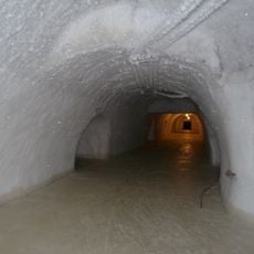
The first exploration expedition to Khalmer-Yu took place in 1942, with geologists nearly dying under extreme conditions before being rescued months later. Organized mining began in 1957, and the settlement grew rapidly until coal reserves became depleted in the 1990s, leading to mine closure in 1993 and the evacuation of the entire population.

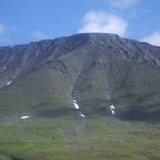
The name Khalmer-Yu comes from the Nenets language and means roughly 'river in the valley of the dead,' reflecting the land's spiritual significance to indigenous peoples. The abandoned houses and ruins now stand as traces of a Soviet mining settlement where workers and families built their lives together in harsh conditions.

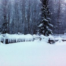
Access to the site is difficult, and after abandonment it was converted into a military testing ground with strict controls that generally restricts public access. Visitors should know that the area experiences extreme cold during winter months, with temperatures dropping well below minus 4 degrees Fahrenheit (-20°C), and that travel to the site requires special vehicles or guided expeditions.

After closure, the ruins became part of a military testing ground called Pemboy, where missile tests and aircraft trials were conducted, which protected the site from looting but also made it inaccessible to the public. This military use has paradoxically preserved the remains of the Soviet settlement from modern development and demolition.

The community of curious travelers

AroundUs brings together thousands of curated places, local tips, and hidden gems, enriched daily by 60,000 contributors worldwide.

Start exploring
GPS coordinates
67.94444,64.79444
Latest update
February 7, 2026 09:31
Around this place
Mount Narodnaya
Russian Federation

Mount Narodnaya

384.6 km
Polar Ural
Russian Federation

Polar Ural

114.4 km
Obskaya–Bovanenkovo Line
Russian Federation

Obskaya–Bovanenkovo Line

310.9 km
Subpolar Ural
Russian Federation

Subpolar Ural

414.7 km
Manaraga
Russian Federation

Manaraga

392.3 km
Новопортовский мерзлотник
Russian Federation

Новопортовский мерзлотник

341.5 km
Prirazlomnaya
Russian Federation

Prirazlomnaya

335.6 km
Inta water tower
Russian Federation

Inta water tower

293.1 km
Dvorets Kultury Shakterov
Russian Federation

Dvorets Kultury Shakterov

59.2 km
Peter and Paul Church
Russian Federation

Peter and Paul Church

176 km
Харнаурды-Кеу
Russian Federation

Харнаурды-Кеу

65.2 km
Здание инородческих управ, в котором была провозглашена советская власть в Обдорске (Салехард)
Russian Federation

Здание инородческих управ, в котором была провозглашена советская власть в Обдорске (Салехард)

176.2 km
Polar circle monument
Russian Federation

Polar circle monument

174 km
Здание театра 501-й стройки (Салехард)
Russian Federation

Здание театра 501-й стройки (Салехард)

176.5 km
Торговый дом купца И.Н. Корнилова (Салехард)
Russian Federation

Торговый дом купца И.Н. Корнилова (Салехард)

176.2 km
Obdorsky ostrog
Russian Federation

Obdorsky ostrog

176.2 km
Здание начальной школы 501-й стройки (Салехард)
Russian Federation

Здание начальной школы 501-й стройки (Салехард)

176.3 km
Obdorskoye Cemetery
Russian Federation

Obdorskoye Cemetery

175.7 km
Фрагмент застройки (2 объекта) (Салехард)
Russian Federation

Фрагмент застройки (2 объекта) (Салехард)

176.5 km
Дом купца И.А. Рочева-Моторова (Салехард)
Russian Federation

Дом купца И.А. Рочева-Моторова (Салехард)

176 km
Обдорское кладбище (Салехард)
Russian Federation

Обдорское кладбище (Салехард)

175.7 km
Церковь Рождества Пресвятой Богородицы (каменная) (Берёзово)
Russian Federation

Церковь Рождества Пресвятой Богородицы (каменная) (Берёзово)

446.3 km
Matveev Island Lighthouse
Russian Federation

Matveev Island Lighthouse

304.2 km
Церковь Николая Чудотворца — первый православный самоедский (ненецкий) храм в Большеземельской тундре (Колва)
Russian Federation

Церковь Николая Чудотворца — первый православный самоедский (ненецкий) храм в Большеземельской тундре (Колва)

391.5 km
Дом священника и церковно-приходская школа (Колва)
Russian Federation

Дом священника и церковно-приходская школа (Колва)

391.5 km
Памятник В.И. Ленину (Инта)
Russian Federation

Памятник В.И. Ленину (Инта)

294 km
Orthodox cathedral of the Iveron Icon of Our Lady in Vorkuta
Russian Federation

Orthodox cathedral of the Iveron Icon of Our Lady in Vorkuta

56.7 km
Church of the Nativity of the Blessed Virgin
Russian Federation

Church of the Nativity of the Blessed Virgin

446.3 km
Show the full map
Reviews
Share your experience

No review yet

Discussions
Start a discussion...

No discussion yet

« Khalmer-Yu - human settlement in Russia » is provided by Around Us (aroundus.com). Images and texts are derived from Wikimedia project under a Creative Commons license. You are allowed to copy, distribute, and modify copies of this page, under the conditions set by the license, as long as this note is clearly visible.

Discover hidden gems everywhere you go!

From secret cafés to breathtaking viewpoints, skip the crowded tourist spots and find places that match your style. Our app makes it easy with voice search, smart filtering, route optimization, and insider tips from travelers worldwide. Download now for the complete mobile experience.

Around Us App Screenshot

A unique approach to discovering new places

Le Figaro

All the places worth exploring

France Info

A tailor-made excursion in just a few clicks

20 Minutes

Around Us
Travel Guide & Maps
Download

Send to your phone

QR Code
1

Open the camera app on your mobile.

2

Point at the QR code with your camera. A notification will appear.

3

Tap the notification to open the link.