Chest opened
+${chestReward.xp} XP
Explorer
NOUVEAU ×${chestReward.collectible.quantity}
tapez pour fermer
Chest locked

Open chests in the app

Around Us is built for your phone — chests unlock when you walk, explore and capture nearby places.

Enable Location

We need your location to show you interesting places around you

Discover nearby places

Find interesting locations and hidden gems around you

Precise directions

Get accurate directions and distances to places

Your location is never shared with other users. It's only used when you tap the location button.

Ciscaucasia

Log in to your account

Start exploring — it's free

Trusted by 72,880 travelers worldwide

Continue with Google
Continue with Apple
or

We will send you a code to connect

By continuing, you accept our Terms and Conditions and our Privacy Policy

Check your inbox

We've sent a pincode in your inbox. Please enter the code below.

Ciscaucasia
Discussion Reviews 1 Photos
19.6k Popularity

Ciscaucasia, Geographic region between Greater Caucasus mountains and Kuma-Manych Depression, Russia

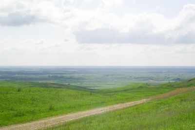
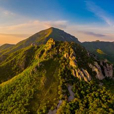
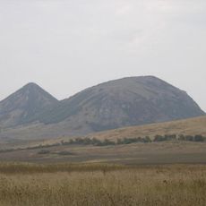
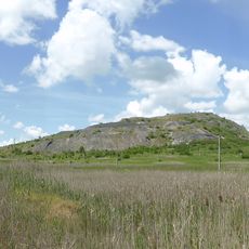
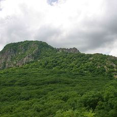
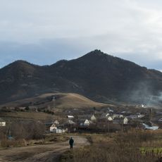
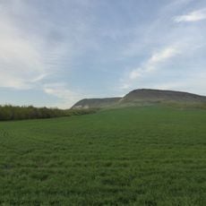
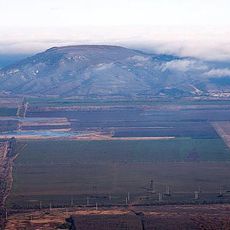
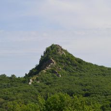
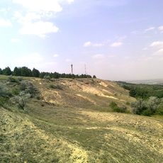
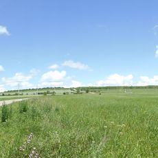
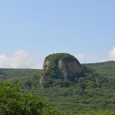
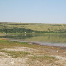
Ciscaucasia extends from the Black Sea to the Caspian Sea, encompassing plains, highlands, and the northern slopes of the Greater Caucasus mountain range. The region features diverse landscapes, from flat steppe areas to mountainous zones with numerous river valleys and natural depressions.

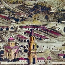
The region has long served as a key passage between Europe and Asia, where different civilizations met and exchanged ideas. This central location shaped the region's development and its diverse population throughout many centuries.

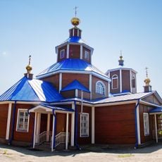
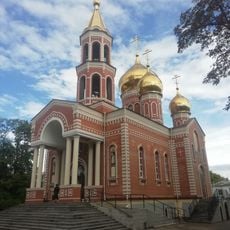
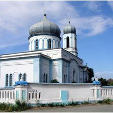
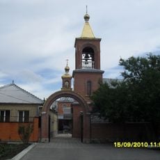
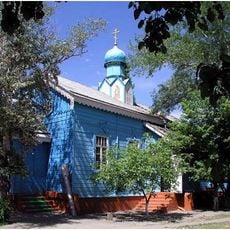
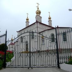
The region is home to many different ethnic groups, each with their own languages and ways of life. Walking through villages and towns, you see this diversity reflected in local architecture, food, and daily customs.

The area is large and diverse, requiring different approaches depending on what you want to explore—mountains, plains, or mineral springs. The best time to visit is from May to September, when the weather is mild and most routes are accessible.

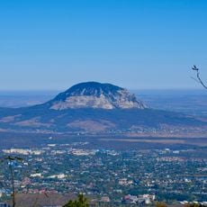
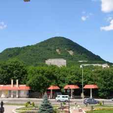
Underground mineral springs and natural hot baths shape certain areas, especially in the Mineralnye Vody-Pyatigorsk district. These natural treasures have made the region a sought-after destination for visitors for generations.

The community of curious travelers

AroundUs brings together thousands of curated places, local tips, and hidden gems, enriched daily by 60,000 contributors worldwide.

Start exploring
GPS coordinates
45.00000,43.50000
Latest update
March 5, 2026 18:16
Around this place
Beshtau
Russian Federation

Beshtau

107.3 km
Gora Zmeyka
Russian Federation

Gora Zmeyka

98.1 km
Emir of Bukhara House
Russian Federation

Emir of Bukhara House

103.3 km
Zheleznaya Mount
Russian Federation

Zheleznaya Mount

102.8 km
Verblyud
Russian Federation

Verblyud

101.6 km
Chogray Reservoir
Russian Federation

Chogray Reservoir

107.4 km
Kinzhal
Russian Federation

Kinzhal

89.8 km
Gora Razvalka
Russian Federation

Gora Razvalka

101.3 km
Byk
Russian Federation

Byk

100.4 km
Medovaya
Russian Federation

Medovaya

103.9 km
Bryk
Russian Federation

Bryk

85.3 km
Lysaya
Russian Federation

Lysaya

103 km
Ostraya
Russian Federation

Ostraya

105.9 km
Kutsay Mountain
Russian Federation

Kutsay Mountain

63.1 km
Mount Kokurtly
Russian Federation

Mount Kokurtly

87.8 km
Mamay-Majarian monastery
Russian Federation

Mamay-Majarian monastery

56.7 km
Kabanka
Russian Federation

Kabanka

105.1 km
Saint Nicholas Church, Georgievsk
Russian Federation

Saint Nicholas Church, Georgievsk

95.3 km
Church of the Annunciation
Russian Federation

Church of the Annunciation

92.2 km
Церковь Покрова Пресвятой Богородицы (Железноводск)
Russian Federation

Церковь Покрова Пресвятой Богородицы (Железноводск)

103.4 km
Церковь Архангела Михаила (Покойное, Будённовский район)
Russian Federation

Церковь Архангела Михаила (Покойное, Будённовский район)

63.6 km
Церковь Святого Николая Чудотворца (Минеральные Воды)
Russian Federation

Церковь Святого Николая Чудотворца (Минеральные Воды)

92.7 km
Церковь Казанской иконы Божией Матери (Будённовск)
Russian Federation

Церковь Казанской иконы Божией Матери (Будённовск)

58.6 km
Solyonoe Lake
Russian Federation

Solyonoe Lake

59.3 km
Церковь равноапостольной княгини Ольги (Железноводск)
Russian Federation

Церковь равноапостольной княгини Ольги (Железноводск)

102.8 km
Храм Апостолов Петра и Павла (Светлоград)
Russian Federation

Храм Апостолов Петра и Павла (Светлоград)

63.1 km
Stavropol stud
Russian Federation

Stavropol stud

54.9 km
Surb Poghos-Petros Armenian church in Georgievsk
Russian Federation

Surb Poghos-Petros Armenian church in Georgievsk

92 km
Show the full map
Reviews
Share your experience

No review yet

Discussions
Start a discussion...

No discussion yet

« Ciscaucasia - Geographic region between Greater Caucasus mountains and Kuma-Manych Depression, Russia » is provided by Around Us (aroundus.com). Images and texts are derived from Wikimedia project under a Creative Commons license. You are allowed to copy, distribute, and modify copies of this page, under the conditions set by the license, as long as this note is clearly visible.

Discover hidden gems everywhere you go!

From secret cafés to breathtaking viewpoints, skip the crowded tourist spots and find places that match your style. Our app makes it easy with voice search, smart filtering, route optimization, and insider tips from travelers worldwide. Download now for the complete mobile experience.

Around Us App Screenshot

A unique approach to discovering new places

Le Figaro

All the places worth exploring

France Info

A tailor-made excursion in just a few clicks

20 Minutes

Around Us
Travel Guide & Maps
Download

Send to your phone

QR Code
1

Open the camera app on your mobile.

2

Point at the QR code with your camera. A notification will appear.

3

Tap the notification to open the link.