Chest opened
+${chestReward.xp} XP
Explorer
NOUVEAU ×${chestReward.collectible.quantity}
tapez pour fermer

See the monuments around you in AR Open chests in the app

Around Us is built for your phone — point your camera at the streets and discover the monuments and places around you in augmented reality. Around Us is built for your phone — chests unlock when you walk, explore and capture nearby places.

•

Enable Location

We need your location to show you interesting places around you

Discover nearby places

Find interesting locations and hidden gems around you

Precise directions

Get accurate directions and distances to places

Your location is never shared with other users. It's only used when you tap the location button.

Kabanka

Log in to your account

Start exploring — it's free

Trusted by 93,246 travelers worldwide

Continue with Google
Continue with Apple
or

We will send you a code to connect

By continuing, you accept our Terms and Conditions and our Privacy Policy

Check your inbox

We've sent a pincode in your inbox. Please enter the code below.

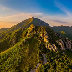
Kabanka, Protected mountain in Stavropol Krai, Russia.

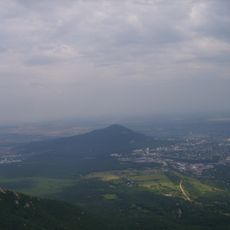
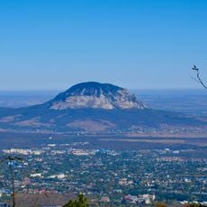
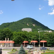
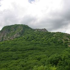
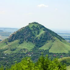
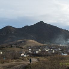
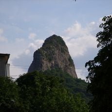
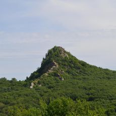
Kabanka (also Tupaya) is a 767 m residual magmatic mountain in the Pyatigorye area, 1.5 km southwest of Zheleznovodsk and 400 m from Mount Ostraya. It forms a 150 by 350 m rocky ridge of beshtaunite, elongated northeast, resembling a lying boar. Its flat summit and steep western, northern and eastern slopes are cut by fissures, while the southern slope is gentle.

Kabanka holds traces of ancient settlements from the 3rd to 4th centuries BCE on its slopes. It was designated a regional geological natural monument by a decision of the Stavropol Krai committee and executive council on 15 September 1961, under measure No. 676 on nature protection in the krai.

The name Kabanka comes from the mountain's profile, which from the side resembles a lying boar (kaban in Russian); its other name, Tupaya ("blunt"), refers to the flat summit. The slopes are covered by broad-leaved forest belonging to the Beshtaugorsky forest massif.

Plan visits during spring or autumn when weather conditions are milder and trail conditions are at their best. Parking areas are available near the base of the mountain close to Zheleznovodsk town.

The mountain's name comes from its silhouette: seen from the side, the 150 by 350 metre rock ridge resembles a lying boar (kaban). Its flat summit gave it the second name Tupaya, meaning blunt. The slopes are covered by broad-leaved forest of the Beshtaugorsky massif.

The community of curious travelers

AroundUs brings together thousands of curated places, local tips, and hidden gems, enriched daily by 93,246 contributors worldwide.

Start exploring
Location
Elevation above the sea
767 m
GPS coordinates
44.12437,43.00357
Latest update
October 28, 2026 23:24
Around this place
Beshtau
Russian Federation

Beshtau

2 mi
Mashuk
Russian Federation

Mashuk

6.7 mi
The place of Lermontov's duel
Russian Federation

The place of Lermontov's duel

5.8 mi
Gora Zmeyka
Russian Federation

Gora Zmeyka

5.4 mi
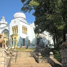
Emir of Bukhara House
Russian Federation

Emir of Bukhara House

1.5 mi
Zheleznaya Mount
Russian Federation

Zheleznaya Mount

1.7 mi
Pyatigorsk Cableway
Russian Federation

Pyatigorsk Cableway

6.7 mi
Gora Razvalka
Russian Federation

Gora Razvalka

2.5 mi
Gora Sheludivaya
Russian Federation

Gora Sheludivaya

2.6 mi
Byk
Russian Federation

Byk

4.6 mi
Church of Saint Lazarus of the Four Days, Pyatigorsk
Russian Federation

Church of Saint Lazarus of the Four Days, Pyatigorsk

6.5 mi
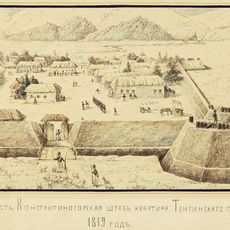
Constantinogorsk Fortress
Russian Federation

Constantinogorsk Fortress

6 mi
Medovaya
Russian Federation

Medovaya

0.8 mi
Komsomolsky Park, Pyatigorsk
Russian Federation

Komsomolsky Park, Pyatigorsk

5.5 mi
Qora lola Pyatigorsk
Russian Federation

Qora lola Pyatigorsk

6.5 mi
Мемориал воинской Славы героев Великой Отечественной войны (Пятигорск)
Russian Federation

Мемориал воинской Славы героев Великой Отечественной войны (Пятигорск)

5.5 mi
Ostraya
Russian Federation

Ostraya

0.5 mi
Памятник Первым комсомольцам Пятигорска
Russian Federation

Памятник Первым комсомольцам Пятигорска

5.6 mi
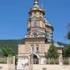
Церковь Покрова Пресвятой Богородицы (Железноводск)
Russian Federation

Церковь Покрова Пресвятой Богородицы (Железноводск)

1.4 mi
Церковь равноапостольной княгини Ольги (Железноводск)
Russian Federation

Церковь равноапостольной княгини Ольги (Железноводск)

1.4 mi
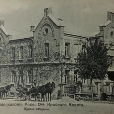
Pyatigorsk Red Cross Colony Ensemble
Russian Federation

Pyatigorsk Red Cross Colony Ensemble

6.3 mi
Building of Pyatigorsk Alexandra and George Nurses Community
Russian Federation

Building of Pyatigorsk Alexandra and George Nurses Community

6.3 mi
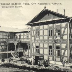
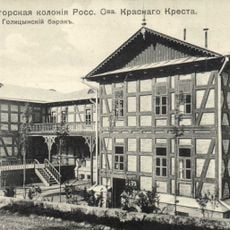
Golitsyn barrack
Russian Federation

Golitsyn barrack

6.3 mi
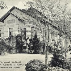
Sheremetiev barrack
Russian Federation

Sheremetiev barrack

6.3 mi
Bolnichka
Russian Federation

Bolnichka

6.3 mi
Building of stable of Pyatigorsk Red Cross Colony
Russian Federation

Building of stable of Pyatigorsk Red Cross Colony

6.3 mi
Building of lodge of Pyatigorsk Red Cross Colony
Russian Federation

Building of lodge of Pyatigorsk Red Cross Colony

6.3 mi
Mud cures hospital main building
Russian Federation

Mud cures hospital main building

6.8 mi
Show the full map
Reviews
Share your experience

No review yet

Discussions
Start a discussion...

No discussion yet

« Kabanka - Protected mountain in Stavropol Krai, Russia » is provided by Around Us (aroundus.com). Images and texts are derived from Wikimedia project under a Creative Commons license. You are allowed to copy, distribute, and modify copies of this page, under the conditions set by the license, as long as this note is clearly visible.

Discover hidden gems everywhere you go!

From secret cafés to breathtaking viewpoints, skip the crowded tourist spots and find places that match your style. Our app makes it easy with voice search, smart filtering, route optimization, and insider tips from travelers worldwide. Download now for the complete mobile experience.
Around Us App Screenshot
❝

A unique approach to discovering new places❞

— Le Figaro

❝

All the places worth exploring❞

— France Info

❝

A tailor-made excursion in just a few clicks❞

— 20 Minutes

Around Us
Travel Guide & Maps
Download

Send to your phone

QR Code
1

Open the camera app on your mobile.

2

Point at the QR code with your camera. A notification will appear.

3

Tap the notification to open the link.