Chest opened
+${chestReward.xp} XP
Explorer
NOUVEAU ×${chestReward.collectible.quantity}
tapez pour fermer
Chest locked

Open chests in the app

Around Us is built for your phone — chests unlock when you walk, explore and capture nearby places.

Enable Location

We need your location to show you interesting places around you

Discover nearby places

Find interesting locations and hidden gems around you

Precise directions

Get accurate directions and distances to places

Your location is never shared with other users. It's only used when you tap the location button.

Kugarchinsky District

Log in to your account

Start exploring — it's free

Trusted by 72,880 travelers worldwide

Continue with Google
Continue with Apple
or

We will send you a code to connect

By continuing, you accept our Terms and Conditions and our Privacy Policy

Check your inbox

We've sent a pincode in your inbox. Please enter the code below.

Kugarchinsky District
Discussion Reviews 1 Photos
10.6k Popularity

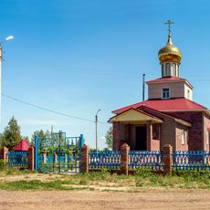
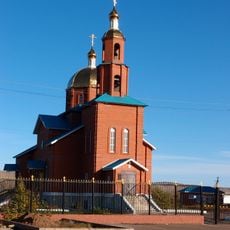
Kugarchinsky District, Municipal district in Bashkortostan, Russia.

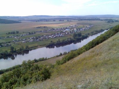
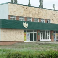
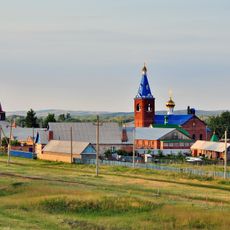
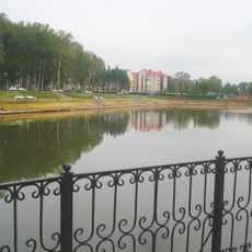
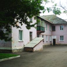
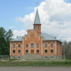
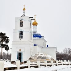
Kugarchinsky District is a municipal territory in Bashkortostan, Russia, covering approximately 3,400 square kilometers of rural land. Its administrative center in the settlement of Mrakovo handles regional services and connections for the scattered communities spread across the area.

This district was established on August 20, 1930, when the region was part of the Bashkir Autonomous Soviet Socialist Republic. Its creation followed administrative changes that reorganized territorial divisions during the early Soviet period.

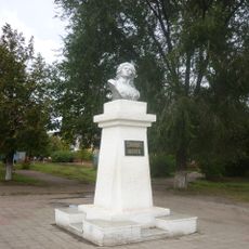
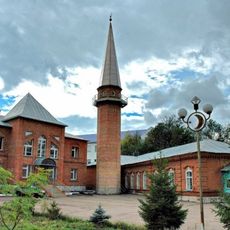
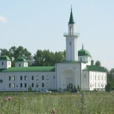
Local communities celebrate traditional festivals like Sabantuy that reflect regional customs and agricultural heritage. These gatherings bring people together and showcase the importance of farming traditions in everyday life.

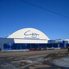
Multiple transport routes connect the scattered rural settlements to each other and to larger regional centers. Travel within the district requires some planning due to the dispersed nature of communities and limited public transportation options.

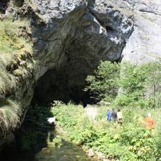
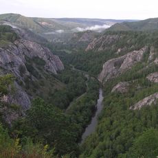
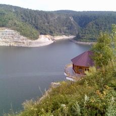
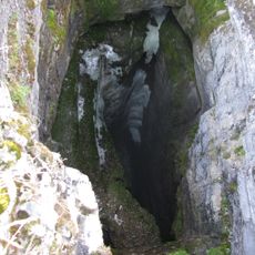
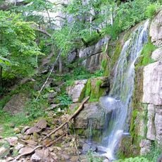
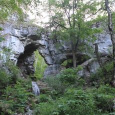
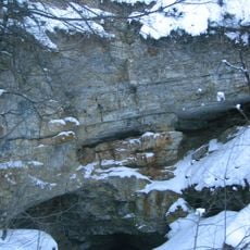
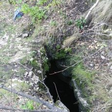
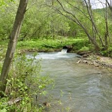
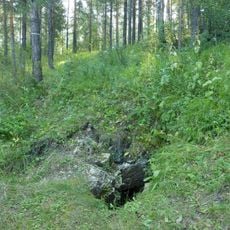
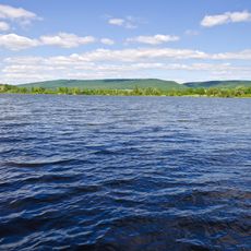
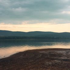
The territory contains protected natural areas and water bodies, including sections of the Bolshoy Ik River. These waterways and conservation zones support diverse agricultural practices and contribute to regional ecological variety.

The community of curious travelers

AroundUs brings together thousands of curated places, local tips, and hidden gems, enriched daily by 60,000 contributors worldwide.

Start exploring
Location
Inception
August 20, 1930
Capital city
Mrakovo
GPS coordinates
52.71389,56.62694
Latest update
December 10, 2025 15:53
Around this place
Kapova Cave
Russian Federation

Kapova Cave

47.1 km
Shulgan-Tash Nature Reserve
Russian Federation

Shulgan-Tash Nature Reserve

45.5 km
Bashkiria National Park
Russian Federation

Bashkiria National Park

33.9 km
Yumaguzino reservoir
Russian Federation

Yumaguzino reservoir

30 km
Salavat State Bashkir Drama Theater
Russian Federation

Salavat State Bashkir Drama Theater

84.5 km
Sumgan-Kutuk
Russian Federation

Sumgan-Kutuk

33 km
Kuperlya waterfall
Russian Federation

Kuperlya waterfall

48 km
Marfo-Mariinsky Convent
Russian Federation

Marfo-Mariinsky Convent

49.8 km
Bashkir Ural
Russian Federation

Bashkir Ural

45.5 km
Park kultury i otdykha
Russian Federation

Park kultury i otdykha

85.4 km
Ilasin Cave
Russian Federation

Ilasin Cave

77.3 km
Memorial "Eternal flame"
Russian Federation

Memorial "Eternal flame"

83.9 km
Salavat Yulaev Bust
Russian Federation

Salavat Yulaev Bust

83.9 km
Salavat Sports and Concert Complex
Russian Federation

Salavat Sports and Concert Complex

84.9 km
Салауат музыка колледжы
Russian Federation

Салауат музыка колледжы

84.6 km
Olympia Cave
Russian Federation

Olympia Cave

75.8 km
Церковь евангельских христиан - баптистов (Салават)
Russian Federation

Церковь евангельских христиан - баптистов (Салават)

83.7 km
Berkhomut
Russian Federation

Berkhomut

79 km
Propaschaya yama
Russian Federation

Propaschaya yama

51.3 km
Our Lady of Kazan Church
Russian Federation

Our Lady of Kazan Church

58.3 km
Михаило-Архангельская церковь (в селе Новониколаевское)
Russian Federation

Михаило-Архангельская церковь (в селе Новониколаевское)

8.1 km
Preobrazhensky Copper Melting Works
Russian Federation

Preobrazhensky Copper Melting Works

76.4 km
Ärkeängeln Mikaels kyrka
Russian Federation

Ärkeängeln Mikaels kyrka

74.1 km
Stroitel Stadium
Russian Federation

Stroitel Stadium

85.5 km
Urazbaevsky Pond
Russian Federation

Urazbaevsky Pond

70.9 km
Meleuz Mosque
Russian Federation

Meleuz Mosque

54.4 km
Salavat Mosque
Russian Federation

Salavat Mosque

81.4 km
Nugush Reservoir
Russian Federation

Nugush Reservoir

42.8 km
Show the full map
Reviews
Share your experience

No review yet

Discussions
Start a discussion...

No discussion yet

« Kugarchinsky District - Municipal district in Bashkortostan, Russia » is provided by Around Us (aroundus.com). Images and texts are derived from Wikimedia project under a Creative Commons license. You are allowed to copy, distribute, and modify copies of this page, under the conditions set by the license, as long as this note is clearly visible.

Discover hidden gems everywhere you go!

From secret cafés to breathtaking viewpoints, skip the crowded tourist spots and find places that match your style. Our app makes it easy with voice search, smart filtering, route optimization, and insider tips from travelers worldwide. Download now for the complete mobile experience.

Around Us App Screenshot

A unique approach to discovering new places

Le Figaro

All the places worth exploring

France Info

A tailor-made excursion in just a few clicks

20 Minutes

Around Us
Travel Guide & Maps
Download

Send to your phone

QR Code
1

Open the camera app on your mobile.

2

Point at the QR code with your camera. A notification will appear.

3

Tap the notification to open the link.