Chest opened
+${chestReward.xp} XP
Explorer
NOUVEAU ×${chestReward.collectible.quantity}
tapez pour fermer

See the monuments around you in AR Open chests in the app

Around Us is built for your phone — point your camera at the streets and discover the monuments and places around you in augmented reality. Around Us is built for your phone — chests unlock when you walk, explore and capture nearby places.

Enable Location

We need your location to show you interesting places around you

Discover nearby places

Find interesting locations and hidden gems around you

Precise directions

Get accurate directions and distances to places

Your location is never shared with other users. It's only used when you tap the location button.

Nevinnomyssk Canal

Log in to your account

Start exploring — it's free

Trusted by 85,755 travelers worldwide

Continue with Google
Continue with Apple
or

We will send you a code to connect

By continuing, you accept our Terms and Conditions and our Privacy Policy

Check your inbox

We've sent a pincode in your inbox. Please enter the code below.

Nevinnomyssk Canal
Discussion Reviews 1 Photos
3.2k Popularity

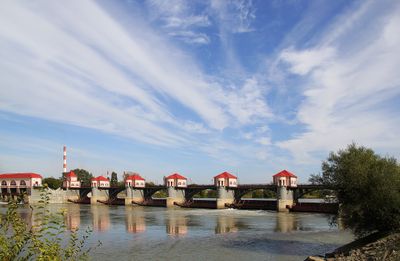
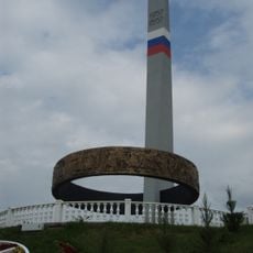
Nevinnomyssk Canal, river in Russia

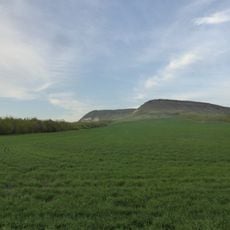
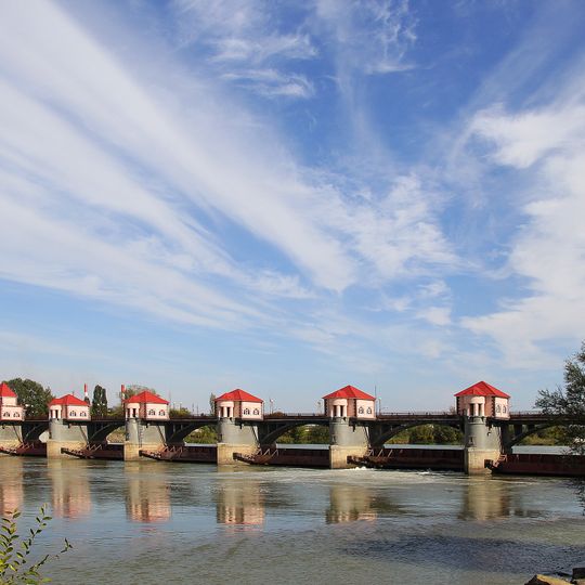
The Nevinnomyssk Canal is a waterway in Stavropol Krai that stretches about 49 miles from the Kuban River to the Yegorlyk River. The canal flows through straight banks and crosses a mountain divide via a 6-kilometer tunnel near the village of Tunnelnyy.

Construction began in 1936 to move water from the Kuban to support farming in the Yegorlyk region. Work paused during World War II and the canal officially opened in 1948, with two small hydroelectric stations added later to generate power from the flowing water.

The canal is easiest to reach from the city of Nevinnomyssk, where it begins at the Kuban Dam. Spring through autumn is the best time to explore, as the banks are dry and walkable paths are accessible.

The remarkable feature is a 6-kilometer underground tunnel near Tunnelnyy that moves water beneath a mountain divide between two river basins. This tunnel showcases mid-20th century Soviet engineering built to overcome natural barriers.

The community of curious travelers

AroundUs brings together thousands of curated places, local tips, and hidden gems, enriched daily by 60,000 contributors worldwide.
Start exploring
Location
GPS coordinates
44.65089,41.91162
Latest update
September 1, 2026 18:14
Around this place
Shoana Church
Russian Federation

Shoana Church

58.6 mi
Strizhament
Russian Federation

Strizhament

12.5 mi
Sengiley reservour
Russian Federation

Sengiley reservour

28 mi
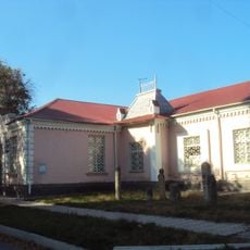
Stavropol Local Museum
Russian Federation

Stavropol Local Museum

27.4 mi
Verblyud
Russian Federation

Verblyud

57.5 mi
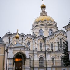
Cathedral of the Kazan Icon of the Mother of God
Russian Federation

Cathedral of the Kazan Icon of the Mother of God

27.8 mi
Novotroitskoe Reservoir
Russian Federation

Novotroitskoe Reservoir

48.4 mi
Russian Federation

Kubansk Reservoir

34.2 mi
Dynamo Stadium
Russian Federation

Dynamo Stadium

27.2 mi
Stavropol Drama Theatre
Russian Federation

Stavropol Drama Theatre

27.3 mi
Bryk
Russian Federation

Bryk

35.2 mi
Stavropol Library
Russian Federation

Stavropol Library

27.3 mi
Armenian Church, Armavir, Russia
Russian Federation

Armenian Church, Armavir, Russia

45.3 mi
Lycée classique de Stavropol
Russian Federation

Lycée classique de Stavropol

27.7 mi
Saint Nicholas Orthodox cathedral in Armavir
Russian Federation

Saint Nicholas Orthodox cathedral in Armavir

45.4 mi
Saint Gregory the Illuminator Church
Russian Federation

Saint Gregory the Illuminator Church

28.2 mi
Аквапарк
Russian Federation

Аквапарк

26.1 mi
Дом Алиева (Черкесск)
Russian Federation

Дом Алиева (Черкесск)

29.8 mi
Saint Andrew Orthodox church in Stavropol
Russian Federation

Saint Andrew Orthodox church in Stavropol

27.3 mi
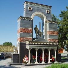
Monument to Soviet soldiers in Cherkessk
Russian Federation

Monument to Soviet soldiers in Cherkessk

29.9 mi
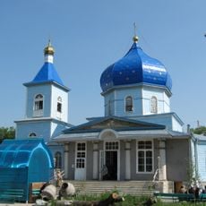
Храм Покрова Пресвятой Богородицы (православный) (Черкесск)
Russian Federation

Храм Покрова Пресвятой Богородицы (православный) (Черкесск)

31.2 mi
Theater of the Mesnyankin Brothers
Russian Federation

Theater of the Mesnyankin Brothers

27.8 mi
Adiyukh tower
Russian Federation

Adiyukh tower

44.8 mi
Samoilenko Hotel
Russian Federation

Samoilenko Hotel

30.1 mi
Provincial government offices, Cherkessk
Russian Federation

Provincial government offices, Cherkessk

30.2 mi
Friendship of Peoples Monument in Cherkessk
Russian Federation

Friendship of Peoples Monument in Cherkessk

29.9 mi
Красногорская сторожевая крепость (Красногорская)
Russian Federation

Красногорская сторожевая крепость (Красногорская)

49.3 mi
Ruins of Skete of Holy Mount Athos monastery, Karachayevsky District
Russian Federation

Ruins of Skete of Holy Mount Athos monastery, Karachayevsky District

58.6 mi
Show the full map
Reviews
Share your experience

No review yet

Discussions
Start a discussion...

No discussion yet

« Nevinnomyssk Canal - river in Russia » is provided by Around Us (aroundus.com). Images and texts are derived from Wikimedia project under a Creative Commons license. You are allowed to copy, distribute, and modify copies of this page, under the conditions set by the license, as long as this note is clearly visible.

Discover hidden gems everywhere you go!

From secret cafés to breathtaking viewpoints, skip the crowded tourist spots and find places that match your style. Our app makes it easy with voice search, smart filtering, route optimization, and insider tips from travelers worldwide. Download now for the complete mobile experience.
Around Us App Screenshot

A unique approach to discovering new places

Le Figaro

All the places worth exploring

France Info

A tailor-made excursion in just a few clicks

20 Minutes

Around Us
Travel Guide & Maps
Download

Send to your phone

QR Code
1

Open the camera app on your mobile.

2

Point at the QR code with your camera. A notification will appear.

3

Tap the notification to open the link.