Chest opened
+${chestReward.xp} XP
Explorer
NOUVEAU ×${chestReward.collectible.quantity}
tapez pour fermer
Chest locked

Open chests in the app

Around Us is built for your phone — chests unlock when you walk, explore and capture nearby places.

Enable Location

We need your location to show you interesting places around you

Discover nearby places

Find interesting locations and hidden gems around you

Precise directions

Get accurate directions and distances to places

Your location is never shared with other users. It's only used when you tap the location button.

Dmitrovskoye Highway

Log in to your account

Start exploring — it's free

Trusted by 72,876 travelers worldwide

Continue with Google
Continue with Apple
or

We will send you a code to connect

By continuing, you accept our Terms and Conditions and our Privacy Policy

Check your inbox

We've sent a pincode in your inbox. Please enter the code below.

Dmitrovskoye Highway
Discussion Reviews 1 Photos
16.7k Popularity

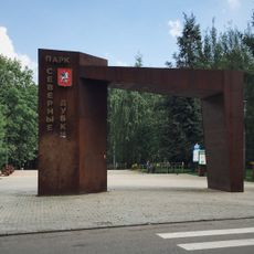
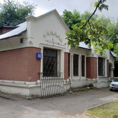
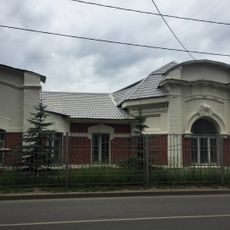
Dmitrovskoye Highway, street in Moscow, Russia

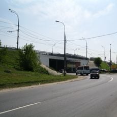
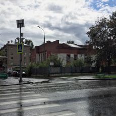
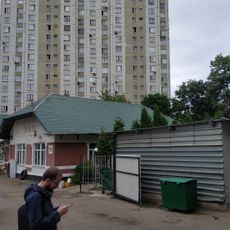
Dmitrovskoye Highway is a major road running through northern Moscow that stretches approximately 15 kilometers and connects several districts including Timiryazevsky, Beskudnikovsky, and Severny. The street features a mix of older industrial buildings alongside modern apartment complexes, shops, and cafes, with steady traffic from cars, buses, and cyclists throughout the day.

The highway was named after the historic town of Dmitrov north of Moscow and evolved over many decades from a quiet local route into a major transportation artery. As the city expanded, the road was widened and improved to handle growing traffic and connect various districts throughout the northern regions.

The road has several metro stations nearby that are busiest during morning and evening rush hours, providing regular access to public transportation. Sidewalks are wide in most sections, and dedicated bike lanes are available in parts of the street, making it relatively safe for pedestrians and cyclists to navigate.

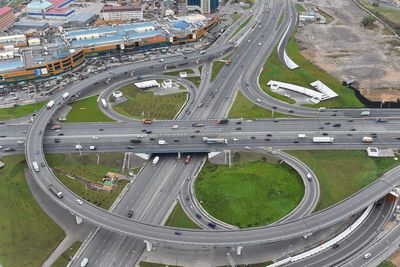
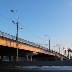
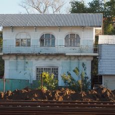
At several points, the road crosses rivers and railway lines with distinctive bridges and overpasses where travelers often pause to watch passing trains or flowing water below. These structures offer a glimpse into the connections linking different parts of the city together.

The community of curious travelers

AroundUs brings together thousands of curated places, local tips, and hidden gems, enriched daily by 60,000 contributors worldwide.

Start exploring
Location
Location
GPS coordinates
55.86644,37.54717
Latest update
February 17, 2026 01:40
Around this place
Grachyovka
Russian Federation

Grachyovka

2.5 km
Angarskye prudy
Russian Federation

Angarskye prudy

1.8 km
Yardyam Mosque
Russian Federation

Yardyam Mosque

3 km
Грачёвский парк
Russian Federation

Грачёвский парк

2.5 km
Church of the Nativity of the Theotokos
Russian Federation

Church of the Nativity of the Theotokos

3 km
Church of Saint Boris and Gleb in Degunino
Russian Federation

Church of Saint Boris and Gleb in Degunino

807 m
Inam Mosque
Russian Federation

Inam Mosque

3 km
Vagonoremont Park
Russian Federation

Vagonoremont Park

2.6 km
Пагода рая
Russian Federation

Пагода рая

3 km
Altufyevsky District Pond
Russian Federation

Altufyevsky District Pond

2.7 km
Church of the Theotokos of the Sign in Moscow
Russian Federation

Church of the Theotokos of the Sign in Moscow

2.4 km
Severnye Dubki Park
Russian Federation

Severnye Dubki Park

2.7 km
First Altufevsky overpass
Russian Federation

First Altufevsky overpass

1.2 km
Second Altufevsky overpass
Russian Federation

Second Altufevsky overpass

1.2 km
Лобненская улица 5А
Russian Federation

Лобненская улица 5А

2.5 km
Пакгаузное шоссе 1 c1
Russian Federation

Пакгаузное шоссе 1 c1

3 km
2-й Павелецкий проезд 4 корпус 1
Russian Federation

2-й Павелецкий проезд 4 корпус 1

2.5 km
Проезд Черепановых 40
Russian Federation

Проезд Черепановых 40

2.9 km
Водонапорная башня станции Михалково
Russian Federation

Водонапорная башня станции Михалково

2.7 km
Путейская улица 3
Russian Federation

Путейская улица 3

2 km
Проезд Черепановых 42 c1
Russian Federation

Проезд Черепановых 42 c1

2.8 km
Проезд Черепановых 15
Russian Federation

Проезд Черепановых 15

2.9 km
Клинская улица 2 c1
Russian Federation

Клинская улица 2 c1

2.5 km
Уборная на станции Лихоборы
Russian Federation

Уборная на станции Лихоборы

2.9 km
Ограда (Отрадное)
Russian Federation

Ограда (Отрадное)

3 km
Путейская улица 21
Russian Federation

Путейская улица 21

1.9 km
Будка центрального управления стрелками и сигналами (Головинский)
Russian Federation

Будка центрального управления стрелками и сигналами (Головинский)

2.7 km
Онежская улица 2А
Russian Federation

Онежская улица 2А

3 km
Show the full map
Reviews
Share your experience

No review yet

Discussions
Start a discussion...

No discussion yet

« Dmitrovskoye Highway - street in Moscow, Russia » is provided by Around Us (aroundus.com). Images and texts are derived from Wikimedia project under a Creative Commons license. You are allowed to copy, distribute, and modify copies of this page, under the conditions set by the license, as long as this note is clearly visible.

Discover hidden gems everywhere you go!

From secret cafés to breathtaking viewpoints, skip the crowded tourist spots and find places that match your style. Our app makes it easy with voice search, smart filtering, route optimization, and insider tips from travelers worldwide. Download now for the complete mobile experience.

Around Us App Screenshot

A unique approach to discovering new places

Le Figaro

All the places worth exploring

France Info

A tailor-made excursion in just a few clicks

20 Minutes

Around Us
Travel Guide & Maps
Download

Send to your phone

QR Code
1

Open the camera app on your mobile.

2

Point at the QR code with your camera. A notification will appear.

3

Tap the notification to open the link.