Enable Location

We need your location to show you interesting places around you

Discover nearby places

Find interesting locations and hidden gems around you

Precise directions

Get accurate directions and distances to places

Your location is never shared with other users. It's only used when you tap the location button.

Kachkanar

Log in to your account

Start exploring — it's free

Trusted by 61,338 travelers worldwide

Continue with Google
Continue with Apple
or

We will send you a code to connect

By continuing, you accept our Terms and Conditions and our Privacy Policy

Check your inbox

We've sent a pincode in your inbox. Please enter the code below.

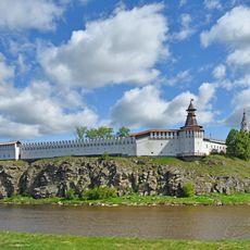
Kachkanar, Mountain ridge in Sverdlovsk Oblast, Russia

Description

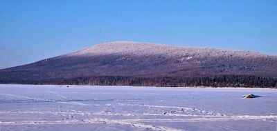
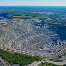
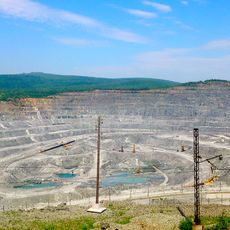
Kachkanar is a mountain ridge in Sverdlovsk Oblast with two summits, the Great peak reaching 878 meters and the Little peak at 866 meters in elevation. The ridge is defined by substantial iron-vanadium ore deposits that are actively extracted through large-scale mining operations.

History

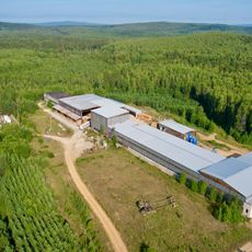
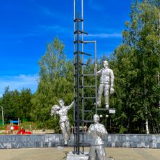
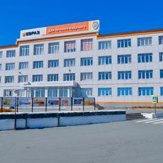
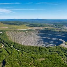
Geological surveys in the 1930s revealed substantial iron-vanadium ore deposits within the ridge, prompting the development of mining operations. This discovery led to the establishment of Kachkanar as an industrial mining town.

Culture

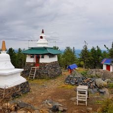
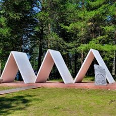
The Shedrub Ling Buddhist monastery was established in 1995 by Lama Sanje Tenzin Dokshitom on the mountain slopes, creating a spiritual presence amid the industrial landscape. This spiritual site coexists with ongoing extraction activities, reflecting the layered character of the place.

Practical

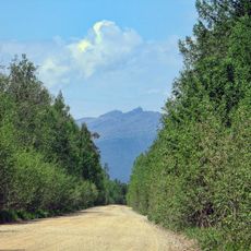
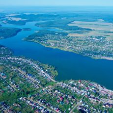
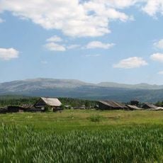
The ridge sits roughly 270 kilometers from Yekaterinburg and is accessible via the Serov road, requiring several hours of travel. Visitors can hike the slopes and find accommodation options nearby, though preparation for mountain terrain and variable weather is advisable.

Did you know?

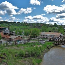
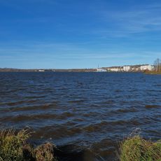
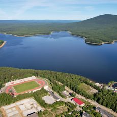
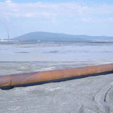
From the Camel Rock formation, visitors gain a panoramic view of both the town of Kachkanar and the extensive iron ore extraction facilities of the processing plant sprawling below. This vantage point reveals how settlement and industrial work have shaped the landscape together.

Elevation above the sea
878.7 m
Part of
Middle Ural
GPS coordinates
58.77074,59.38359
Latest update
December 8, 2025 13:42

AroundUs brings together thousands of curated places, local tips, and hidden gems, enriched daily by 60,000 contributors worldwide. Discover all places nearby (Sverdlovsk Oblast).

Around this place
Uralskaya Superdeep Borehole
Russian Federation

Uralskaya Superdeep Borehole

48.2 km
Bshad sgrub gling
Russian Federation

Bshad sgrub gling

717 m
Blagodat
Russian Federation

Blagodat

58.6 km
Verkhoturye Kremlin
Russian Federation

Verkhoturye Kremlin

82.7 km
Nizhne Turinskiy Prud
Russian Federation

Nizhne Turinskiy Prud

31 km
Gornyak Stadium
Russian Federation

Gornyak Stadium

8.4 km
Sinyaya
Russian Federation

Sinyaya

72.6 km
Кусье-Александровский завод
Russian Federation

Кусье-Александровский завод

79.6 km
Church of Icon of the Mother of God «Seeking the Lost»
Russian Federation

Church of Icon of the Mother of God «Seeking the Lost»

10.4 km
Upper Kachkanar Reservoir
Russian Federation

Upper Kachkanar Reservoir

6.9 km
Church of Our Lady of the Sign, Verkhoturye
Russian Federation

Church of Our Lady of the Sign, Verkhoturye

82.4 km
Park Stroiteley
Russian Federation

Park Stroiteley

9.4 km
Kachkanar Historical and Local History Museum
Russian Federation

Kachkanar Historical and Local History Museum

8.9 km
Pashiysky Metallurgical and Cement Plant
Russian Federation

Pashiysky Metallurgical and Cement Plant

75.4 km
Upper Tura Reservoir
Russian Federation

Upper Tura Reservoir

52.2 km
Kushvinskiy Prud
Russian Federation

Kushvinskiy Prud

59.2 km
Дом почётных гостей
Russian Federation

Дом почётных гостей

82.7 km
Lower Kachkanar Reservoir
Russian Federation

Lower Kachkanar Reservoir

7.3 km
Усадьба Рагозина
Russian Federation

Усадьба Рагозина

82.4 km
Prometheus Park in Kachkanar
Russian Federation

Prometheus Park in Kachkanar

10.4 km
Glavniy quarry of Kachkanarsky GOK
Russian Federation

Glavniy quarry of Kachkanarsky GOK

7.4 km
Severniy quarry of Kachkanarsky GOK
Russian Federation

Severniy quarry of Kachkanarsky GOK

6.5 km
Saint Alexander Nevsky Church
Russian Federation

Saint Alexander Nevsky Church

51.2 km
KGOK administrative building
Russian Federation

KGOK administrative building

9.5 km
Administration of Kachkanar district
Russian Federation

Administration of Kachkanar district

9.3 km
Tailings of Kachkanarskiy mining and processing plant
Russian Federation

Tailings of Kachkanarskiy mining and processing plant

10.5 km
Oslyanka
Russian Federation

Oslyanka

64.9 km
Zapadniy quarry of Kachkanarsky GOK
Russian Federation

Zapadniy quarry of Kachkanarsky GOK

4.7 km
Show the full map
« Kachkanar - Mountain ridge in Sverdlovsk Oblast, Russia » is provided by Around Us (aroundus.com). Images and texts are derived from Wikimedia project under a Creative Commons license. You are allowed to copy, distribute, and modify copies of this page, under the conditions set by the license, as long as this note is clearly visible.

Discover hidden gems everywhere you go!

From secret cafés to breathtaking viewpoints, skip the crowded tourist spots and find places that match your style. Our app makes it easy with voice search, smart filtering, route optimization, and insider tips from travelers worldwide. Download now for the complete mobile experience.

Around Us App Screenshot

A unique approach to discovering new places

Le Figaro

All the places worth exploring

France Info

A tailor-made excursion in just a few clicks

20 Minutes

Around Us
Travel Guide & Maps
Download

Send to your phone

QR Code
1

Open the camera app on your mobile.

2

Point at the QR code with your camera. A notification will appear.

3

Tap the notification to open the link.