Chest opened
+${chestReward.xp} XP
Explorer
NOUVEAU ×${chestReward.collectible.quantity}
tapez pour fermer

See the monuments around you in AR Open chests in the app

Around Us is built for your phone — point your camera at the streets and discover the monuments and places around you in augmented reality. Around Us is built for your phone — chests unlock when you walk, explore and capture nearby places.

Enable Location

We need your location to show you interesting places around you

Discover nearby places

Find interesting locations and hidden gems around you

Precise directions

Get accurate directions and distances to places

Your location is never shared with other users. It's only used when you tap the location button.

Log in to your account

Start exploring — it's free

Trusted by 86,321 travelers worldwide

Continue with Google
Continue with Apple
or

We will send you a code to connect

By continuing, you accept our Terms and Conditions and our Privacy Policy

Check your inbox

We've sent a pincode in your inbox. Please enter the code below.

Сухарная балка
Discussion Reviews Photo
1.4k Popularity

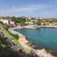
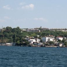
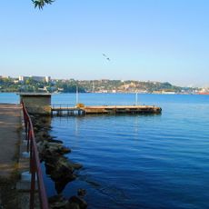
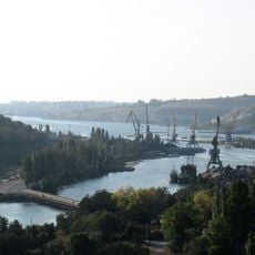
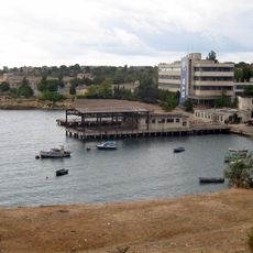
Сухарная балка, Naval ravine and bay in Nakhimovsky district, Sevastopol, Crimean Peninsula

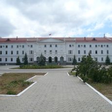
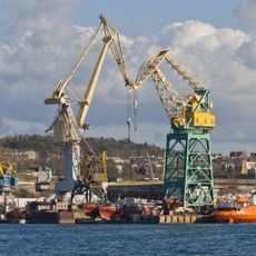
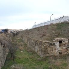
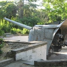
Sukharnaya Ravine stretches from Mekenzievy Gory railway station toward Sevastopol Bay, where it opens into a natural inlet at its mouth. The valley holds military storage facilities and arsenals, with a specialized museum dedicated to weapons and ammunition.

In the early 19th century, a naval bakery operated in the ravine, producing hardtack bread for the Black Sea Fleet. This facility remained active until the end of the Crimean War.

The location was once a Tatar fishing settlement called Ak-Yar, meaning white cliff, before military structures were built here. The name and its heritage reflect the different peoples who have lived along this strategic coastal area.

The area has restricted access due to active military storage facilities in the ravine. Visitors should confirm which sections are open and how to reach the museum before planning a visit.

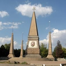
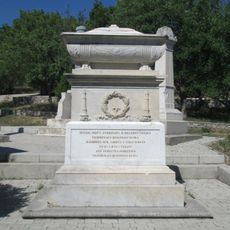
During World War II, sailor Chikarenko sacrificed himself by detonating an arsenal tunnel to prevent German forces from seizing military supplies. His act of bravery helped protect valuable resources from enemy capture.

The community of curious travelers

AroundUs brings together thousands of curated places, local tips, and hidden gems, enriched daily by 60,000 contributors worldwide.
Start exploring
Location
GPS coordinates
44.62417,33.58250
Latest update
September 11, 2026 20:46
Around this place
Inkerman Cave Monastery
Russian Federation

Inkerman Cave Monastery

1.9 mi
Grafska Wharf in Sevastopol
Russian Federation

Grafska Wharf in Sevastopol

2.8 mi
Saint Nicholas church in Sevastopol
Russian Federation

Saint Nicholas church in Sevastopol

1.5 mi
North side, Sevastopol
Ukraine

North side, Sevastopol

1.5 mi
Kalamita Fortress
Russian Federation

Kalamita Fortress

2 mi
Sevastopol Zoo
Russian Federation

Sevastopol Zoo

2.8 mi
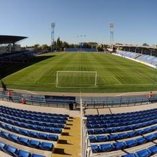
Sevastopol Sports Complex
Russian Federation

Sevastopol Sports Complex

2.5 mi
Severnaya bay, Sevastopol
Ukraine

Severnaya bay, Sevastopol

2.4 mi
Kornilov monument in Sevastopol
Russian Federation

Kornilov monument in Sevastopol

2.2 mi
Lazarev Barracks
Russian Federation

Lazarev Barracks

2.6 mi
Корабельна бухта
Ukraine

Корабельна бухта

2.4 mi
Памятник М. П. Лазареву
Russian Federation

Памятник М. П. Лазареву

2.5 mi
North Fort
Ukraine

North Fort

2.3 mi
Apollonova Bay
Ukraine

Apollonova Bay

2.1 mi
Gollandiya Bay
Ukraine

Gollandiya Bay

1.1 mi
Monument to 2nd Guard Army
Russian Federation

Monument to 2nd Guard Army

2.4 mi
Старопівнічна бухта
Ukraine

Старопівнічна бухта

2.6 mi
Monument to Volhynian Infantry Regiment in Sevastopol
Russian Federation

Monument to Volhynian Infantry Regiment in Sevastopol

1.5 mi
Artillery battery of Matyukhin
Russian Federation

Artillery battery of Matyukhin

2.1 mi
Пам'ятник воїнам першого бастіону (Севастополь)
Ukraine

Пам'ятник воїнам першого бастіону (Севастополь)

1.6 mi
Пам'ятник воїнам другого бастіону (Севастополь)
Russian Federation

Пам'ятник воїнам другого бастіону (Севастополь)

1.8 mi
Category:Zagaytansky fortified settlement
Russian Federation

Category:Zagaytansky fortified settlement

2.2 mi
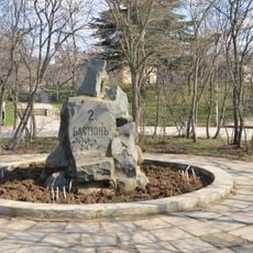
Monument to the 2nd Bastion
Ukraine

Monument to the 2nd Bastion

1.8 mi
Inkerman Bay
Ukraine

Inkerman Bay

1.6 mi
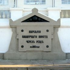
Monument to floating bridge in Sevastopol
Russian Federation

Monument to floating bridge in Sevastopol

2.8 mi
Башня Микрюковского водопровода
Ukraine

Башня Микрюковского водопровода

2.3 mi
Кордон (мис)
Russian Federation

Кордон (мис)

2.5 mi
Кінотеатр «Моряк»
Ukraine

Кінотеатр «Моряк»

2.1 mi
Show the full map
Reviews
Share your experience

No review yet

Discussions
Start a discussion...

No discussion yet

« Сухарная балка - Naval ravine and bay in Nakhimovsky district, Sevastopol, Crimean Peninsula » is provided by Around Us (aroundus.com). Images and texts are derived from Wikimedia project under a Creative Commons license. You are allowed to copy, distribute, and modify copies of this page, under the conditions set by the license, as long as this note is clearly visible.

Discover hidden gems everywhere you go!

From secret cafés to breathtaking viewpoints, skip the crowded tourist spots and find places that match your style. Our app makes it easy with voice search, smart filtering, route optimization, and insider tips from travelers worldwide. Download now for the complete mobile experience.
Around Us App Screenshot

A unique approach to discovering new places

Le Figaro

All the places worth exploring

France Info

A tailor-made excursion in just a few clicks

20 Minutes

Around Us
Travel Guide & Maps
Download

Send to your phone

QR Code
1

Open the camera app on your mobile.

2

Point at the QR code with your camera. A notification will appear.

3

Tap the notification to open the link.