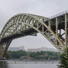
Øresund Bridge, Cable-stayed bridge between Copenhagen, Denmark and Malmö, Sweden
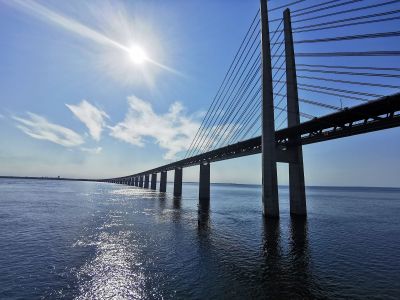
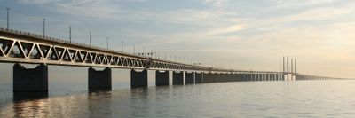
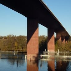
The structure extends 7,845 meters (4.9 miles) across the strait with a double-deck configuration containing four traffic lanes on the upper level and two railway tracks below. The high bridge section over the main shipping channel reaches 57 meters (187 feet) above sea level. Steel pylons support the cable-stayed section while truss spans carry the longer stretches.
Planning commenced in the 1990s as a joint Danish-Swedish project to replace ferry services between the two countries. Construction started in 1995 and required 79,000 tons of steel and 85,000 cubic meters of concrete. King Carl XVI Gustaf of Sweden and Queen Margrethe II of Denmark opened the connection on July 1, 2000. Rail services began the same month with direct trains running between both capitals.
The connection handles over 70,000 vehicle movements daily and forms a central axis for the Øresund Region, where nearly four million people live and work on both shores. Commuters cross the strait regularly for employment, education and family visits, creating an integrated cross-border economic zone. The merger of two labor markets has established Malmö as a residential area for Copenhagen workers and vice versa.
Travelers purchase tickets online through the ØresundGO system, which offers the lowest rates and includes discounts for frequent users. Motorists pay tolls based on vehicle size while train passengers use regular rail tickets. The crossing takes roughly ten minutes by car and eight minutes by train. Pedestrians and cyclists cannot use the route directly but shuttle buses are available.
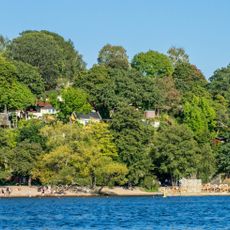
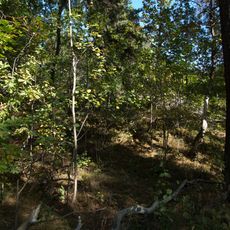
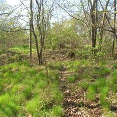
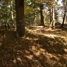
The project transitions from a bridge to an artificial island called Peberholm, then continues through an underwater tunnel to complete the Denmark-Sweden connection. This three-stage design was created to avoid interfering with flight patterns at nearby Copenhagen Airport. Peberholm itself remains uninhabited and has become a nature reserve where various plant and animal species have spontaneously established themselves.
Location: Tårnby Municipality
Location: Malmö Municipality
Inception: 1999
Architects: Dissing+Weitling
Official opening: July 1, 2000
Height: 204 m
Length: 7,845 m
Longest Span: 490 m
Width: 23.5 m
Made from material: steel, reinforced concrete
Part of: Oresund Connection, Denmark–Sweden border
Address: 216 30 Malmö, Sweden
Phone: +4640223000
Website: https://oresundsbron.com
GPS coordinates: 55.57644,12.82164
Latest update: December 14, 2025 22:17
This collection gathers bridges and engineering structures that mark the history of modern infrastructure worldwide. Structures such as the Akashi-Kaikyo Bridge in Japan, with its span of 3,911 meters, or the 37-kilometer Chesapeake Bay Bridge-Tunnel in Virginia demonstrate technological advances...
Bridges are a part of our daily lives. They have connected banks, valleys, and communities for centuries. This collection presents structures from various periods and regions. From medieval stone arches to modern steel constructions, these works demonstrate the evolution of engineering. The Rialto...
Malmö tells the story of Sweden through its streets and buildings. This collection invites you to explore the places that have shaped the city, from small medieval squares to large green parks. You will find churches made of red bricks, Renaissance castles, museums that hold memories of the past,...
Årstabroarna
519.8 km
Årsta gård
519.2 km
Padjelanta National Park
519.7 km
Tantolundens luftvärnsställning
520.1 km
Ekermanska malmgården
520.4 km
Årstalundens reservoar
520.2 km
Molitors malmgård
519.9 km
K7
519.2 km
Årstaskogen och Årsta holmars naturreservat
519.6 km
Årsta kvarn
519.3 km
Årsta Bridge northeast
519.5 km
Östra Årstabron
519.4 km
Västra Årstabron
519.4 km
Tanto strandbad
519.8 km
Årstaviken 10
519.7 km
Årsta Bridge southwest
519.3 km
Årsta Bridge southeast
519.4 km
Årsta Bridge northwest
519.5 km
Brännkyrka 19:1
519.4 km
Brännkyrka 16:2
519.2 km
Brännkyrka 16:1
519.2 km
Brännkyrka 18:1
519.1 km
Brännkyrka 17:1
519.1 km
Brännkyrka 16:4
519.2 km
Brännkyrka 19:2
519.4 km
Scenic viewpoint
519.9 km
Scenic viewpoint
519.4 km
Scenic viewpoint
520 kmVisited this place? Tap the stars to rate it and share your experience / photos with the community! Try now! You can cancel it anytime.
Discover hidden gems everywhere you go!
From secret cafés to breathtaking viewpoints, skip the crowded tourist spots and find places that match your style. Our app makes it easy with voice search, smart filtering, route optimization, and insider tips from travelers worldwide. Download now for the complete mobile experience.
A unique approach to discovering new places❞
— Le Figaro
All the places worth exploring❞
— France Info
A tailor-made excursion in just a few clicks❞
— 20 Minutes