Chest opened
+${chestReward.xp} XP
Explorer
NOUVEAU ×${chestReward.collectible.quantity}
tapez pour fermer

See the monuments around you in AR Open chests in the app

Around Us is built for your phone — point your camera at the streets and discover the monuments and places around you in augmented reality. Around Us is built for your phone — chests unlock when you walk, explore and capture nearby places.

•

Enable Location

We need your location to show you interesting places around you

Discover nearby places

Find interesting locations and hidden gems around you

Precise directions

Get accurate directions and distances to places

Your location is never shared with other users. It's only used when you tap the location button.

Ramberget

Log in to your account

Start exploring — it's free

Trusted by 93,481 travelers worldwide

Continue with Google
Continue with Apple
or

We will send you a code to connect

By continuing, you accept our Terms and Conditions and our Privacy Policy

Check your inbox

We've sent a pincode in your inbox. Please enter the code below.

Ramberget, Hill and park in Gothenburg, Sweden

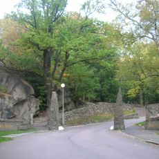
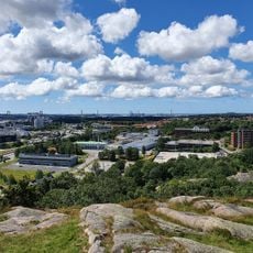
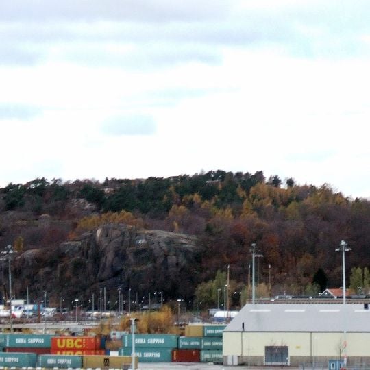
Ramberget is a hill on Hisingen island in Gothenburg, rising to 87 metres above sea level. Its northeast slope is gentle, while the southwest side forms a steep cliff visible from the river. The summit is part of Keillers Park, which covers over 31 hectares and includes a lower height called Lilla Ramberget (49 metres).

The land was owned by the Keiller family until 1906, when they donated the entire area to Gothenburg as a public gift. Since then it has been open to the public and has grown into a popular recreation area.

The name comes from the Swedish word for raven, and these birds have nested here for generations. Local people connect the mountain with wildlife and often visit to observe nature and enjoy the open air.

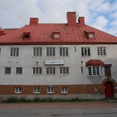
A paved road leads by car all the way to the top of Ramberget, and the gentler northeast slope makes the climb easier on foot. The steeper southwest side drops as a cliff toward the river. A water reservoir from 1910, designed by architect Yngve Rasmussen, stands at about 60 metres on the southeast slope along Rambergvägen.

A viewing table with arrows pointing to landmarks was installed at the top in 1949 and completed with a wall naming later landmarks in 1997. A lookout tower built there for military use during World War II still stood in the mid-1950s. The summit can be reached by car.

The community of curious travelers

AroundUs brings together thousands of curated places, local tips, and hidden gems, enriched daily by 93,481 contributors worldwide.

Start exploring
Elevation above the sea
87 m
GPS coordinates
57.71458,11.93620
Latest update
October 31, 2026 07:30
Reviews
Share your experience

No review yet

Discussions
Start a discussion...

No discussion yet

« Ramberget - Hill and park in Gothenburg, Sweden » is provided by Around Us (aroundus.com). Images and texts are derived from Wikimedia project under a Creative Commons license. You are allowed to copy, distribute, and modify copies of this page, under the conditions set by the license, as long as this note is clearly visible.

Discover hidden gems everywhere you go!

From secret cafés to breathtaking viewpoints, skip the crowded tourist spots and find places that match your style. Our app makes it easy with voice search, smart filtering, route optimization, and insider tips from travelers worldwide. Download now for the complete mobile experience.

Around Us App Screenshot
❝

A unique approach to discovering new places❞

— Le Figaro

❝

All the places worth exploring❞

— France Info

❝

A tailor-made excursion in just a few clicks❞

— 20 Minutes

Around Us
Travel Guide & Maps
Download

Send to your phone

QR Code
1

Open the camera app on your mobile.

2

Point at the QR code with your camera. A notification will appear.

3

Tap the notification to open the link.