Šarišská vrchovina, Mountain range in District of Košice - okolie, Slovakia
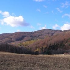
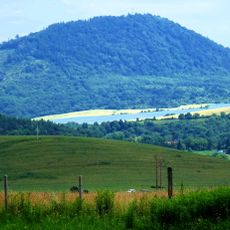
Šarišská vrchovina is a geomorphological unit of the Podhôľno-magurská oblast in the Outer Western Carpathians, stretching about 30 km northwest to southeast and 12–15 km wide across roughly 300 km². Its highest point, Za horou, reaches 717 m; elevations range from 253 to 700 m. Broad ridges of sandstone and conglomerate alternate with wide valleys and erosion furrows cut into claystone, and narrow gorge sections such as the Sopotnica valley formed on resistant rock.
This mountain region formed from marine sediments deposited during the early Tertiary period, creating the geological structures visible today. The layering and compression of these ancient materials shaped the land into its present terrain over millions of years.
The name Šariš refers to the historical Šariš county; the highest point is Za horou at 717 m. Villages such as Brežany keep the wooden Church of St Luke the Evangelist from 1727, a national cultural monument, while Chmiňany preserves remains of a Slavic hillfort from before the 11th century.
Extensive trail networks for hiking and cycling routes give visitors multiple ways to explore the area at their own pace. Winter visitors can find gentler slopes and cross-country skiing paths when snow is available.
Several rivers flow through the territory, creating natural corridors that connect habitats and supply the region's water resources. These waterways have long been essential for human settlement, providing both resources and pathways through the mountains.
The community of curious travelers
AroundUs brings together thousands of curated places, local tips, and hidden gems, enriched daily by 93,955 contributors worldwide.