Enable Location

We need your location to show you interesting places around you

Discover nearby places

Find interesting locations and hidden gems around you

Precise directions

Get accurate directions and distances to places

Your location is never shared with other users. It's only used when you tap the location button.

Log in to your account

Start exploring — it's free

Trusted by 62,830 travelers worldwide

Continue with Google
Continue with Apple
or

We will send you a code to connect

By continuing, you accept our Terms and Conditions and our Privacy Policy

Check your inbox

We've sent a pincode in your inbox. Please enter the code below.

Mureybet

Mureybet, Archaeological settlement mound in Al-Raqqah, Syria.

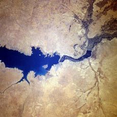
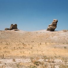
Mureybet is a submerged settlement mound on the western shore of the Euphrates in Al-Raqqah Governorate, Syria. The mound spanned 75 meters in diameter and rose to 6 meters above the former river level before construction of the Tabqa Dam submerged it beneath Lake Assad.

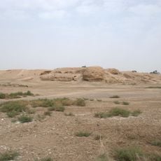
People lived here continuously between 10,200 and 8,000 BCE, a period when hunters and gatherers began settling down and cultivating plants for the first time. Archaeologists worked at this location from 1964 until 1974, documenting several layers from different centuries before the impounded waters of the Euphrates covered all traces.

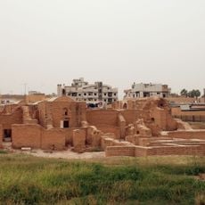
Researchers named the location after a small village on a terrace along the Euphrates, now lost beneath the waters. Findings include flint and basalt tools as well as circular stone-walled dwellings where occupants first gathered and began storing wild cereals.

The location lies entirely beneath Lake Assad and cannot be visited since the dam was completed in the nineteen seventies. All recovered objects are now held in museums or research collections outside the region.

This location gave its name to an entire epoch and serves as the model example for Pre-Pottery Neolithic A in the Levant. Researchers discovered here traces of early use of wild cereals, long before people began systematically sowing and harvesting grain.

The community of curious travelers

AroundUs brings together thousands of curated places, local tips, and hidden gems, enriched daily by 60,000 contributors worldwide.

Start exploring
Height
6 m
Diameter
75 m
GPS coordinates
36.04333,38.12861
Latest update
December 5, 2025 22:29
« Mureybet - Archaeological settlement mound in Al-Raqqah, Syria » is provided by Around Us (aroundus.com). Images and texts are derived from Wikimedia project under a Creative Commons license. You are allowed to copy, distribute, and modify copies of this page, under the conditions set by the license, as long as this note is clearly visible.

Discover hidden gems everywhere you go!

From secret cafés to breathtaking viewpoints, skip the crowded tourist spots and find places that match your style. Our app makes it easy with voice search, smart filtering, route optimization, and insider tips from travelers worldwide. Download now for the complete mobile experience.

Around Us App Screenshot

A unique approach to discovering new places

Le Figaro

All the places worth exploring

France Info

A tailor-made excursion in just a few clicks

20 Minutes

Around Us
Travel Guide & Maps
Download

Send to your phone

QR Code
1

Open the camera app on your mobile.

2

Point at the QR code with your camera. A notification will appear.

3

Tap the notification to open the link.