Enable Location

We need your location to show you interesting places around you

Discover nearby places

Find interesting locations and hidden gems around you

Precise directions

Get accurate directions and distances to places

Your location is never shared with other users. It's only used when you tap the location button.

Horbachykha Tract

Log in to your account

Start exploring — it's free

Trusted by 63,877 travelers worldwide

Continue with Google
Continue with Apple
or

We will send you a code to connect

By continuing, you accept our Terms and Conditions and our Privacy Policy

Check your inbox

We've sent a pincode in your inbox. Please enter the code below.

Horbachykha Tract
Discussion Reviews 1 Photos
1.9k Popularity

Horbachykha Tract, Field name in Dniprovskyi District of Kyiv, Ukraine.

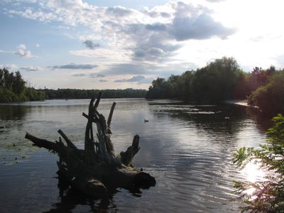
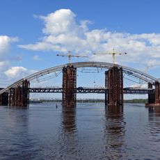
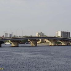
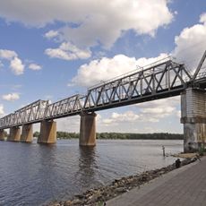
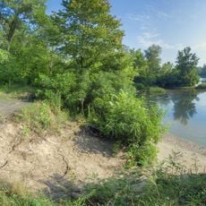
Horbachykha Tract is a field stretching along the left bank of the Dnieper River in Dniprovskyi District, bordered by the Chortoryi Strait and positioned downstream from the Rybalskyi Railway Bridge. The land covers around 83 hectares and contains floodplain meadows, willow forests, and remnant sand dunes that create varied terrain across the area.

In the 1800s, this area formed a low sandy hill stretching from Vyhurivshchyna village to Rusanivska Bay, and it appeared as an island on maps from 1855. After World War II, a post-war concrete road was built through the territory, comparable to infrastructure constructed on nearby Trukhaniv Island.

The name comes from the Horbachiv Strait, which flows between Dolobetskyi Island and the main area, reflecting how locals named places after natural features. This kind of naming shows how the landscape was organized by those who lived near it.

The area is easy to walk through because it is flat and has a concrete path running across it from the post-war period. Spring and summer are good times to visit when the meadows are green and wildlife is more active.

The southeastern section contains original floodplain meadows and willow forests that survive from the river's natural landscape before modern changes. These remaining ecosystems have become uncommon elsewhere along the Dnieper as development has altered similar areas.

The community of curious travelers

AroundUs brings together thousands of curated places, local tips, and hidden gems, enriched daily by 60,000 contributors worldwide.

Start exploring
GPS coordinates
50.47556,30.56194
Latest update
December 14, 2025 11:21
Reviews
Share your experience

No review yet

Discussions
Start a discussion...

No discussion yet

« Horbachykha Tract - Field name in Dniprovskyi District of Kyiv, Ukraine » is provided by Around Us (aroundus.com). Images and texts are derived from Wikimedia project under a Creative Commons license. You are allowed to copy, distribute, and modify copies of this page, under the conditions set by the license, as long as this note is clearly visible.

Discover hidden gems everywhere you go!

From secret cafés to breathtaking viewpoints, skip the crowded tourist spots and find places that match your style. Our app makes it easy with voice search, smart filtering, route optimization, and insider tips from travelers worldwide. Download now for the complete mobile experience.

Around Us App Screenshot

A unique approach to discovering new places

Le Figaro

All the places worth exploring

France Info

A tailor-made excursion in just a few clicks

20 Minutes

Around Us
Travel Guide & Maps
Download

Send to your phone

QR Code
1

Open the camera app on your mobile.

2

Point at the QR code with your camera. A notification will appear.

3

Tap the notification to open the link.