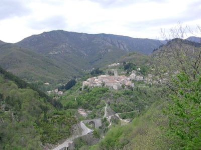
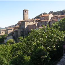
Antraigues-sur-Volane, Mountain village in Ardèche, France
Antraigues-sur-Volane is a village built on volcanic basalt rock, positioned where three river valleys meet: Volane, Bise, and Maselande. Stone houses in shades of gray cluster tightly together on steep slopes, with narrow passageways connecting different levels of the settlement.
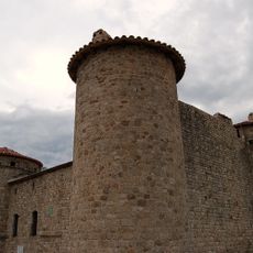
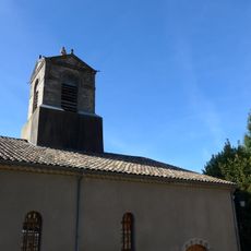
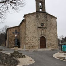
The medieval village served as the ancestral seat of the Antraigues family, a local noble lineage with considerable regional influence. The castle's keep was later converted into the bell tower of the parish church and remains a defining landmark today.
The name comes from the Volane river that flows through the surrounding valleys and shapes the landscape. The narrow, winding streets reflect how medieval residents adapted their daily life to the steep mountainous terrain.
Exploring on foot at a leisurely pace works best, as you navigate the narrow alleys and discover the many lava stone sculptures scattered throughout. The steep terrain demands sturdy footwear, and climbing between different levels is part of any walk through the village.
The village displays around seventy stone sculptures carved from lava rock, scattered throughout its narrow streets and created by a local artist. This unusual collection transforms the streets into an open-air gallery found nowhere else in the region.
Location: canton of Antraigues-sur-Volane
Location: Ardèche
Location: arrondissement of Largentière
Location: Vallées-d'Antraigues-Asperjoc
Elevation above the sea: 685 m
Shares border with: Aizac, Asperjoc, Genestelle, Labastide-sur-Bésorgues, Laviolle, Mézilhac
Address: Antraigues-sur-Volane, 07530 Vallées-d'Antraigues-Asperjoc, France
Website: http://antraigues.org
GPS coordinates: 44.71833,4.35778
Latest update: December 20, 2025 12:58
The Ardèche combines natural formations with centuries of human settlement. This southeastern French département stretches from the volcanic heights of the Cévennes to deeply carved limestone gorges along the river of the same name. The Pont d'Arc, a 197-foot (60-meter) natural stone arch, marks the...
Château de Craux
1.5 kmLe Champ de Mars
7.1 km
Église Sainte-Marie de Genestelle
2.7 km
Église Saint-Baudile d'Antraigues-sur-Volane
25 m
Église de Saint-Joseph-des-Bancs
4.7 kmLe Coulet Gras
5.9 kmLa Pissarelle
5.5 kmBench, scenic viewpoint
189 mToposcope, scenic viewpoint
313 mToposcope, scenic viewpoint
1.8 kmScenic viewpoint
7.2 kmScenic viewpoint
6.8 kmAux Morts
106 mFamille Tenenbaum (Jean Ferrat)
189 mCroix de Valmos
3.1 kmRuins
2.4 kmWayside cross
5.4 kmMemorial, commemorative plaque
4.1 kmWaterfall
5.4 kmCascade de la Pissarelle
5.5 kmWaterfall
7 kmWaterfall
7 kmWaterfall
5.3 kmWaterfall
5.4 kmCascade de l'Espissard
447 mWaterfall
1.7 kmWaterfall
7 kmLauzaret
6.7 kmVisited this place? Tap the stars to rate it and share your experience / photos with the community! Try now! You can cancel it anytime.
Discover hidden gems everywhere you go!
From secret cafés to breathtaking viewpoints, skip the crowded tourist spots and find places that match your style. Our app makes it easy with voice search, smart filtering, route optimization, and insider tips from travelers worldwide. Download now for the complete mobile experience.
A unique approach to discovering new places❞
— Le Figaro
All the places worth exploring❞
— France Info
A tailor-made excursion in just a few clicks❞
— 20 Minutes