Enable Location

We need your location to show you interesting places around you

Discover nearby places

Find interesting locations and hidden gems around you

Precise directions

Get accurate directions and distances to places

Your location is never shared with other users. It's only used when you tap the location button.

Kisimul Castle

Log in to your account

Start exploring — it's free

Trusted by 61,677 travelers worldwide

Continue with Google
Continue with Apple
or

We will send you a code to connect

By continuing, you accept our Terms and Conditions and our Privacy Policy

Check your inbox

We've sent a pincode in your inbox. Please enter the code below.

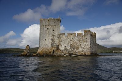
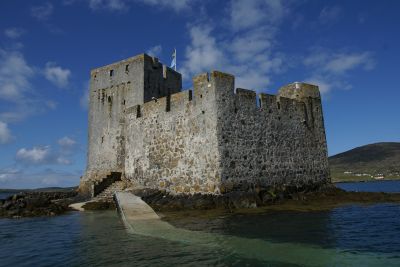
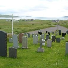
Kisimul Castle, Island castle in Outer Hebrides, Scotland

Description

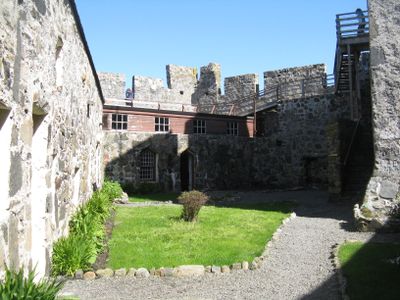
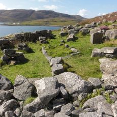
Kisimul Castle is a medieval fortress standing on a rocky islet in Castlebay's waters. The complex includes a square tower, encircling walls, and defensive structures arranged to protect against attacks from the sea.

History

The castle was built in 1427 as the home of Clan MacNeil and remained under their control until 1838 when money troubles forced the sale of the island. The building was later restored and now belongs to the state.

Culture

The name comes from Gaelic roots with Norse influences, reflecting how different cultures met in the medieval Hebrides. This blend of languages is part of what makes the place feel connected to the islands' past.

Practical

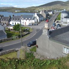
You reach the castle by taking a short boat ride from Castlebay pier, with regular services running throughout the day. The crossing takes just a few minutes and you land right next to the fortress.

Did you know?

The state pays the MacNeil clan a symbolic sum plus a bottle of whisky each year as part of a long-term agreement. This unusual arrangement keeps the connection between the family and their historic seat alive.

Location
Location
Inception
1427
Part of
Outer Hebrides
GPS coordinates
56.95200,-7.48700
Latest update
December 7, 2025 19:25

AroundUs brings together thousands of curated places, local tips, and hidden gems, enriched daily by 60,000 contributors worldwide. Discover all places nearby (Outer Hebrides).

Around this place
Barra Head Lighthouse
United Kingdom

Barra Head Lighthouse

21.1 km
Tràigh Mhòr
United Kingdom

Tràigh Mhòr

8.7 km
St Michael's Church
United Kingdom

St Michael's Church

18.6 km
Biruaslum
United Kingdom

Biruaslum

5.8 km
Arnamul
United Kingdom

Arnamul

19.9 km
Dun Cuier
United Kingdom

Dun Cuier

5.5 km
Dun Bharpa,chambered cairn 800m NE of Balnacraig
United Kingdom

Dun Bharpa,chambered cairn 800m NE of Balnacraig

4 km
Church of our Lady, Star of the Sea, Barra
United Kingdom

Church of our Lady, Star of the Sea, Barra

383 m
Eriskay Causeway
United Kingdom

Eriskay Causeway

19.3 km
Barra, Castlebay, The Square
United Kingdom

Barra, Castlebay, The Square

372 m
Cille Bharra
United Kingdom

Cille Bharra

10.3 km
Prince’s Beach
United Kingdom

Prince’s Beach

17.5 km
Dun a Chaolais
United Kingdom

Dun a Chaolais

3.7 km
Garrynamonie, Our Lady Of Sorrows Rc Church Including Boundary Walls And Gatepiers
United Kingdom

Garrynamonie, Our Lady Of Sorrows Rc Church Including Boundary Walls And Gatepiers

20.7 km
Annie Jane Monument, Vatersay
United Kingdom

Annie Jane Monument, Vatersay

4.4 km
Barra Head Lighthouse, Berneray, Keeper's House
United Kingdom

Barra Head Lighthouse, Berneray, Keeper's House

21.2 km
South Uist, Pollachar Inn
United Kingdom

South Uist, Pollachar Inn

18.3 km
Mingulay, Geirum Mor
United Kingdom

Mingulay, Geirum Mor

20.4 km
Barra, Dun Ban
United Kingdom

Barra, Dun Ban

4.2 km
Dun Scurrival,dun,Eoligarry
United Kingdom

Dun Scurrival,dun,Eoligarry

10.6 km
Dunan Ruadh,galleried dun,Pabbay,Barra
United Kingdom

Dunan Ruadh,galleried dun,Pabbay,Barra

11.5 km
Pabbay,symbol stone,cross-marked stones,chapel and settlement
United Kingdom

Pabbay,symbol stone,cross-marked stones,chapel and settlement

12 km
Cille Bharra, church, two chapels, and seven grave markers, Barra
United Kingdom

Cille Bharra, church, two chapels, and seven grave markers, Barra

10.3 km
West Kilbride Walled Garden, South Uist
United Kingdom

West Kilbride Walled Garden, South Uist

18.6 km
Pollachar,standing stone 250m SW of
United Kingdom

Pollachar,standing stone 250m SW of

18.3 km
Mingulay, village and field system
United Kingdom

Mingulay, village and field system

17.9 km
Alt Chrisal, multi-period settlement 750m ESE of Gortein, Barra
United Kingdom

Alt Chrisal, multi-period settlement 750m ESE of Gortein, Barra

2.3 km
Mingulay, Dun Mhiughlaigh
United Kingdom

Mingulay, Dun Mhiughlaigh

19.5 km
Show the full map
« Kisimul Castle - Island castle in Outer Hebrides, Scotland » is provided by Around Us (aroundus.com). Images and texts are derived from Wikimedia project under a Creative Commons license. You are allowed to copy, distribute, and modify copies of this page, under the conditions set by the license, as long as this note is clearly visible.

Discover hidden gems everywhere you go!

From secret cafés to breathtaking viewpoints, skip the crowded tourist spots and find places that match your style. Our app makes it easy with voice search, smart filtering, route optimization, and insider tips from travelers worldwide. Download now for the complete mobile experience.

Around Us App Screenshot

A unique approach to discovering new places

Le Figaro

All the places worth exploring

France Info

A tailor-made excursion in just a few clicks

20 Minutes

Around Us
Travel Guide & Maps
Download

Send to your phone

QR Code
1

Open the camera app on your mobile.

2

Point at the QR code with your camera. A notification will appear.

3

Tap the notification to open the link.