Wat's Dyke, Linear earthwork in Powys, Wales
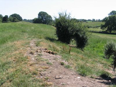
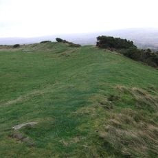
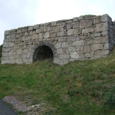
Wat's Dyke is an early medieval earth barrier stretching about 64 kilometers between the River Dee and River Severn across the Welsh-English border region. The structure consists of a raised bank with a ditch on its western side, creating a defensive line that once served to separate two distinct territories.
The dyke was likely built between the 5th and 8th centuries in response to shifting power between Welsh and English kingdoms. Archaeological findings from nearby sites show that builders of that era possessed sophisticated knowledge of earth construction and defense.
The earthwork marks an early medieval boundary between two kingdoms, showing how people then used massive earth structures to define territorial limits. Walking along it today reveals how seriously this division was taken by the communities on both sides.
The best way to explore this site is along a dedicated walking route that follows the earthwork's course and provides several viewpoints along the way. Sturdy footwear is essential since the path crosses farmland and hills where weather can change quickly.
In certain sections, the ditch was dug up to six meters wide and three meters deep, revealing that builders of that time possessed the capability to plan and execute massive projects. Such scale demonstrates the significant effort communities invested in establishing their boundaries.
The community of curious travelers
AroundUs brings together thousands of curated places, local tips, and hidden gems, enriched daily by 60,000 contributors worldwide.