Alexandria

Log in to your account

AroundUs is a community-driven map of interesting places, built by curious explorers like you. It grows with every review, story, and photo you share.
Connect to save your favorite spots, contribute locations, and create personalized routes.
By continuing, you accept our Terms and Conditions and our Privacy Policy
Add to collection
Map
Suggest a change
Share

Alexandria, Independent city in northern Virginia, United States

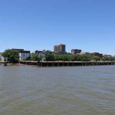
Alexandria is an independent city in northern Virginia that stretches along the western bank of the Potomac River, combining residential neighborhoods, commercial areas, and waterfront districts within a grid of streets. The historic core sits near the river, surrounded by newer districts that spread inland and blend modern development with older structures.

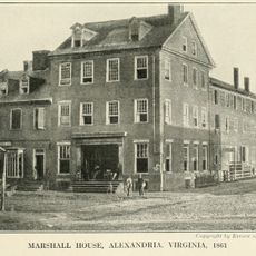
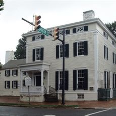
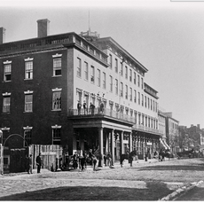
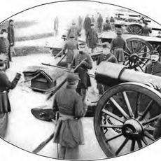
The settlement began in 1749 on land originally granted decades earlier to a tobacco planter by the colonial governor of Virginia. During the Civil War, it fell under Union control and served as a supply hub and hospital center for the federal army throughout the conflict.

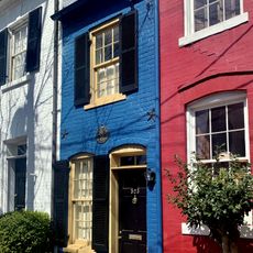
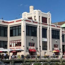
Residents and visitors gather in the Old Town waterfront district where farmers markets, street performers, and outdoor cafes fill cobblestone sidewalks throughout the year. Neighborhood festivals and art walks bring people together in historic squares, maintaining the social rhythms that have shaped community life for generations.

A free trolley runs between the metro station and the waterfront, making it easier for visitors to move around the historic center without driving. Most points of interest lie within a few blocks of the river, so walking is often the simplest way to explore the district.

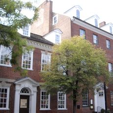
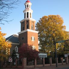
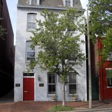
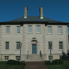
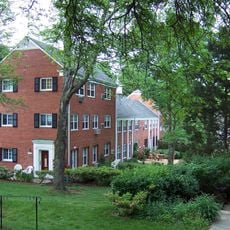
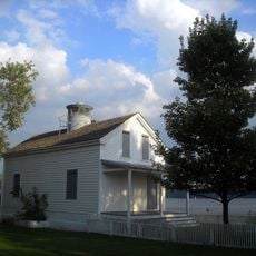
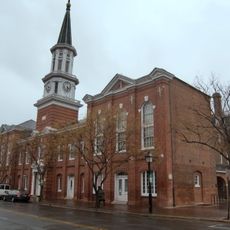
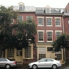
The settlement predates the federal capital by about half a century, making it one of the older preserved districts on the eastern seaboard. Many of its 18th-century buildings remain occupied and in everyday use, offering a living example of early American urban planning and architecture.

Location: Virginia

Inception: 1749

Elevation above the sea: 12 m

Part of: Arlington–Alexandria–Reston metropolitan division

Shares border with: Arlington County, Washington, D.C., Fairfax County, Prince George's County

Website: https://alexandriava.gov

GPS coordinates: 38.80472,-77.04722

Latest update: December 14, 2025 19:43

Photos
Around this place
George Washington Masonic National Memorial
United States of America

George Washington Masonic National Memorial

1.7 km
Hollensbury Spite House
United States of America

Hollensbury Spite House

332 m
Mark Center Building
United States of America

Mark Center Building

6.6 km
Virginia Theological Seminary
United States of America

Virginia Theological Seminary

4.3 km
Washington & Old Dominion Railroad Regional Park
United States of America

Washington & Old Dominion Railroad Regional Park

5.4 km
Gadsby's Tavern Museum
United States of America

Gadsby's Tavern Museum

304 m
Christ Church
United States of America

Christ Church

177 m
Franklin and Armfield Office
United States of America

Franklin and Armfield Office

655 m
Carlyle House
United States of America

Carlyle House

440 m
Appomattox
United States of America

Appomattox

87 m
Torpedo Factory Art Center
United States of America

Torpedo Factory Art Center

653 m
Marshall House
United States of America

Marshall House

227 m
Alfred Street Baptist Church
United States of America

Alfred Street Baptist Church

244 m
Parkfairfax
United States of America

Parkfairfax

4.6 km
Alexandria Canal
United States of America

Alexandria Canal

1.3 km
Potomac
United States of America

Potomac

2.6 km
Gerald R. Ford, Jr., House
United States of America

Gerald R. Ford, Jr., House

3 km
Fort Ward
United States of America

Fort Ward

5.6 km
Lee-Fendall House
United States of America

Lee-Fendall House

508 m
Mansion House Hospital
United States of America

Mansion House Hospital

438 m
Robert E. Lee Boyhood Home
United States of America

Robert E. Lee Boyhood Home

572 m
Jones Point Light
United States of America

Jones Point Light

1.7 km
Robinson Terminal
United States of America

Robinson Terminal

681 m
Fort Lyon
United States of America

Fort Lyon

2.9 km
Alexandria City Hall
United States of America

Alexandria City Hall

316 m
Stabler-Leadbeater Apothecary Shop
United States of America

Stabler-Leadbeater Apothecary Shop

391 m
United States of America

Luna Park, Arlington

4.5 km
Albert V. Bryan United States Courthouse
United States of America

Albert V. Bryan United States Courthouse

1.7 km
Show the full map
Reviews

Visited this place? Tap the stars to rate it and share your experience / photos with the community! Try now! You can cancel it anytime.

« Alexandria - Independent city in northern Virginia, United States » is provided by Around Us (aroundus.com). Images and texts are derived from Wikimedia project under a Creative Commons license. You are allowed to copy, distribute, and modify copies of this page, under the conditions set by the license, as long as this note is clearly visible.

Discover hidden gems everywhere you go!

From secret cafés to breathtaking viewpoints, skip the crowded tourist spots and find places that match your style. Our app makes it easy with voice search, smart filtering, route optimization, and insider tips from travelers worldwide. Download now for the complete mobile experience.

Around Us App Screenshot

A unique approach to discovering new places

Le Figaro

All the places worth exploring

France Info

A tailor-made excursion in just a few clicks

20 Minutes