Enable Location

We need your location to show you interesting places around you

Discover nearby places

Find interesting locations and hidden gems around you

Precise directions

Get accurate directions and distances to places

Your location is never shared with other users. It's only used when you tap the location button.

Sioux County

Log in to your account

Start exploring — it's free

Trusted by 61,908 travelers worldwide

Continue with Google
Continue with Apple
or

We will send you a code to connect

By continuing, you accept our Terms and Conditions and our Privacy Policy

Check your inbox

We've sent a pincode in your inbox. Please enter the code below.

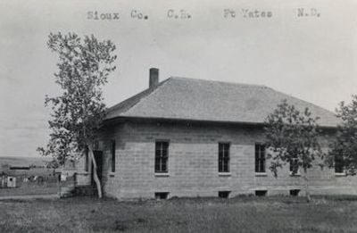
Sioux County, County administrative division in Iowa, United States.

Sioux County is an administrative division in Iowa that encompasses rural communities and settlements, with Orange City serving as the main administrative center. The area consists of multiple townships where farming is the dominant activity.

It was established in 1851 from lands that originally belonged to Native Americans before European settlers arrived. The area developed as settlers farmed and built their communities in the region.

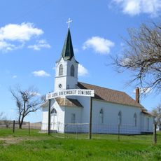
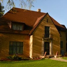
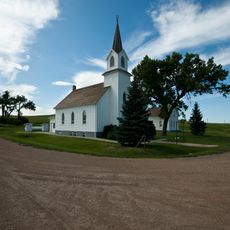
Dutch heritage shows in the way buildings are designed, how farming is done, and through festivals that bring people together each year. You can see this influence walking through the towns and talking with local families who maintain these traditions.

The county office operates on weekdays and handles official records like property documents and marriage certificates. It's best to visit during regular business hours for any services you might need.

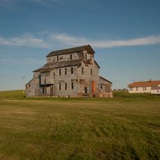
More than 80 percent of the land is used for farming, growing corn and soybeans and raising cattle. This strong focus on agriculture shapes how the landscape looks throughout the year and defines life in the region.

The community of curious travelers

AroundUs brings together thousands of curated places, local tips, and hidden gems, enriched daily by 60,000 contributors worldwide.

Start exploring
GPS coordinates
46.06547,-100.97819
Latest update
December 7, 2025 19:32
Around this place
Fort Abraham Lincoln
United States of America

Fort Abraham Lincoln

78.4 km
Salem Sue
United States of America

Salem Sue

94.1 km
Dakota Zoo
United States of America

Dakota Zoo

82.7 km
Fort Rice
United States of America

Fort Rice

58.3 km
Huff Archeological Site
United States of America

Huff Archeological Site

66.7 km
Heart Butte Dam
United States of America

Heart Butte Dam

87.2 km
Liberty Memorial Bridge
United States of America

Liberty Memorial Bridge

84.7 km
Pretty Rock National Wildlife Refuge
United States of America

Pretty Rock National Wildlife Refuge

77.7 km
Lemmon Petrified Park
United States of America

Lemmon Petrified Park

91.8 km
Camp Hancock State Historic Site
United States of America

Camp Hancock State Historic Site

83.6 km
Annunciation Monastery
United States of America

Annunciation Monastery

74.9 km
Our Lady of the Annunciation Chapel at Annunciation Priory
United States of America

Our Lady of the Annunciation Chapel at Annunciation Priory

75 km
Bismarck Air Museum
United States of America

Bismarck Air Museum

81.3 km
E. G. Patterson Building
United States of America

E. G. Patterson Building

83.7 km
Hotel Brown
United States of America

Hotel Brown

47.5 km
Evangelical Lutheran Trinity Church
United States of America

Evangelical Lutheran Trinity Church

90.2 km
Cedar Creek Bridge
United States of America

Cedar Creek Bridge

96.5 km
Carson Roller Mill
United States of America

Carson Roller Mill

59.8 km
United States of America

Holy Spirit Chapel

54.6 km
Missouri River High Bridge
United States of America

Missouri River High Bridge

84.6 km
Dr. Albert M. and Evelyn M. Brandt House
United States of America

Dr. Albert M. and Evelyn M. Brandt House

83.1 km
Raging Rivers
United States of America

Raging Rivers

82.9 km
Midway Lanes
United States of America

Midway Lanes

84.2 km
SuperSlide Amusement Park
United States of America

SuperSlide Amusement Park

83 km
Sims Lutheran Church
United States of America

Sims Lutheran Church

88.3 km
Petrified Wood Park & Museum
United States of America

Petrified Wood Park & Museum

92.4 km
Camp Hancock State Historic Site
United States of America

Camp Hancock State Historic Site

83.6 km
Lemmon Recreation Center
United States of America

Lemmon Recreation Center

92.4 km
Show the full map
« Sioux County - County administrative division in Iowa, United States » is provided by Around Us (aroundus.com). Images and texts are derived from Wikimedia project under a Creative Commons license. You are allowed to copy, distribute, and modify copies of this page, under the conditions set by the license, as long as this note is clearly visible.

Discover hidden gems everywhere you go!

From secret cafés to breathtaking viewpoints, skip the crowded tourist spots and find places that match your style. Our app makes it easy with voice search, smart filtering, route optimization, and insider tips from travelers worldwide. Download now for the complete mobile experience.

Around Us App Screenshot

A unique approach to discovering new places

Le Figaro

All the places worth exploring

France Info

A tailor-made excursion in just a few clicks

20 Minutes

Around Us
Travel Guide & Maps
Download

Send to your phone

QR Code
1

Open the camera app on your mobile.

2

Point at the QR code with your camera. A notification will appear.

3

Tap the notification to open the link.