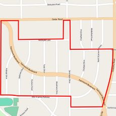
Pepper Pike, city in Cuyahoga County, Ohio, United States
Location: Cuyahoga County
Elevation above the sea: 323 m
Website: http://www.pepperpike.org/
Shares border with: Mayfield Heights
Website: http://pepperpike.org
GPS coordinates: 41.47690,-81.46890
Latest update: April 3, 2025 09:11
Notre Dame College
5.2 km
James A. Garfield Memorial
10.9 km
Forest Hill
18.8 km
Warner and Swasey Observatory
10.6 km
Chagrin Falls
8.2 km
Park Synagogue
8.9 km
Alcazar Hotel
10.8 km
Tower East
5.6 km
Forest Hill Park
10.3 km
Mayfield Cemetery
10.3 km
David Berger National Memorial
2 km
Temple Tifereth-Israel
2.2 km
First Baptist Church of Greater Cleveland
6.7 km
Stadium Square Historic District
8.1 km
Shaker Heights Public Library
8.3 km
Shaker Village Historic District
7 km
Euclid Golf Allotment
10 km
St. Paul's Episcopal Church
9.5 km
Fairmount Boulevard District
9.5 km
Fairhill Road Village
10.8 km
W.A. Thorp House
4.9 km
Halle Brothers Shaker Square department store
10.3 km
Woodland-Larchmere Commercial Historic District
10.4 km
Brainard Splash Park
3.8 km
Chester and Frances Bolton House
4.5 km
Fairmount Theatre
5.6 km
John Carroll University North Quad Historic District
5.5 km
Madstone Centrum
9.9 kmReviews
Visited this place? Tap the stars to rate it and share your experience / photos with the community! Try now! You can cancel it anytime.
Discover hidden gems everywhere you go!
From secret cafés to breathtaking viewpoints, skip the crowded tourist spots and find places that match your style. Our app makes it easy with voice search, smart filtering, route optimization, and insider tips from travelers worldwide. Download now for the complete mobile experience.
A unique approach to discovering new places❞
— Le Figaro
All the places worth exploring❞
— France Info
A tailor-made excursion in just a few clicks❞
— 20 Minutes