Enable Location

We need your location to show you interesting places around you

Discover nearby places

Find interesting locations and hidden gems around you

Precise directions

Get accurate directions and distances to places

Your location is never shared with other users. It's only used when you tap the location button.

Euclid Golf Allotment

Log in to your account

Start exploring — it's free

Trusted by 62,555 travelers worldwide

Continue with Google
Continue with Apple
or

We will send you a code to connect

By continuing, you accept our Terms and Conditions and our Privacy Policy

Check your inbox

We've sent a pincode in your inbox. Please enter the code below.

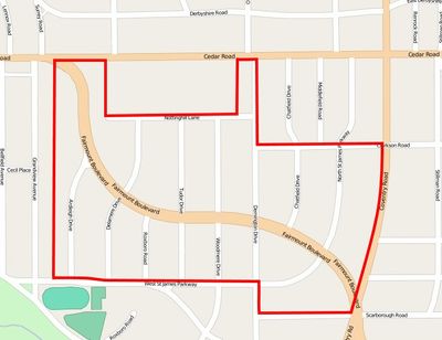
Euclid Golf Allotment, Historic residential district in Cleveland Heights, United States.

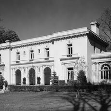
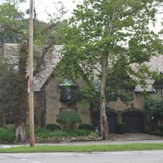
Euclid Golf Allotment is a historic residential district in Cleveland Heights laid out on over 100 acres with spacious grounds. The area was planned with wide streets, larger properties positioned along Fairmount Boulevard, and smaller parcels arranged on the surrounding roads.

This area was originally part of John D. Rockefeller's land holdings, which he leased to the Euclid Club in 1901 for golf purposes. Barton Deming purchased the property in 1913 and transformed it into a planned residential community that was developed systematically over the following years.

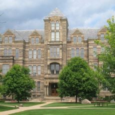
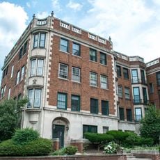
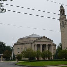
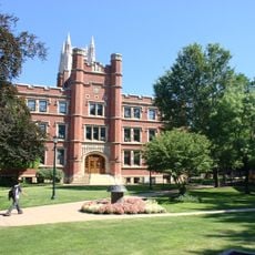
The neighborhood displays a mix of different architectural styles that visitors can observe throughout the streets and on the properties. The varied houses with their distinct facades create a visual record of how various building traditions coexisted during this period.

Visitors should explore slowly by car or on foot to fully appreciate the house details and wide, tree-lined streets. The area follows strict preservation guidelines, so checking the historic boundaries on a map helps understand the full extent of the neighborhood.

The district was designed with seven specific deed restrictions that still govern building design and character to this day. These early restrictions were an unusual strategy for the time, created to ensure the neighborhood maintained its original appearance and quality standards.

The community of curious travelers

AroundUs brings together thousands of curated places, local tips, and hidden gems, enriched daily by 60,000 contributors worldwide.

Start exploring
GPS coordinates
41.49700,-81.58600
Latest update
December 14, 2025 16:46
Around this place
Cleveland Museum of Natural History
United States of America

Cleveland Museum of Natural History

1.2 km
James A. Garfield Memorial
United States of America

James A. Garfield Memorial

1.5 km
Severance Hall
United States of America

Severance Hall

2.2 km
Museum of Contemporary Art Cleveland
United States of America

Museum of Contemporary Art Cleveland

2.1 km
Wade Memorial Chapel
United States of America

Wade Memorial Chapel

2 km
Children's Museum of Cleveland
United States of America

Children's Museum of Cleveland

2.3 km
Dittrick Museum of Medical History
United States of America

Dittrick Museum of Medical History

2.1 km
Mayfield Cemetery
United States of America

Mayfield Cemetery

1.9 km
Adelbert Hall
United States of America

Adelbert Hall

2.1 km
Cedar Glen Apartments
United States of America

Cedar Glen Apartments

1.5 km
Allen Memorial Medical Library
United States of America

Allen Memorial Medical Library

2.1 km
First Church of Christ, Scientist
United States of America

First Church of Christ, Scientist

1.3 km
Flora Stone Mather College Historic District
United States of America

Flora Stone Mather College Historic District

2.2 km
Michelson-Morley Memorial Fountain
United States of America

Michelson-Morley Memorial Fountain

2 km
Cozad-Bates House
United States of America

Cozad-Bates House

1.9 km
Ambler Heights Historic District
United States of America

Ambler Heights Historic District

1.3 km
St. Paul's Episcopal Church
United States of America

St. Paul's Episcopal Church

590 m
Fairmount Boulevard District
United States of America

Fairmount Boulevard District

590 m
Alta Public Library
United States of America

Alta Public Library

1.5 km
Fairhill Road Village
United States of America

Fairhill Road Village

958 m
Weizer Building
United States of America

Weizer Building

2.1 km
Woodland-Larchmere Commercial Historic District
United States of America

Woodland-Larchmere Commercial Historic District

1.2 km
Mather House
United States of America

Mather House

2.2 km
Mayfield Theater
United States of America

Mayfield Theater

1.6 km
Moreland Theater
United States of America

Moreland Theater

2.1 km
Madstone Centrum
United States of America

Madstone Centrum

1.3 km
The Michelson-Morley Experiment
United States of America

The Michelson-Morley Experiment

1.9 km
Coventry Branch Library
United States of America

Coventry Branch Library

1.3 km
Show the full map
« Euclid Golf Allotment - Historic residential district in Cleveland Heights, United States » is provided by Around Us (aroundus.com). Images and texts are derived from Wikimedia project under a Creative Commons license. You are allowed to copy, distribute, and modify copies of this page, under the conditions set by the license, as long as this note is clearly visible.

Discover hidden gems everywhere you go!

From secret cafés to breathtaking viewpoints, skip the crowded tourist spots and find places that match your style. Our app makes it easy with voice search, smart filtering, route optimization, and insider tips from travelers worldwide. Download now for the complete mobile experience.

Around Us App Screenshot

A unique approach to discovering new places

Le Figaro

All the places worth exploring

France Info

A tailor-made excursion in just a few clicks

20 Minutes

Around Us
Travel Guide & Maps
Download

Send to your phone

QR Code
1

Open the camera app on your mobile.

2

Point at the QR code with your camera. A notification will appear.

3

Tap the notification to open the link.