Chest opened
+${chestReward.xp} XP
Explorer
NOUVEAU ×${chestReward.collectible.quantity}
tapez pour fermer
Chest locked

Open chests in the app

Around Us is built for your phone — chests unlock when you walk, explore and capture nearby places.

Enable Location

We need your location to show you interesting places around you

Discover nearby places

Find interesting locations and hidden gems around you

Precise directions

Get accurate directions and distances to places

Your location is never shared with other users. It's only used when you tap the location button.

Hockessin

Log in to your account

Start exploring — it's free

Trusted by 72,889 travelers worldwide

Continue with Google
Continue with Apple
or

We will send you a code to connect

By continuing, you accept our Terms and Conditions and our Privacy Policy

Check your inbox

We've sent a pincode in your inbox. Please enter the code below.

Discussion Reviews 1 Photos
28.8k Popularity

Hockessin, Census-designated place in New Castle County, Delaware

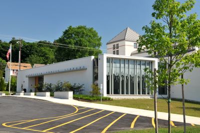
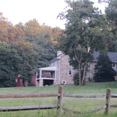
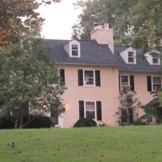
Hockessin is a census-designated place in New Castle County, located in northwestern Delaware near the Pennsylvania border. The community spreads across roughly 26 square kilometers and is characterized by residential neighborhoods, local parks, and Delaware Route 41 running through the area.

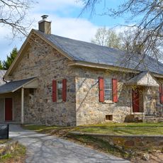
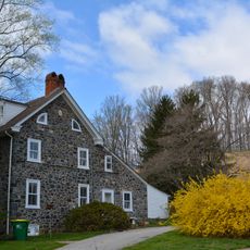
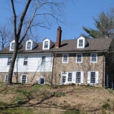
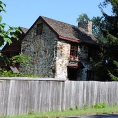
The settlement took root around 1688 as a small village, with the Hockessin Meeting House marking the early community's identity. Over time, the area grew into a larger residential community while maintaining its local character.

The Fourth of July gathering at Swift Park draws residents together for parades and community celebrations that reflect how neighbors connect throughout the year. These gatherings show what matters to the people who call this place home.

Delaware Route 41 serves as the main connection through the area, providing direct access to Wilmington and neighboring Pennsylvania communities. Plan to visit by car, as public transportation is limited and the area is designed around vehicle access.

The name likely comes from the Lenape language and may mean good bark hill, though another theory traces it to an early property called Occasion. This naming history reveals the early influences that shaped the place.

The community of curious travelers

AroundUs brings together thousands of curated places, local tips, and hidden gems, enriched daily by 60,000 contributors worldwide.

Start exploring
Elevation above the sea
78 m
GPS coordinates
39.78390,-75.68580
Latest update
December 20, 2025 12:10
Around this place
Ashland Covered Bridge
United States of America

Ashland Covered Bridge

2.8 km
Hindu Temple of Delaware
United States of America

Hindu Temple of Delaware

765 m
Auburn Valley State Park
United States of America

Auburn Valley State Park

2.9 km
Garrett Snuff Mill
United States of America

Garrett Snuff Mill

2.9 km
Jacob Broom House
United States of America

Jacob Broom House

2 km
Wooddale Bridge
United States of America

Wooddale Bridge

4.6 km
Mount Cuba Astronomical Observatory
United States of America

Mount Cuba Astronomical Observatory

4.5 km
Hockessin Friends Meetinghouse
United States of America

Hockessin Friends Meetinghouse

1.1 km
Coffee Run Mission Site
United States of America

Coffee Run Mission Site

2.9 km
Auburn Mills Historic District
United States of America

Auburn Mills Historic District

2.7 km
Chandler Mill Bridge
United States of America

Chandler Mill Bridge

4 km
Red Clay Creek Presbyterian Church
United States of America

Red Clay Creek Presbyterian Church

3.7 km
Garrett Snuff Mills Historic District
United States of America

Garrett Snuff Mills Historic District

3.2 km
T. Pierson Farm
United States of America

T. Pierson Farm

2.6 km
A. Armstrong Farm
United States of America

A. Armstrong Farm

1 km
Mount Cuba Historic District
United States of America

Mount Cuba Historic District

3.9 km
Springer Farm
United States of America

Springer Farm

3.2 km
Public School No. 29
United States of America

Public School No. 29

1.4 km
S. P. Dixon Farm
United States of America

S. P. Dixon Farm

2.7 km
J. Mason Farm
United States of America

J. Mason Farm

3.4 km
Graves Mill Historic District
United States of America

Graves Mill Historic District

4.2 km
Wooddale Historic District
United States of America

Wooddale Historic District

4.4 km
Mt. Cuba Center
United States of America

Mt. Cuba Center

3.3 km
United States of America

Scenic viewpoint

4.3 km
United States of America

Scenic viewpoint

2.9 km
United States of America

Bird Blind

2.6 km
United States of America

Scenic viewpoint

2.5 km
United States of America

Red Caboose

1.6 km
Show the full map
Reviews
Share your experience

No review yet

Discussions
Start a discussion...

No discussion yet

« Hockessin - Census-designated place in New Castle County, Delaware » is provided by Around Us (aroundus.com). Images and texts are derived from Wikimedia project under a Creative Commons license. You are allowed to copy, distribute, and modify copies of this page, under the conditions set by the license, as long as this note is clearly visible.

Discover hidden gems everywhere you go!

From secret cafés to breathtaking viewpoints, skip the crowded tourist spots and find places that match your style. Our app makes it easy with voice search, smart filtering, route optimization, and insider tips from travelers worldwide. Download now for the complete mobile experience.

Around Us App Screenshot

A unique approach to discovering new places

Le Figaro

All the places worth exploring

France Info

A tailor-made excursion in just a few clicks

20 Minutes

Around Us
Travel Guide & Maps
Download

Send to your phone

QR Code
1

Open the camera app on your mobile.

2

Point at the QR code with your camera. A notification will appear.

3

Tap the notification to open the link.