Rooks County

Log in to your account

AroundUs is a community-driven map of interesting places, built by curious explorers like you. It grows with every review, story, and photo you share.
Connect to save your favorite spots, contribute locations, and create personalized routes.
By continuing, you accept our Terms and Conditions and our Privacy Policy
Add to collection
Map
Suggest a change
Share

Rooks County, Administrative county in north-central Kansas, US

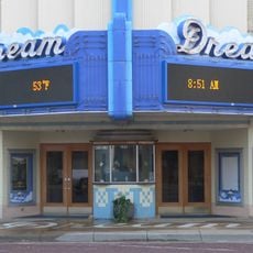
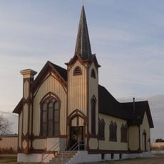
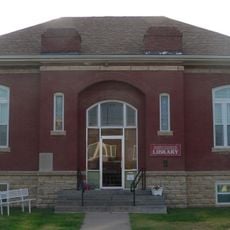
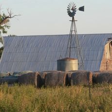
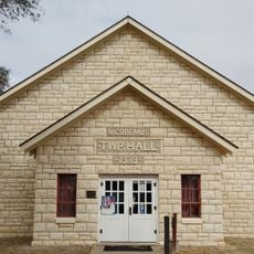
Rooks County is an administrative county in north-central Kansas covering a broad rural area of farmland and open spaces. Stockton serves as the county seat, anchoring the region with its role as the main community hub.

The county was established in 1867 and named after Private John C. Rooks, who died in the Battle of Prairie Grove in 1862. This naming honors a soldier who gave his life during the Civil War era.

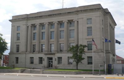
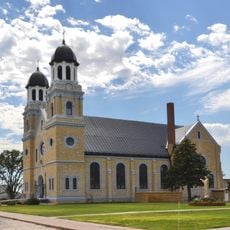
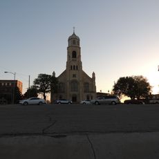
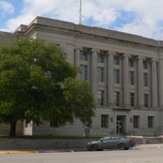
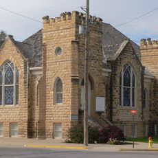
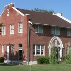
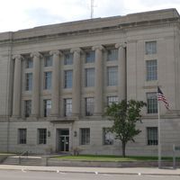
The courthouse built in 1923 anchors the county seat and shapes how residents and visitors experience the town center. Its design reflects architectural traditions that were common across rural Kansas during that era.

Getting around the county is straightforward thanks to its network of highways connecting the main communities. The best time to explore is during warmer months when roads are in their best condition for driving.

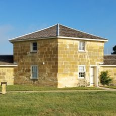
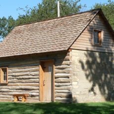
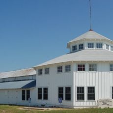
The first courthouse from 1881 was built from cottonwood logs and reinforced with substantial amounts of iron to create a durable structure. This resourceful design reflects how settlers adapted their construction methods to available local materials.

Location: Kansas

Inception: February 26, 1867

Capital city: Stockton

Shares border with: Phillips County, Ellis County, Smith County, Osborne County, Trego County, Graham County

Website: http://RooksCounty.net

GPS coordinates: 39.45139,-99.10194

Latest update: December 10, 2025 16:02

Photos
Around this place
Fort Hays
United States of America

Fort Hays

68.8 km
Basilica of St. Fidelis
United States of America

Basilica of St. Fidelis

66.4 km
Meades Ranch Triangulation Station
United States of America

Meades Ranch Triangulation Station

54.4 km
Norton County meteorite
United States of America

Norton County meteorite

70.5 km
Lewis Field
United States of America

Lewis Field

68.3 km
Home on the Range Cabin
United States of America

Home on the Range Cabin

50.5 km
Sternberg Museum of Natural History
United States of America

Sternberg Museum of Natural History

64.8 km
Dream Theater
United States of America

Dream Theater

65.7 km
St. Joseph Catholic Church
United States of America

St. Joseph Catholic Church

44.2 km
St. Joseph's Church and Parochial School
United States of America

St. Joseph's Church and Parochial School

67.2 km
Paradise Water Tower
United States of America

Paradise Water Tower

40.4 km
Natoma Presbyterian Church
United States of America

Natoma Presbyterian Church

30 km
Rooks County Courthouse
United States of America

Rooks County Courthouse

14.9 km
Barbeau House
United States of America

Barbeau House

79.1 km
First National Bank Building
United States of America

First National Bank Building

45.3 km
Downs Carnegie Library
United States of America

Downs Carnegie Library

48.2 km
Justus Bissing Jr. Historic District
United States of America

Justus Bissing Jr. Historic District

67.3 km
Ellis Congregational Church
United States of America

Ellis Congregational Church

69.3 km
North Fork Solomon River Lattice Truss Bridge
United States of America

North Fork Solomon River Lattice Truss Bridge

78 km
Harry Keith Barn
United States of America

Harry Keith Barn

76.3 km
Kirwin City Hall
United States of America

Kirwin City Hall

24.7 km
Pottawatomie County Fair Pavilion
United States of America

Pottawatomie County Fair Pavilion

10.5 km
Osborne Public Carnegie Library
United States of America

Osborne Public Carnegie Library

34.7 km
Nicodemus National Historic Site
United States of America

Nicodemus National Historic Site

44.7 km
Kirwin National Wildlife Refuge
United States of America

Kirwin National Wildlife Refuge

22.3 km
Fox Pavilion
United States of America

Fox Pavilion

67.3 km
Strand Theatre
United States of America

Strand Theatre

67.4 km
Chestnut Street Historic District
United States of America

Chestnut Street Historic District

69.6 km
Show the full map
Reviews

Visited this place? Tap the stars to rate it and share your experience / photos with the community! Try now! You can cancel it anytime.

Administrative divisions
« Rooks County - Administrative county in north-central Kansas, US » is provided by Around Us (aroundus.com). Images and texts are derived from Wikimedia project under a Creative Commons license. You are allowed to copy, distribute, and modify copies of this page, under the conditions set by the license, as long as this note is clearly visible.

Discover hidden gems everywhere you go!

From secret cafés to breathtaking viewpoints, skip the crowded tourist spots and find places that match your style. Our app makes it easy with voice search, smart filtering, route optimization, and insider tips from travelers worldwide. Download now for the complete mobile experience.

Around Us App Screenshot

A unique approach to discovering new places

Le Figaro

All the places worth exploring

France Info

A tailor-made excursion in just a few clicks

20 Minutes