Cheyenne County

Log in to your account

AroundUs is a community-driven map of interesting places, built by curious explorers like you. It grows with every review, story, and photo you share.
Connect to save your favorite spots, contribute locations, and create personalized routes.
Continue with Google
Continue with Apple
Continue with X
Continue with Facebook
Continue with email
By continuing, you accept our Terms and Conditions and our Privacy Policy
Create an account
Add to collection
Map
Suggest a change
Share

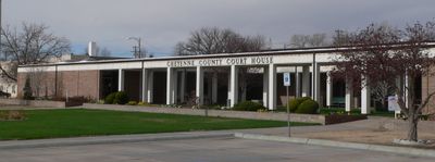
Cheyenne County, County in western Nebraska, United States.

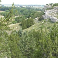
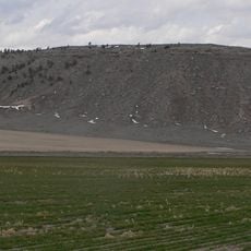
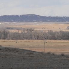
Cheyenne County is an administrative division in western Nebraska defined by open plains and farmland. The area spans flat terrain with low population density across its expanse.

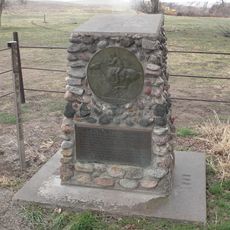
The county was established in 1871 and named after the Cheyenne Native American tribe inhabiting these lands. Railroad development later connected the area to broader transportation networks.

Agricultural traditions shape how people live and work across the region today. The landscape reflects generations of farming families who have built their lives here.

Interstate 80 and US Highways 30 and 385 pass through the county linking it to surrounding areas. Visitors should expect long stretches between towns and plan accordingly.

The county received number 39 in Nebraska's license plate system based on vehicle registrations in 1922. This lower number reflects how sparsely settled the region was at that time.

Location: Nebraska

Inception: 1867

Capital city: Sidney

Shares border with: Morrill County, Logan County, Garden County, Deuel County, Banner County, Kimball County, Sedgwick County

Website: http://co.cheyenne.ne.us

GPS coordinates: 41.22000,-102.99000

Latest update: December 10, 2025 15:57

Photos
Around this place
Ash Hollow State Historical Park
United States of America

Ash Hollow State Historical Park

73.3 km
North Sterling State Park
United States of America

North Sterling State Park

53.2 km
Bighorn Mountain
United States of America

Bighorn Mountain

57.7 km
Camp Clarke Bridge Site
United States of America

Camp Clarke Bridge Site

52.3 km
Sedgwick County Courthouse
United States of America

Sedgwick County Courthouse

66.1 km
St. Anthony's Roman Catholic Church
United States of America

St. Anthony's Roman Catholic Church

69.2 km
Mud Springs Station Archeological District
United States of America

Mud Springs Station Archeological District

29.5 km
Sioux Ordnance Depot Fire & Guard Headquarters
United States of America

Sioux Ordnance Depot Fire & Guard Headquarters

9.6 km
Lisco State Aid Bridge
United States of America

Lisco State Aid Bridge

42.8 km
Sterling Public Library
United States of America

Sterling Public Library

69 km
Lewellen State Aid Bridge
United States of America

Lewellen State Aid Bridge

71.7 km
Fraternal Hall
United States of America

Fraternal Hall

56.4 km
Deuel County Courthouse
United States of America

Deuel County Courthouse

45.7 km
Fred and Minnie Meyer Sudman House
United States of America

Fred and Minnie Meyer Sudman House

45.6 km
Garden County Courthouse
United States of America

Garden County Courthouse

57.9 km
First United Presbyterian Church
United States of America

First United Presbyterian Church

68.9 km
Christ Episcopal Church
United States of America

Christ Episcopal Church

8.8 km
Conrad Luft Sr. House
United States of America

Conrad Luft Sr. House

69.4 km
First National Bank of Haxtun
United States of America

First National Bank of Haxtun

71.2 km
Oshkosh Water Tower
United States of America

Oshkosh Water Tower

57.9 km
Morrill County Courthouse
United States of America

Morrill County Courthouse

50.7 km
Logan County Courthouse
United States of America

Logan County Courthouse

68.9 km
Schuetz Log Cabin
United States of America

Schuetz Log Cabin

32.2 km
Sidney Carnegie Library
United States of America

Sidney Carnegie Library

8.4 km
Maginnis Irrigation Aqueduct
United States of America

Maginnis Irrigation Aqueduct

66 km
Downtown Sterling Historic District
United States of America

Downtown Sterling Historic District

68.9 km
Lodgepole Opera House
United States of America

Lodgepole Opera House

30.5 km
Hippodrome Theatre
United States of America

Hippodrome Theatre

66.2 km
Show the full map
Reviews

Visited this place? Tap the stars to rate it and share your experience / photos with the community! Try now! You can cancel it anytime.

Administrative divisions
« Cheyenne County - County in western Nebraska, United States » is provided by Around Us (aroundus.com). Images and texts are derived from Wikimedia project under a Creative Commons license. You are allowed to copy, distribute, and modify copies of this page, under the conditions set by the license, as long as this note is clearly visible.

Discover hidden gems everywhere you go!

From secret cafés to breathtaking viewpoints, skip the crowded tourist spots and find places that match your style. Our app makes it easy with voice search, smart filtering, route optimization, and insider tips from travelers worldwide. Download now for the complete mobile experience.

Around Us App Screenshot

A unique approach to discovering new places

Le Figaro

All the places worth exploring

France Info

A tailor-made excursion in just a few clicks

20 Minutes