Delaware County

Log in to your account

AroundUs is a community-driven map of interesting places, built by curious explorers like you. It grows with every review, story, and photo you share.
Connect to save your favorite spots, contribute locations, and create personalized routes.
Continue with Google
Continue with Apple
Continue with X
Continue with Facebook
Continue with email
By continuing, you accept our Terms and Conditions and our Privacy Policy
Create an account
Add to collection
Map
Suggest a change
Share

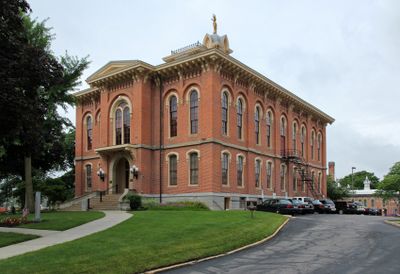
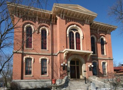
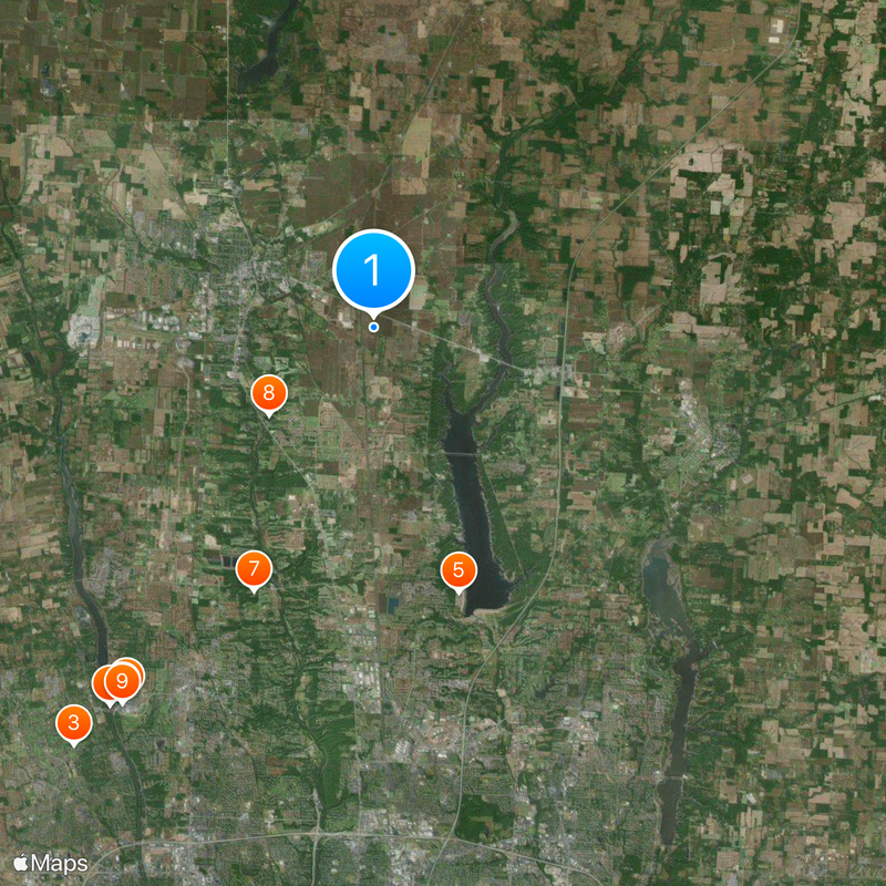
Delaware County, County in central Ohio, United States

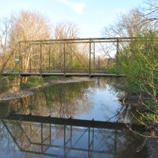
Delaware County spreads across central Ohio with fertile land watered by the Scioto and Olentangy rivers. The landscape mixes farmland, woodlands, and towns that developed along these waterways.

Delaware County was created on February 10, 1808, carved out from Franklin County territory. It takes its name from the Delaware people who lived in the region long before European settlement.

Ohio Wesleyan University, founded in 1842, is the county's main college and influences how residents think about learning and community. The campus sits in the heart of the region and its activities shape life for local students and families.

Interstate 71 and US Route 23 run through the county, linking it easily to the greater Columbus area. These major roads make it simple to reach different towns and attractions spread across the region.

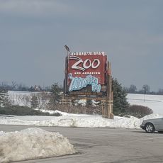
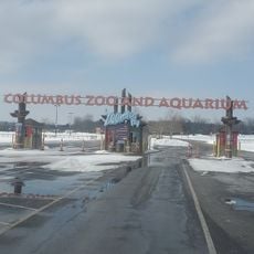
The Columbus Zoo and Aquarium sits within the county, housing thousands of animals from around the world. The zoo spreads across a large property and draws visitors interested in wildlife and conservation.

Location: Ohio

Inception: February 10, 1808

Capital city: Delaware

Reference: DEL

Shares border with: Morrow County, Knox County, Licking County, Franklin County, Union County, Marion County

Website: http://co.delaware.oh.us

GPS coordinates: 40.28000,-83.01000

Latest update: December 14, 2025 18:16

Photos
Around this place
Columbus Zoo and Aquarium
United States of America

Columbus Zoo and Aquarium

16.6 km
Muirfield Village
United States of America

Muirfield Village

19.1 km
Zoombezi Bay
United States of America

Zoombezi Bay

16.8 km
Alum Creek State Park
United States of America

Alum Creek State Park

10.3 km
O'Shaughnessy Dam
United States of America

O'Shaughnessy Dam

17.1 km
United States of America

Olentangy Indian Caverns

10.7 km
Perkins Observatory
United States of America

Perkins Observatory

5.1 km
Sea Dragon
United States of America

Sea Dragon

16.8 km
Delaware State Park
United States of America

Delaware State Park

10.1 km
Alum Creek Beach
United States of America

Alum Creek Beach

10.5 km
United States of America

Bharatiya Hindu Temple

11 km
Delaware County Courthouse
United States of America

Delaware County Courthouse

5.5 km
Highbanks Metropolitan Park Mounds I and II
United States of America

Highbanks Metropolitan Park Mounds I and II

13.8 km
Spruce Run Earthworks
United States of America

Spruce Run Earthworks

16.8 km
Activism at Ohio Wesleyan University
United States of America

Activism at Ohio Wesleyan University

5.2 km
Gooding House and Tavern
United States of America

Gooding House and Tavern

11 km
Highbank Park Works
United States of America

Highbank Park Works

15.6 km
Richard Ross Museum of Art
United States of America

Richard Ross Museum of Art

5.3 km
Austin Hall
United States of America

Austin Hall

6.2 km
Chambers Road Covered Bridge
United States of America

Chambers Road Covered Bridge

17.5 km
Delaware Public Library
United States of America

Delaware Public Library

5.3 km
Alkire House
United States of America

Alkire House

17.7 km
Stratford Methodist Episcopal Church
United States of America

Stratford Methodist Episcopal Church

5.3 km
Schimmel-Conrades Science Center
United States of America

Schimmel-Conrades Science Center

5 km
Jain Center of Central Ohio
United States of America

Jain Center of Central Ohio

10.8 km
Westerville High School-Vine Street School
United States of America

Westerville High School-Vine Street School

18.4 km
West Orange Road-Thomas Bridge
United States of America

West Orange Road-Thomas Bridge

12 km
Jungle Jack's Landing
United States of America

Jungle Jack's Landing

16.7 km
Show the full map
Reviews

Visited this place? Tap the stars to rate it and share your experience / photos with the community! Try now! You can cancel it anytime.

Administrative divisions
« Delaware County - County in central Ohio, United States » is provided by Around Us (aroundus.com). Images and texts are derived from Wikimedia project under a Creative Commons license. You are allowed to copy, distribute, and modify copies of this page, under the conditions set by the license, as long as this note is clearly visible.

Discover hidden gems everywhere you go!

From secret cafés to breathtaking viewpoints, skip the crowded tourist spots and find places that match your style. Our app makes it easy with voice search, smart filtering, route optimization, and insider tips from travelers worldwide. Download now for the complete mobile experience.

Around Us App Screenshot

A unique approach to discovering new places

Le Figaro

All the places worth exploring

France Info

A tailor-made excursion in just a few clicks

20 Minutes