Enable Location

We need your location to show you interesting places around you

Discover nearby places

Find interesting locations and hidden gems around you

Precise directions

Get accurate directions and distances to places

Your location is never shared with other users. It's only used when you tap the location button.

Lee County

Log in to your account

Start exploring — it's free

Trusted by 60,648 travelers worldwide

Continue with Google
Continue with Apple
or

We will send you a code to connect

By continuing, you accept our Terms and Conditions and our Privacy Policy

Check your inbox

We've sent a pincode in your inbox. Please enter the code below.

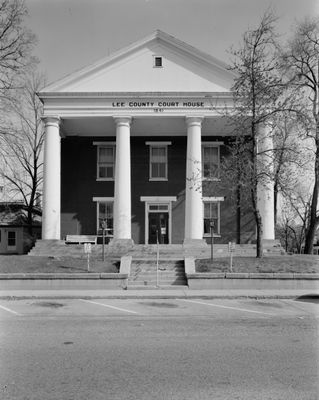
Lee County, Administrative division in southeastern Iowa, United States.

Description

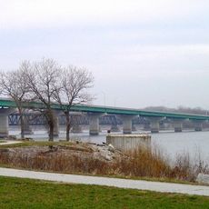
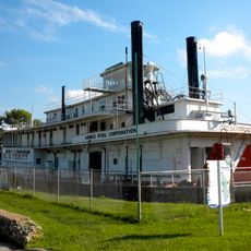
Lee County is an administrative division in southeastern Iowa that spans rolling terrain and waterways. Fort Madison and Keokuk, its two county seats, sit along the Mississippi River and serve as the main hubs for commerce and government services.

History

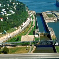
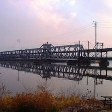
The county was established in 1836 from early settlements located along major waterways that fueled trade and westward expansion. Its position on the Mississippi River has shaped its growth and character ever since.

Culture

The Division of Criminal Investigation and Iowa State Patrol maintain strong connections with local communities through regular engagement and safety programs.

Practical

Several state and federal highways connect the county to surrounding regions, making it accessible by car. Both county seats offer typical services and amenities including government offices, shopping, and lodging.

Did you know?

In September 2021, archaeological discoveries in West Point led to extensive investigations involving multiple law enforcement agencies and specialized search teams.

Location
Inception
1836
Capital city
Fort Madison
Part of
Fort Madison-Keokuk, IA-IL-MO Micropolitan Statistical Area
Shares border with
Henry County, Des Moines County, Henderson County, Hancock County, Clark County, Van Buren County
GPS coordinates
40.64278,-91.47444
Latest update
December 7, 2025 19:22

AroundUs brings together thousands of curated places, local tips, and hidden gems, enriched daily by 60,000 contributors worldwide. Discover all places nearby (Iowa).

Around this place
Iowa State Penitentiary
United States of America

Iowa State Penitentiary

15 km
Nauvoo Illinois Temple
United States of America

Nauvoo Illinois Temple

12.8 km
Carthage Jail
United States of America

Carthage Jail

38 km
Lock and Dam No. 19
United States of America

Lock and Dam No. 19

28.8 km
Fort Madison Toll Bridge
United States of America

Fort Madison Toll Bridge

15.2 km
Nauvoo House
United States of America

Nauvoo House

13.4 km
Joseph Smith Mansion House
United States of America

Joseph Smith Mansion House

13.3 km
United States of America

Des Moines Rapids

21.2 km
Nauvoo Historic District
United States of America

Nauvoo Historic District

13.1 km
Battle of Athens State Historic Site
United States of America

Battle of Athens State Historic Site

20.3 km
Keokuk Rail Bridge
United States of America

Keokuk Rail Bridge

29.3 km
Keokuk–Hamilton Bridge
United States of America

Keokuk–Hamilton Bridge

29.4 km
George M. Verity
United States of America

George M. Verity

29.2 km
C. R. Joy House
United States of America

C. R. Joy House

27.8 km
Keokuk National Cemetery
United States of America

Keokuk National Cemetery

27.7 km
Holy Family Catholic Church
United States of America

Holy Family Catholic Church

13.4 km
Bridgeport Bridge
United States of America

Bridgeport Bridge

18.9 km
Walter A. Sheaffer House
United States of America

Walter A. Sheaffer House

15.8 km
Gen. William Worth Belknap House
United States of America

Gen. William Worth Belknap House

28.6 km
Gen. Samuel R. Curtis House
United States of America

Gen. Samuel R. Curtis House

28.7 km
Fort Madison Downtown Commercial Historic District
United States of America

Fort Madison Downtown Commercial Historic District

13.9 km
E. H. Harrison House
United States of America

E. H. Harrison House

28.5 km
Sharon Cemetery Historic District
United States of America

Sharon Cemetery Historic District

18.3 km
St. Joseph's Church Complex
United States of America

St. Joseph's Church Complex

14.2 km
Faeth Farmstead and Orchard District
United States of America

Faeth Farmstead and Orchard District

3.3 km
St. Barnabas Episcopal Church
United States of America

St. Barnabas Episcopal Church

13.2 km
St. John's Episcopal Church
United States of America

St. John's Episcopal Church

28.5 km
Lee County Courthouse
United States of America

Lee County Courthouse

13.9 km
Show the full map
Administrative divisions
« Lee County - Administrative division in southeastern Iowa, United States » is provided by Around Us (aroundus.com). Images and texts are derived from Wikimedia project under a Creative Commons license. You are allowed to copy, distribute, and modify copies of this page, under the conditions set by the license, as long as this note is clearly visible.

Discover hidden gems everywhere you go!

From secret cafés to breathtaking viewpoints, skip the crowded tourist spots and find places that match your style. Our app makes it easy with voice search, smart filtering, route optimization, and insider tips from travelers worldwide. Download now for the complete mobile experience.

Around Us App Screenshot

A unique approach to discovering new places

Le Figaro

All the places worth exploring

France Info

A tailor-made excursion in just a few clicks

20 Minutes

Around Us
Travel Guide & Maps
Download

Send to your phone

QR Code
1

Open the camera app on your mobile.

2

Point at the QR code with your camera. A notification will appear.

3

Tap the notification to open the link.