Enable Location

We need your location to show you interesting places around you

Discover nearby places

Find interesting locations and hidden gems around you

Precise directions

Get accurate directions and distances to places

Your location is never shared with other users. It's only used when you tap the location button.

Butler County

Log in to your account

Start exploring — it's free

Trusted by 65,051 travelers worldwide

Continue with Google
Continue with Apple
or

We will send you a code to connect

By continuing, you accept our Terms and Conditions and our Privacy Policy

Check your inbox

We've sent a pincode in your inbox. Please enter the code below.

Discussion Reviews 1 Photos
12.1k Popularity

Butler County, Administrative county in Kentucky, US

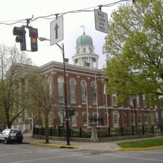
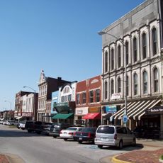
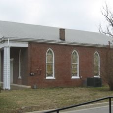
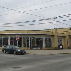
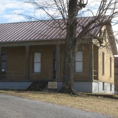
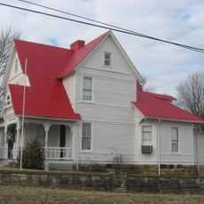
Butler County is an administrative county located in central Kentucky with Morgantown serving as its county seat. The area encompasses several smaller communities and rural regions spread across its territory.

The county was established by the Kentucky General Assembly on January 18, 1819, becoming an official administrative division. Its creation was part of the state's expansion of local government structures during the early 1800s.

The county administration organizes regular community events and local gatherings that bring together residents from different parts of the region throughout the year.

The county provides various public services and information through its administrative offices and online platforms where residents can access official documents and announcements. When planning a visit, check local road conditions and hours of operation for public buildings.

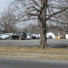
The county's geographical position in Kentucky places it at a junction of different terrains, creating a mixture of landscapes within its boundaries.

The community of curious travelers

AroundUs brings together thousands of curated places, local tips, and hidden gems, enriched daily by 60,000 contributors worldwide.

Start exploring
Location
Inception
January 18, 1819
Capital city
Morgantown
Shares border with
Ohio County, Grayson County, Edmonson County, Warren County, Logan County, Muhlenberg County
GPS coordinates
37.21000,-86.68000
Latest update
December 7, 2025 20:46
Around this place
E. A. Diddle Arena
United States of America

E. A. Diddle Arena

31.8 km
Kentucky Rumbler
United States of America

Kentucky Rumbler

32.3 km
Riverview at Hobson Grove
United States of America

Riverview at Hobson Grove

29.4 km
The Historic Railpark and Train Museum
United States of America

The Historic Railpark and Train Museum

31.7 km
Annis Mound and Village Site
United States of America

Annis Mound and Village Site

11 km
Henry Hardin Cherry Hall
United States of America

Henry Hardin Cherry Hall

32 km
Standard Oil Company Filling Station
United States of America

Standard Oil Company Filling Station

32.1 km
Salem Baptist Church
United States of America

Salem Baptist Church

11.5 km
Van Meter Hall
United States of America

Van Meter Hall

31.8 km
Eloise B. Houchens Center
United States of America

Eloise B. Houchens Center

31.6 km
Confederate-Union Veterans' Monument in Morgantown
United States of America

Confederate-Union Veterans' Monument in Morgantown

1.7 km
St. Joseph Roman Catholic Church
United States of America

St. Joseph Roman Catholic Church

31.1 km
Western Kentucky University Heating Plant
United States of America

Western Kentucky University Heating Plant

31.8 km
Hines House
United States of America

Hines House

31.6 km
Warren County Courthouse
United States of America

Warren County Courthouse

32.1 km
Downtown Commercial District
United States of America

Downtown Commercial District

32 km
Mount Olivet Cumberland Presbyterian Church
United States of America

Mount Olivet Cumberland Presbyterian Church

31.9 km
Cecilia Memorial Christian Church
United States of America

Cecilia Memorial Christian Church

32.1 km
Young's Ferry House
United States of America

Young's Ferry House

19.9 km
Modern Automotive District
United States of America

Modern Automotive District

32.2 km
U.S. Army Corps of Engineers Superintendent's House and Workmen's Office
United States of America

U.S. Army Corps of Engineers Superintendent's House and Workmen's Office

5.1 km
John Carson House
United States of America

John Carson House

1.7 km
W.H. Everhardt House
United States of America

W.H. Everhardt House

32 km
Bowling Green Organizational Maintenance Shop No. 10
United States of America

Bowling Green Organizational Maintenance Shop No. 10

30.9 km
Gordon Wilson Hall
United States of America

Gordon Wilson Hall

32 km
Baker Arboretum & Downing Museum
United States of America

Baker Arboretum & Downing Museum

28 km
Riverview at Hobson Grove
United States of America

Riverview at Hobson Grove

29.5 km
Regal Bowling Green Stadium 12
United States of America

Regal Bowling Green Stadium 12

32.2 km
Show the full map
Reviews
Share your experience

No review yet

Discussions
Start a discussion...

No discussion yet

Administrative divisions
« Butler County - Administrative county in Kentucky, US » is provided by Around Us (aroundus.com). Images and texts are derived from Wikimedia project under a Creative Commons license. You are allowed to copy, distribute, and modify copies of this page, under the conditions set by the license, as long as this note is clearly visible.

Discover hidden gems everywhere you go!

From secret cafés to breathtaking viewpoints, skip the crowded tourist spots and find places that match your style. Our app makes it easy with voice search, smart filtering, route optimization, and insider tips from travelers worldwide. Download now for the complete mobile experience.

Around Us App Screenshot

A unique approach to discovering new places

Le Figaro

All the places worth exploring

France Info

A tailor-made excursion in just a few clicks

20 Minutes

Around Us
Travel Guide & Maps
Download

Send to your phone

QR Code
1

Open the camera app on your mobile.

2

Point at the QR code with your camera. A notification will appear.

3

Tap the notification to open the link.